Willett Hot Springs
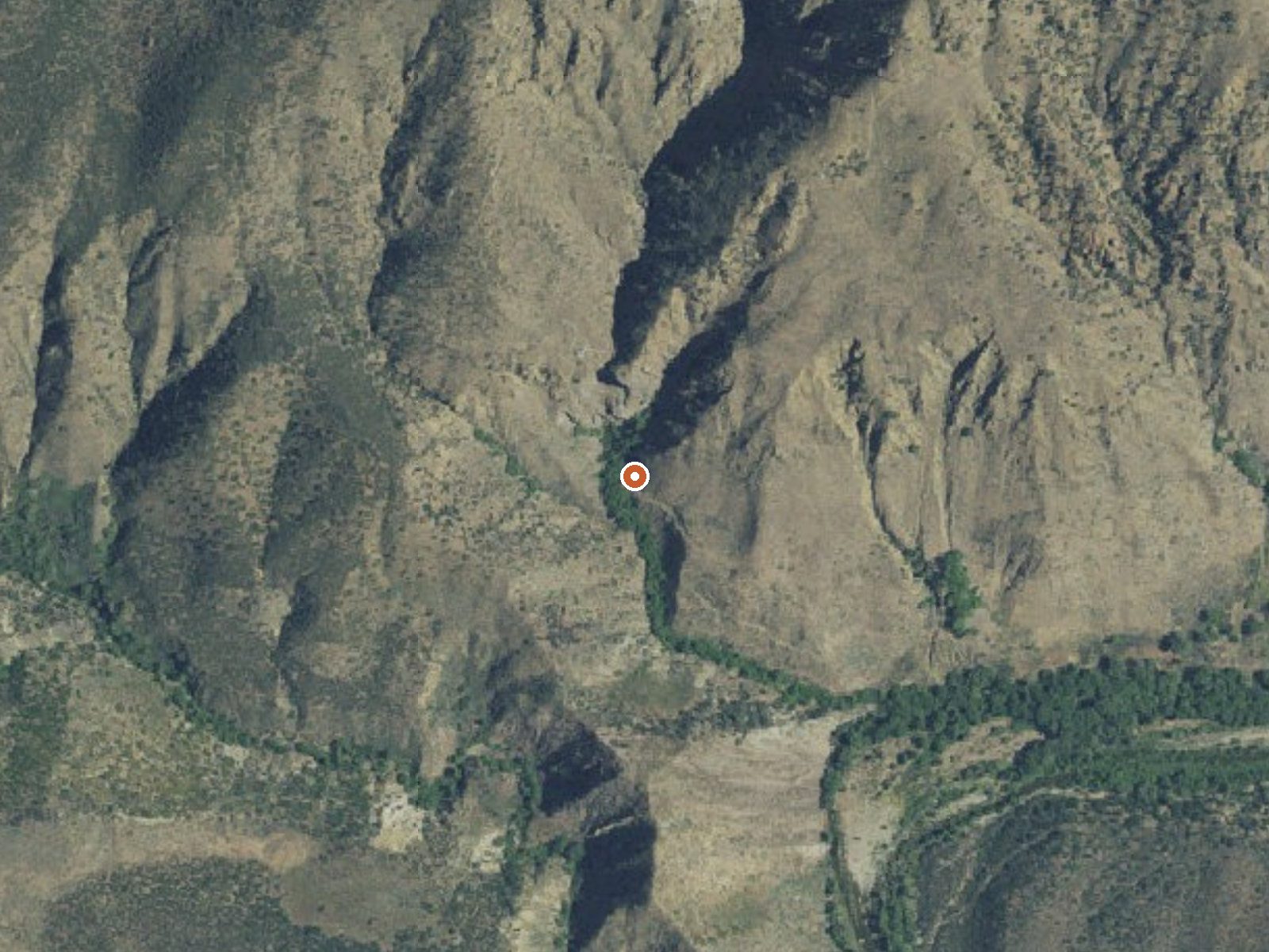
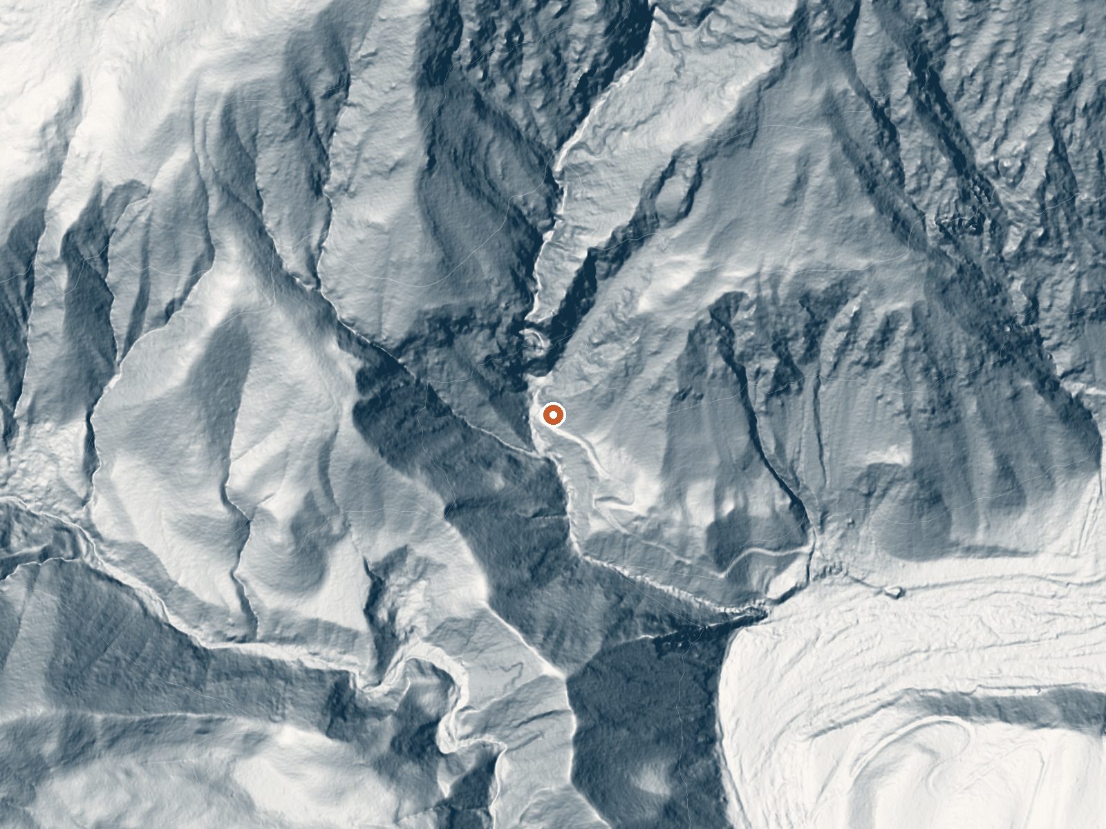
Drag the handle to compare the two views. The orange dot marks the spring, in a frame about three quarters of a mile wide.
A second entry on file for Willett Hot Springs, at a lower elevation than the other and with no temperature attached. Same Ventura County wilderness, same Los Padres National Forest, same open access. Fillmore is the nearest town, about 14 miles. Treat this as a location record for the same spring complex; the other Willett page carries the thermal reading.
The hike in is a little longer by this record, about four and a third miles off Mutau OHV Road. Elevation here is under 2,800 feet, lower and milder, with snow a minor event most winters and fifteen inches of rain. Middle Lion Campground is the closest camping, under seven miles away. Sespe Wilderness.
This record lists no best months. Because the temperature is blank here, rely on the other Willett listing for heat and on this one for position only. Forest Service wilderness rules apply. No fee recorded. Middle Lion is the place to camp if you want a base.
Wikipedia describes the hot spring as having a built basin that collects the flow and puts it in the Sespe Wilderness north of Ojai, reached most often by a long hike, about eleven miles, out of the Piedra Blanca trailhead.
Aircraft with laser scanners measured this ground to within inches. The scan strips out trees and buildings, leaving the bare shape of the land around Willett Hot Springs.
- Setting
- Canyon floor
- Steep ground climbs away on both sides of the spring.
- Highest ground nearby
- 935 ft above the spring
- Within a quarter mile, to the north
A slice through the ground from west to east, about 0.6 miles end to end.
Elevation data: USGS 3D Elevation Program. Aerial imagery: USGS The National Map. Public domain.
That's about 1½ times the US average of 65. It's higher than at 40% of the springs on this site.
Heat flow measures the warmth working its way up through the ground from deep inside the earth. Where it runs high, rain and snowmelt that seep down through cracks in the rock come back up hot.
See every spring on the geothermal heat map →
Heat flow estimate: Stanford Thermal Earth Model (Aljubran & Horne, 2024), CC BY 4.0.
Some links are affiliate links. We may earn a commission at no extra cost to you.
Overview Leave the city vibe behind as you meander down a winding, partially paved, narrow road that leads you into wooded Middle Lion Campground and day use area. Relax next to the running creek, take a refreshing dip, or hike the nearby trails. Tucked away in a canyon encased by chaparral and wildflower covered mountains, Middle Lion Campground is particularly beautiful in the spring and fall, but camping is great year-round.Recreation The Lion Canyon Trail (22W06) starts at the back of the...
Willett Hot Springs is road-accessible, so you can bring more gear.




As an Amazon Associate, we earn from qualifying purchases.
Springs Near Willett Hot Springs
Hike 6 waterfalls near Willett Hot Springs
Looking for more outdoor adventures? Explore waterfall hikes near Willett Hot Springs, California.