Gilroy Hot Springs
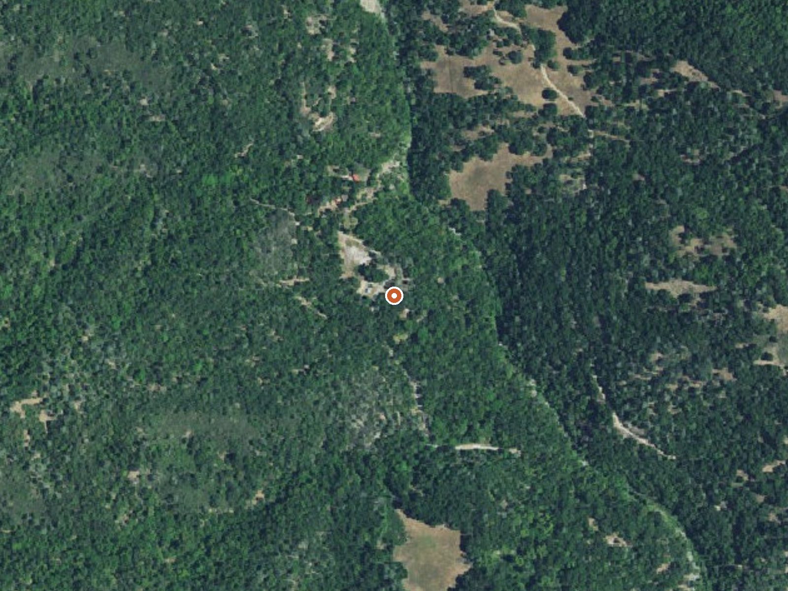
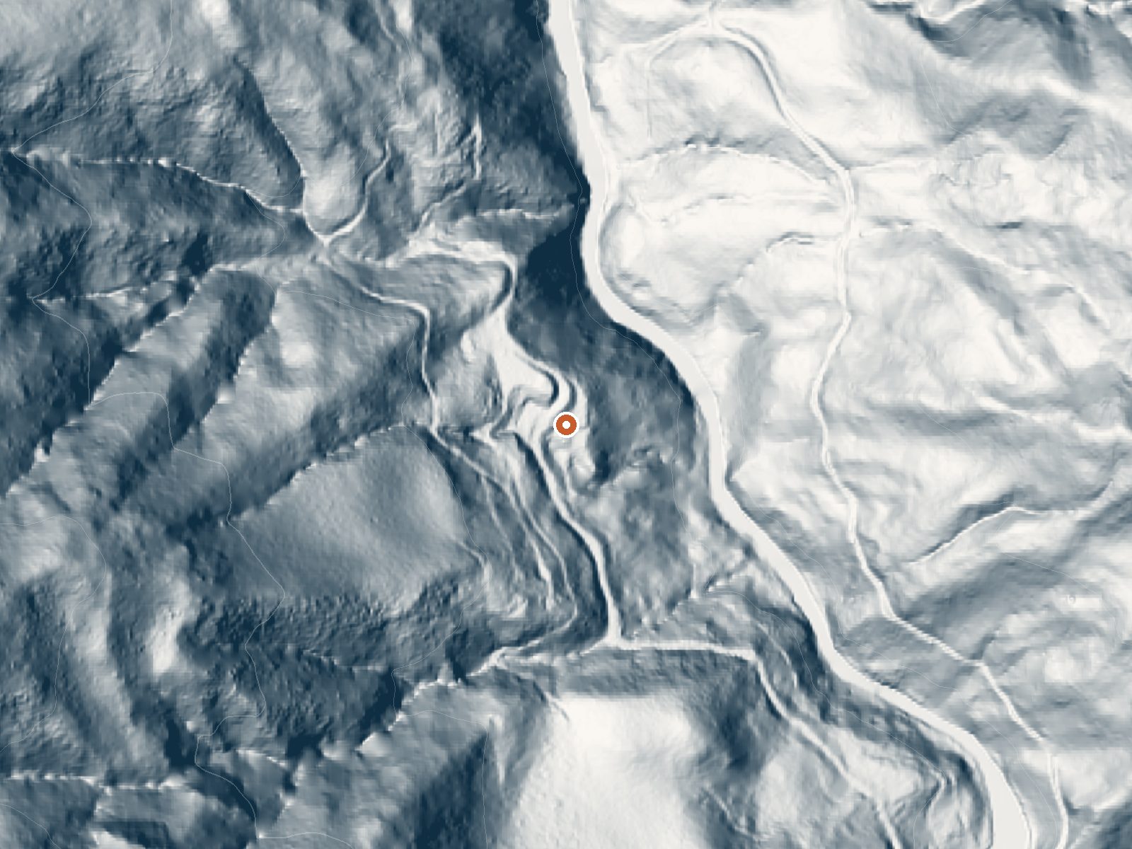
Drag the handle to compare the two views. The orange dot marks the spring, in a frame about three quarters of a mile wide.
Gilroy Hot Springs, formally Gilroy Yamato Hot Springs, is a historic resort property inside Henry W. Coe State Park in Santa Clara County, about seven miles from San Martin. The water is soaking warm. The property is on the National Register. Access is recorded as open, though that refers to the land; what the old buildings and bathhouse allow is another matter our data skips.
Foothills at a little over a thousand feet, inside a state park. The springs lie a couple hundred feet from an unnamed road. Modest rain, no snow. No campground is attached to this spring in our records, and the state park designation is the only thing the row says about who runs the place.
Winter months top the list here. The land is state park, access open, no fee recorded. There is no camping tied to this spring in our data. The water is soaking warm. Because this is a historic landmark with standing structures, check with the park about what is open to visitors.
Wikipedia describes Gilroy Yamato Hot Springs as a California Historical Landmark and a National Register property, developed by early settlers and later by Japanese immigrants. The oldest surviving buildings, in Italianate Victorian style, date from the 1870s, the earliest bathhouse from 1890, and a Buddhist shrine and Japanese garden teahouse both from 1939.
Aircraft with laser scanners measured this ground to within inches. The scan strips out trees and buildings, leaving the bare shape of the land around Gilroy Hot Springs.
- Setting
- Hillside
- The spring sits on a steep slope that climbs to the west.
- Highest ground nearby
- 601 ft above the spring
- Within a quarter mile, to the west
A slice through the ground from northwest to southeast, about 0.6 miles end to end.
Elevation data: USGS 3D Elevation Program. Aerial imagery: USGS The National Map. Public domain.
That's about 1½ times the US average of 65. It's higher than at 58% of the springs on this site.
Heat flow measures the warmth working its way up through the ground from deep inside the earth. Where it runs high, rain and snowmelt that seep down through cracks in the rock come back up hot.
See every spring on the geothermal heat map →
Heat flow estimate: Stanford Thermal Earth Model (Aljubran & Horne, 2024), CC BY 4.0.
Some links are affiliate links. We may earn a commission at no extra cost to you.
Gilroy Hot Springs is road-accessible, so you can bring more gear.




As an Amazon Associate, we earn from qualifying purchases.
Springs Near Gilroy Hot Springs
More Springs Around 106°F
Hike 6 waterfalls near Gilroy Hot Springs
Looking for more outdoor adventures? Explore waterfall hikes near Gilroy Hot Springs, California.