Cow Flats Hot Spring
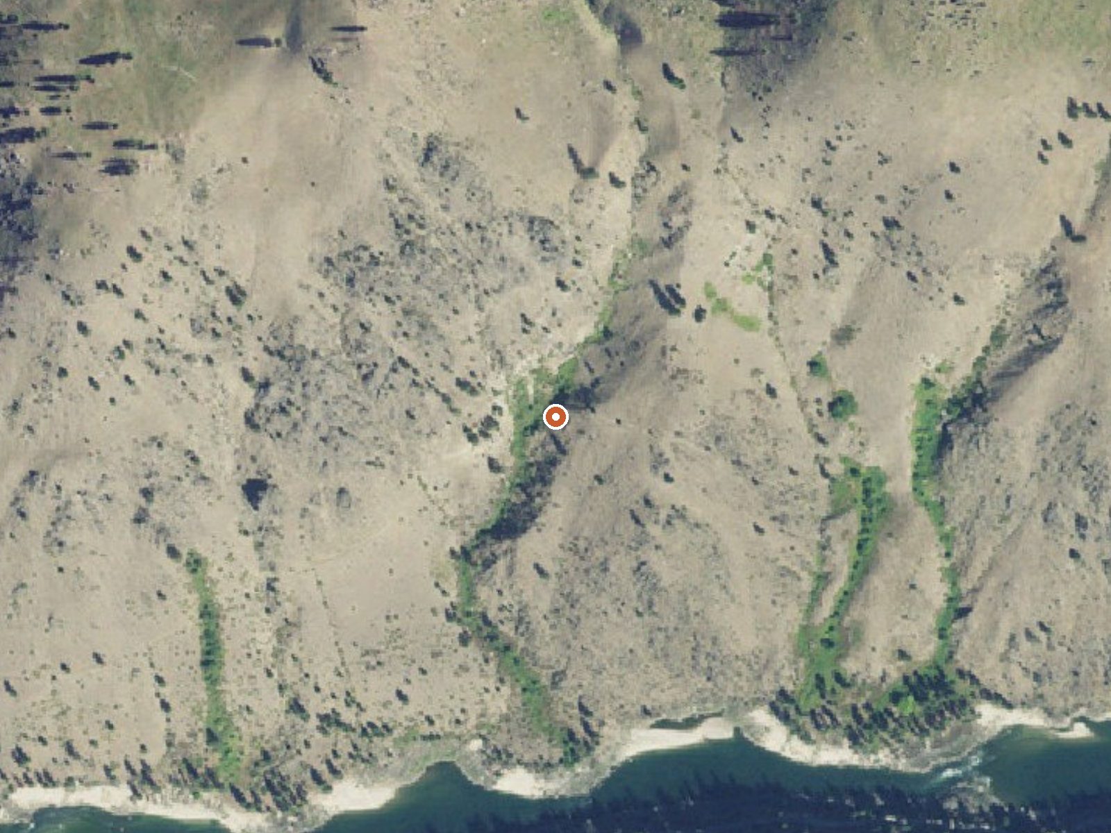
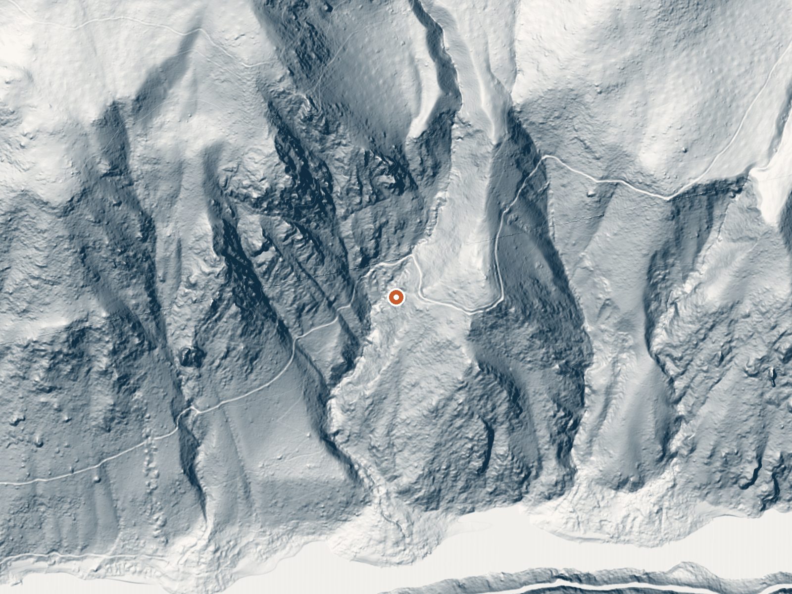
Drag the handle to compare the two views. The orange dot marks the spring, in a frame about three quarters of a mile wide.
Cow Flats is a hot roadside spring on the Nezperce National Forest in Idaho County, a long drive from anything; Grangeville, the closest town listed, is nearly thirty-five miles off. The water comes up close to a hundred and forty degrees, which hurts. Access is listed open; the ground is Forest Service. Milner Trail, which the record lists as a road, passes within a hundred feet.
Calling this roadside is accurate. Milner Trail comes within about ninety feet of the water, in country a little under thirty-five hundred feet up where winters stack ten or eleven feet of snow while the other seasons are fairly damp. Spring Bar Campground is listed about six miles away. The file holds nothing on what the spring itself looks like.
The temperature sits right at the line where touching hurts. Test carefully. the record says winter, which for a snowbound forest road is a puzzle. No water chemistry was ever sampled here. Spring Bar is the place to camp nearby.
Aircraft with laser scanners measured this ground to within inches. The scan strips out trees and buildings, leaving the bare shape of the land around Cow Flats Hot Spring.
- Setting
- Canyon floor
- Steep ground climbs away on both sides of the spring.
- Highest ground nearby
- 940 ft above the spring
- Within a quarter mile, to the north
A slice through the ground from northwest to southeast, about 0.6 miles end to end.
Elevation data: USGS 3D Elevation Program. Aerial imagery: USGS The National Map. Public domain.
That's close to the US average of 65. It's higher than at 12% of the springs on this site.
Heat flow measures the warmth working its way up through the ground from deep inside the earth. Where it runs high, rain and snowmelt that seep down through cracks in the rock come back up hot.
See every spring on the geothermal heat map →
Heat flow estimate: Stanford Thermal Earth Model (Aljubran & Horne, 2024), CC BY 4.0.
A popular take-out point for floaters of the Salmon River, the Spring Bar Campground offers a boat launching ramp and 18 tent campsites. A table and fire ring are provided at all but two of the sites. Spring Bar is situated next to a relatively flat part of the Salmon River with the south end nestled in the shade of various fruit bearing trees. The surrounding area also provides for fishing, swimming, berry picking, and exploring. Wheelchair accessible picnic facilities are available at Allis...
Springs Near Cow Flats Hot Spring
More Springs Around 138°F
Hike 5 waterfalls near Cow Flats Hot Spring
Looking for more outdoor adventures? Explore waterfall hikes near Cow Flats Hot Spring, Idaho.