Dianas Punch Bowl
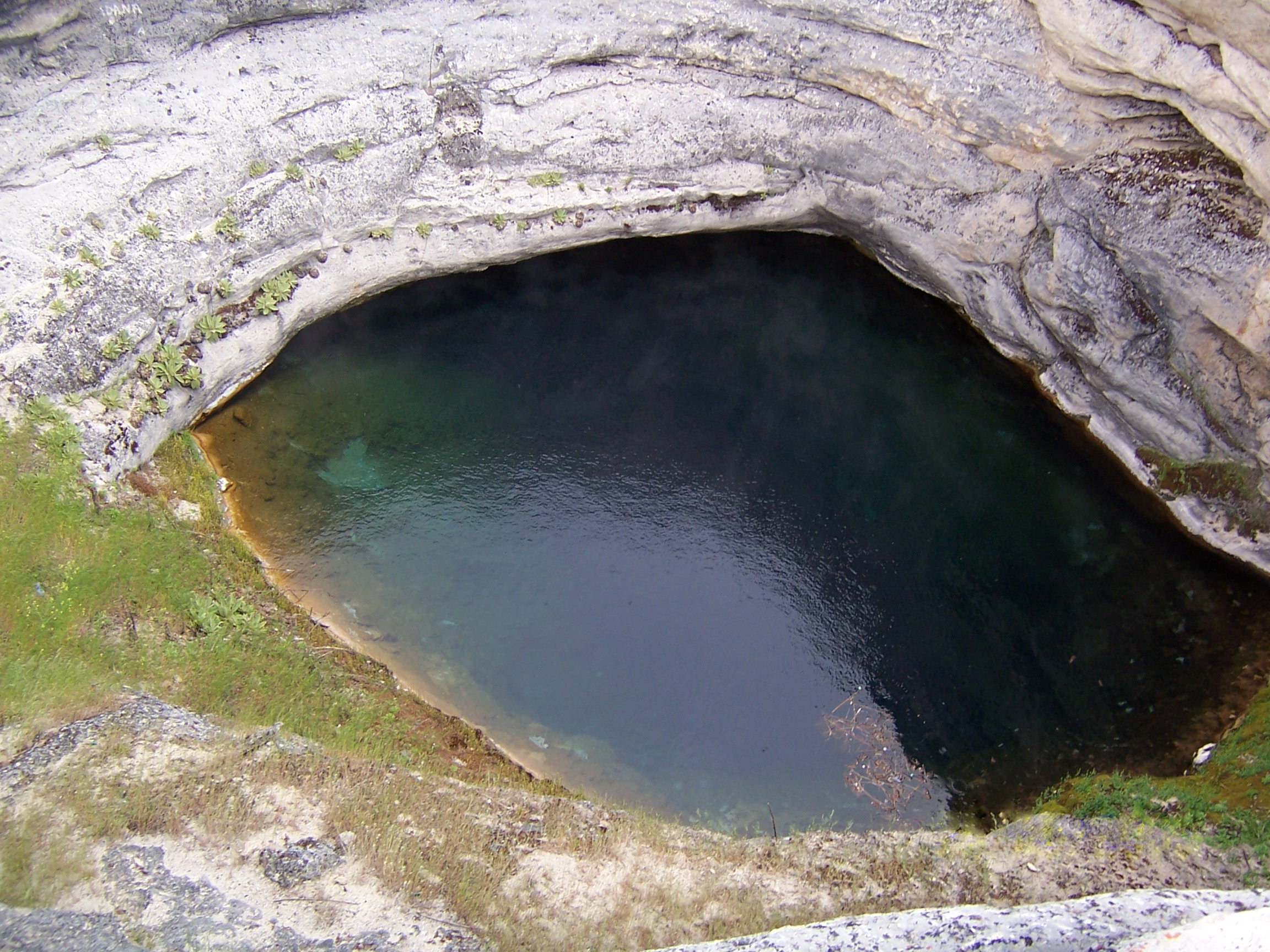
Picture a travertine dome with an opening in the top and hot water thirty feet down inside. Dianas Punch Bowl counts among the odder thermal sites in Nevada, about fifty miles from Eureka out in high basin country. Eureka County holds it. The water runs hot, near enough to scalding. Nothing on record names an owner or settles access.
The nearest road, unnamed on file, passes within seventy feet. At nearly 6,800 feet this is cold country in winter; snow piles up past three feet through the season. Precipitation overall is low, nine inches. The feature itself is a cup-shaped pit about fifty feet wide set in a hill of travertine roughly six hundred feet across.
The record's preferred months are December through February. Roadside, no walking to speak of. The water is hot and sits well below the rim of the bowl, so the hazard is the drop as much as the heat. Keep back from the edge. Public access is not recorded. Chemistry on file dates from 1974, near neutral.
Wikipedia also calls it the Devil's Cauldron and describes a geothermal feature on a small fault, exposed through a cup-shaped depression at the top of a domelike travertine hill. It lists the location as Nye County, while the record here puts it in Eureka County.
Aircraft with laser scanners measured this ground to within inches. The scan strips out trees and buildings, leaving the bare shape of the land around Dianas Punch Bowl.
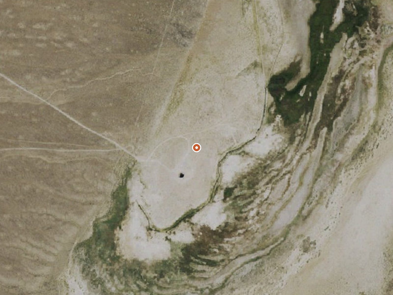
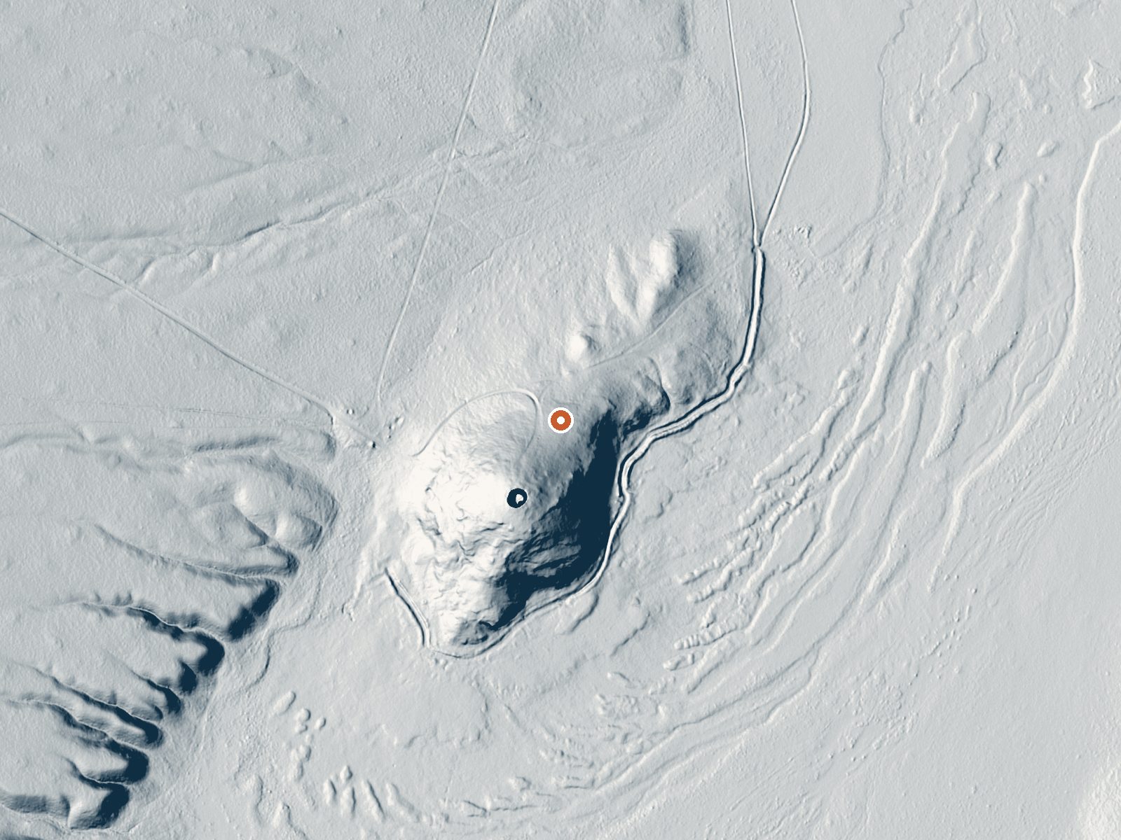
Drag the handle to compare the two views. The orange dot marks the spring, in a frame about three quarters of a mile wide.
- Setting
- Gentle slope
- The ground tilts gently up to the southwest.
- Highest ground nearby
- 37 ft above the spring
- Within a quarter mile, to the southwest
A slice through the ground from southwest to northeast, about 0.6 miles end to end.
Elevation data: USGS 3D Elevation Program. Aerial imagery: USGS The National Map. Public domain.
That's about 1½ times the US average of 65. It's higher than at 22% of the springs on this site.
Heat flow measures the warmth working its way up through the ground from deep inside the earth. Where it runs high, rain and snowmelt that seep down through cracks in the rock come back up hot.
See every spring on the geothermal heat map →
Heat flow estimate: Stanford Thermal Earth Model (Aljubran & Horne, 2024), CC BY 4.0.
The water at Dianas Punch Bowl is slightly acidic (pH 6.7).
Some links are affiliate links. We may earn a commission at no extra cost to you.
Dianas Punch Bowl sits at 6,757 feet above sea level, way above the mile-high mark. You may not feel the altitude strongly, but hot water still dehydrates you faster at elevation. UV is about 27% stronger than at sea level, so bring sunscreen and drink more water than you normally would.



As an Amazon Associate, we earn from qualifying purchases.
Dianas Punch Bowl is road-accessible, so you can bring more gear. The water runs hot, so extra hydration is key.





As an Amazon Associate, we earn from qualifying purchases.
Springs Near Dianas Punch Bowl
More Springs Around 138°F
Slightly Acidic Springs (pH ~6.7)
Hike 1 waterfall near Dianas Punch Bowl
Looking for more outdoor adventures? Explore waterfall hikes near Dianas Punch Bowl, Nevada.