Rattlesnake Hot Spring
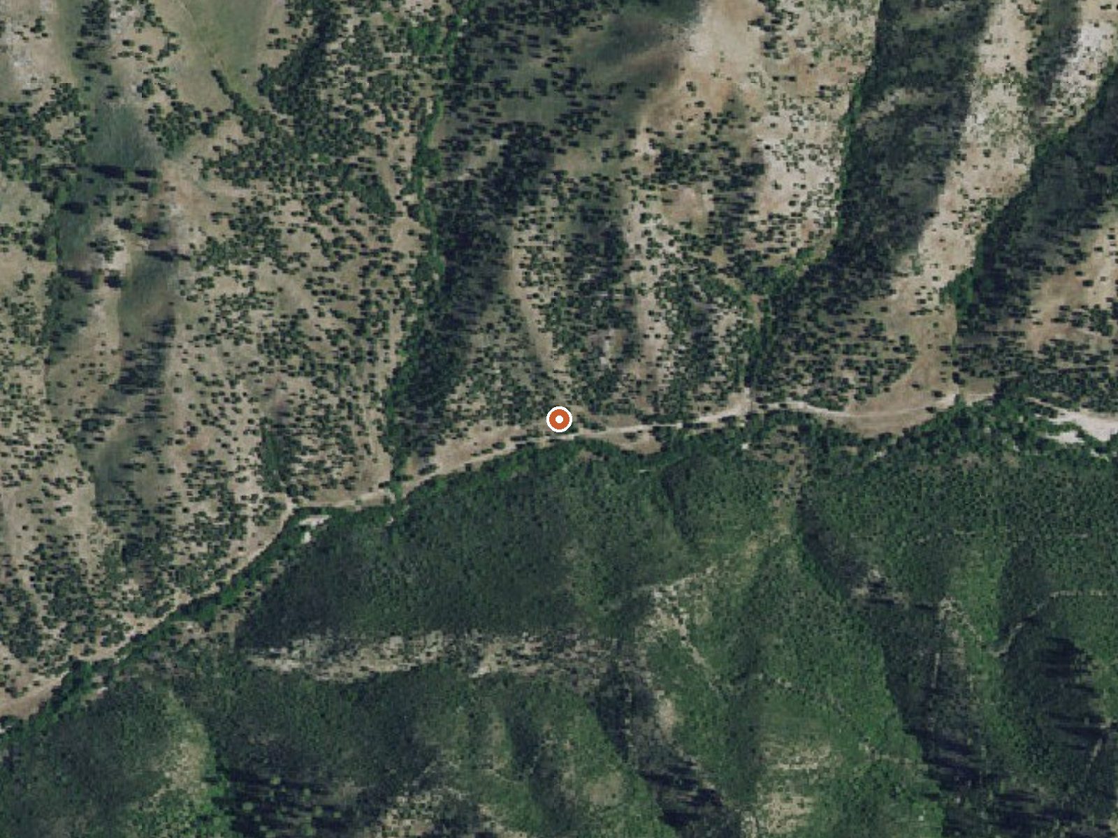
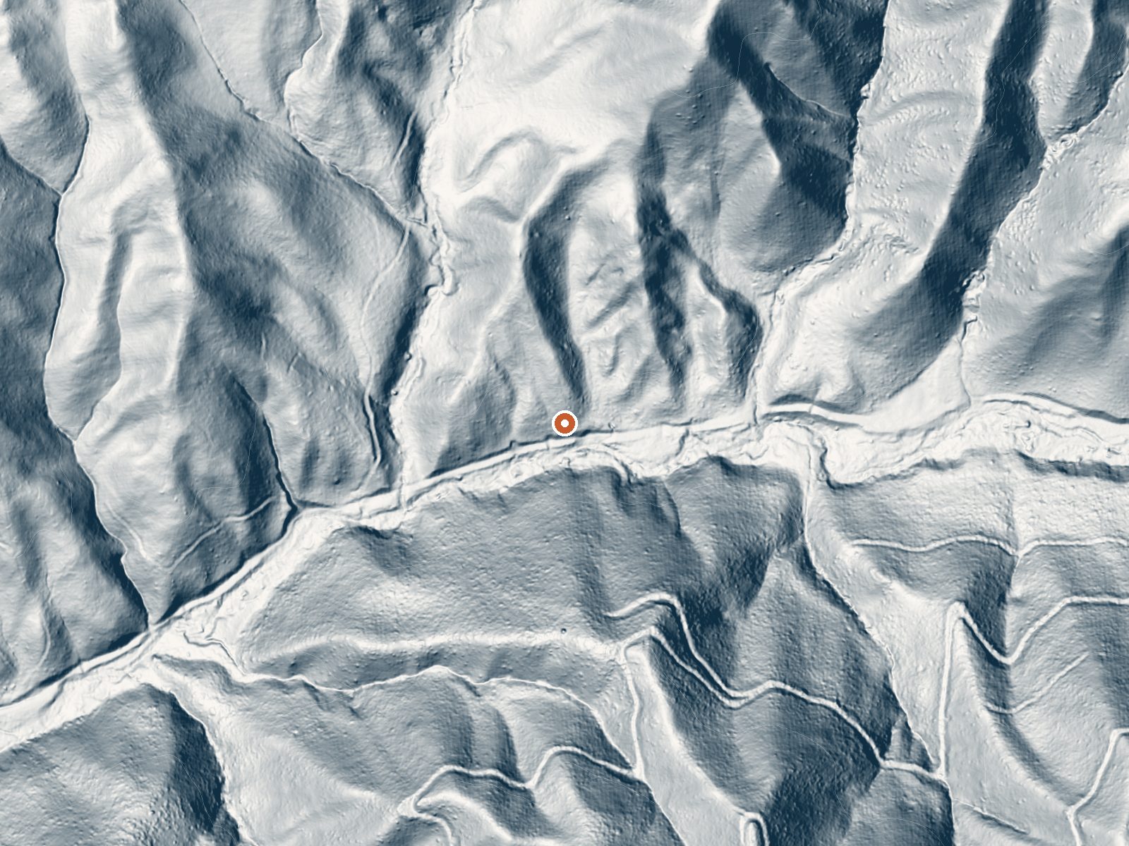
Drag the handle to compare the two views. The orange dot marks the spring, in a frame about three quarters of a mile wide.
Boise National Forest land holds Rattlesnake Hot Spring, in Boise County, 17 miles or so beyond Idaho City. The water is hot, near the upper end of what will cool to a soakable temperature. Access is open to anyone. No sample was ever taken and no USGS number assigned, which leaves the temperature as the one solid thing known about this water.
A hike of a bit over a mile in from a road the record leaves nameless. Forest Service land at moderate elevation. Snow totals are moderate too, around four and a half feet, and the year is fairly dry with a cool average.
Big Roaring River Lake Campground, eleven miles out, is the camp on file. Winter, per the record. The water is hot enough to hurt, so find a cooled spot before you sit. With no chemistry to go by, you are relying on your own senses. The walk in is a little over a mile, so this is a hike, short as it is.
Aircraft with laser scanners measured this ground to within inches. The scan strips out trees and buildings, leaving the bare shape of the land around Rattlesnake Hot Spring.
- Setting
- Canyon floor
- Steep ground climbs away on both sides of the spring.
- Highest ground nearby
- 466 ft above the spring
- Within a quarter mile, to the south
A slice through the ground from south to north, about 0.6 miles end to end.
Elevation data: USGS 3D Elevation Program. Aerial imagery: USGS The National Map. Public domain.
That's about twice the US average of 65. It's higher than at 75% of the springs on this site.
Heat flow measures the warmth working its way up through the ground from deep inside the earth. Where it runs high, rain and snowmelt that seep down through cracks in the rock come back up hot.
See every spring on the geothermal heat map →
Heat flow estimate: Stanford Thermal Earth Model (Aljubran & Horne, 2024), CC BY 4.0.
Overview: Set within the beautiful Trinity Recreation area, the Big Roaring River Lake Campground has12 campsites in a dense lodgepole forest on the river.The Trailhead to the north follows the Upper Roaring River and the Trailhead to the south accesses the William H. Pogue National Recreation Trail and the Lava Mountain Trail.Both trails are open to two-wheeled ATVs, horses, bikes, and people. The Lava Mountain Trail itself passes three lovely lakes on its way south to Lava Mountain.Fishing...
Springs Near Rattlesnake Hot Spring
More Springs Around 133°F
Hike 6 waterfalls near Rattlesnake Hot Spring
Looking for more outdoor adventures? Explore waterfall hikes near Rattlesnake Hot Spring, Idaho.