Roystone Hot Springs
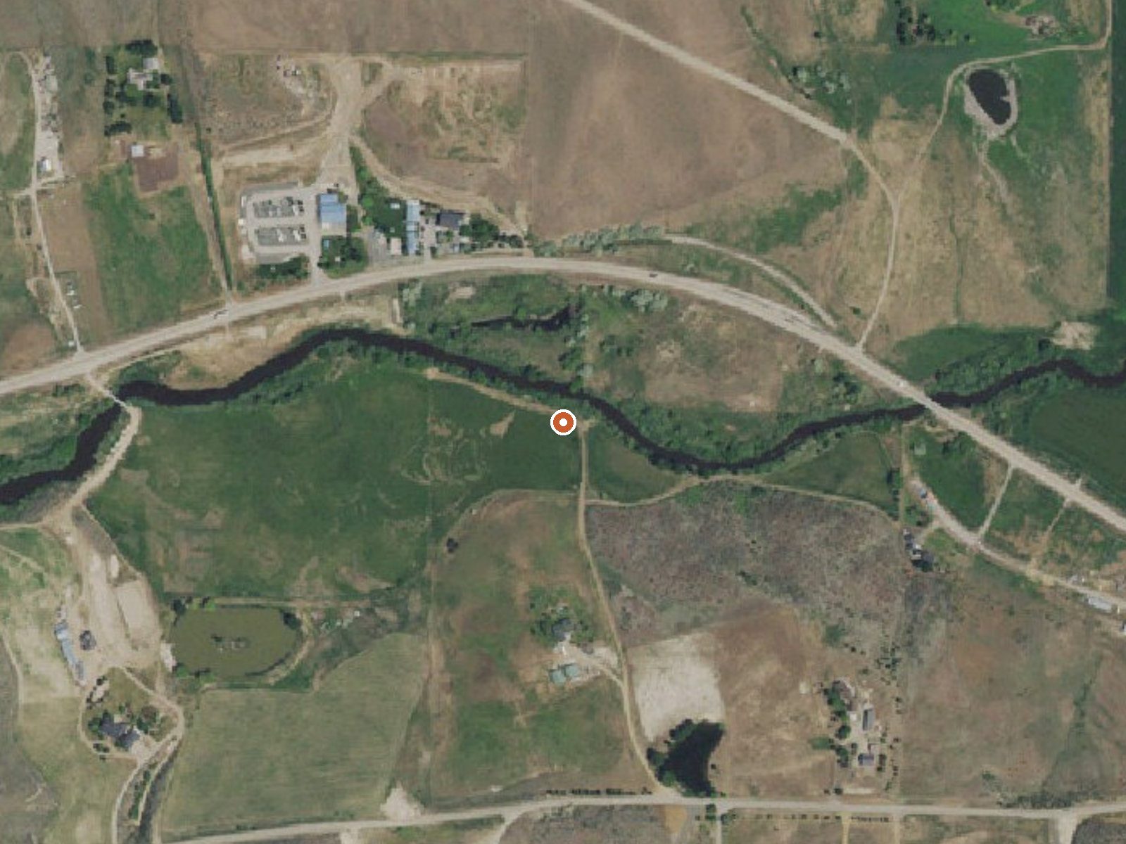
Drag the handle to compare the two views. The orange dot marks the spring, in a frame about three quarters of a mile wide.
Roystone Hot Springs is in Gem County, about nine miles from Emmett, and the water is scalding. The USGS reading sits well above what skin can take, so this is no place to get in without knowing the flow has cooled somewhere. Nothing on file names an owner or says if you can visit. No water chemistry is recorded.
East Black Canyon Highway is about a tenth of a mile off, a short walk. The spring sits low, where the yearly average is mild. Snow is light, under three feet a year, and precipitation is modest. Emmett is the closest town in the record.
Shafer Butte campground is the nearest listed, about eighteen miles away. Midwinter is the recommended time, January first. The source temperature is far above safe. Do not touch the outflow directly and keep pets and children away from it. With no owner recorded, confirm you are allowed there before visiting. No chemistry has been taken, so what the water carries is anyone's guess.
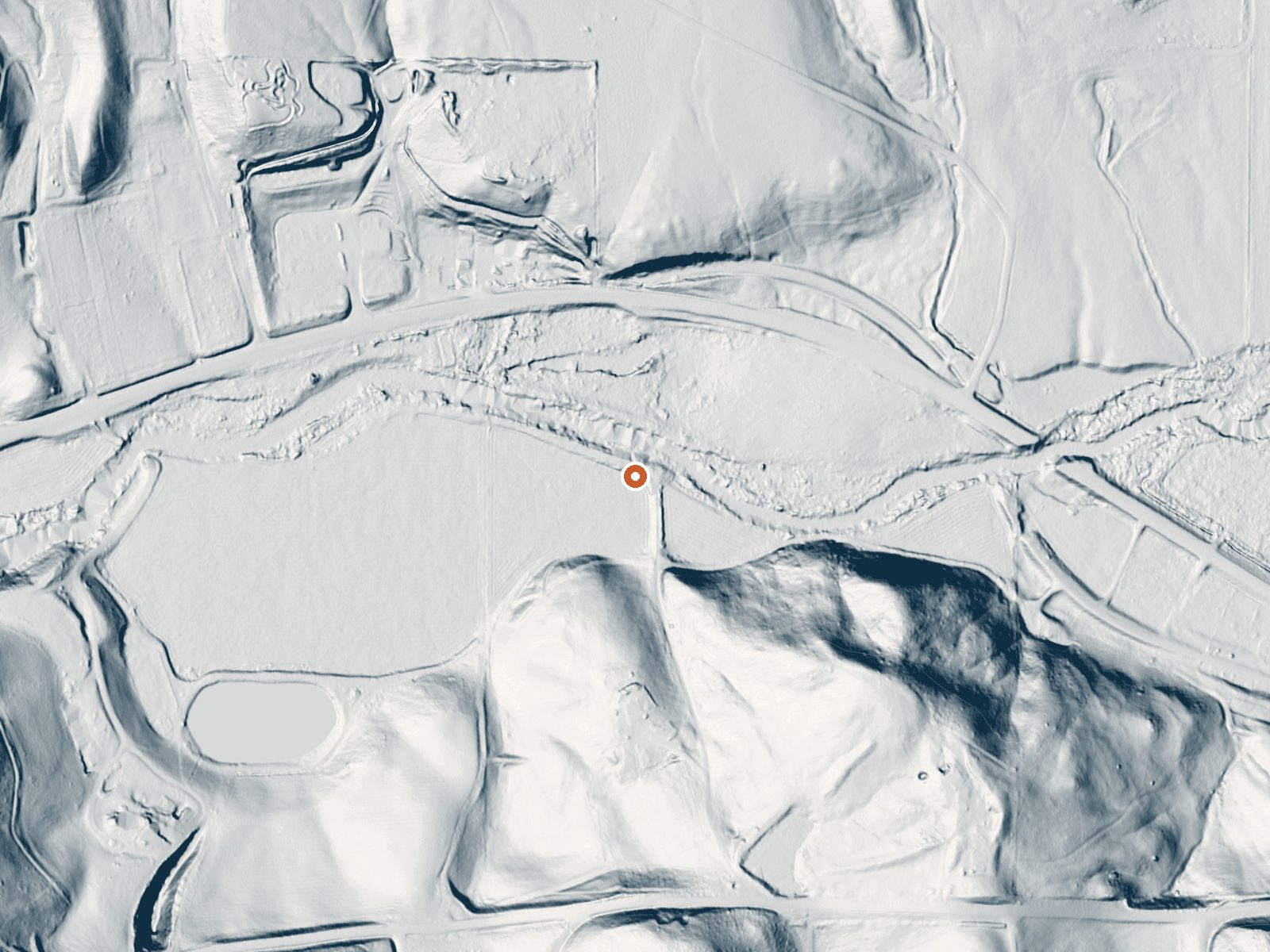
Aircraft with laser scanners measured this ground to within inches. The scan strips out trees and buildings, leaving the bare shape of the land around Roystone Hot Springs.
- Setting
- Gentle slope
- The ground tilts gently up to the southeast.
- Highest ground nearby
- 147 ft above the spring
- Within a quarter mile, to the southeast
A slice through the ground from northwest to southeast, about 0.6 miles end to end.
Elevation data: USGS 3D Elevation Program. Aerial imagery: USGS The National Map. Public domain.
That's about 1½ times the US average of 65. It's higher than at 26% of the springs on this site.
Heat flow measures the warmth working its way up through the ground from deep inside the earth. Where it runs high, rain and snowmelt that seep down through cracks in the rock come back up hot.
See every spring on the geothermal heat map →
Heat flow estimate: Stanford Thermal Earth Model (Aljubran & Horne, 2024), CC BY 4.0.
Overview Shafer Butte is located atop the scenic Boise Ridge Mountains, near Bogus Basin Mountain Recreation Area, at an elevation of 7,000 feet. Visitors enjoy hiking and biking on various trails in the surrounding area, and simply relaxing and taking in the area's beautiful views.Recreation Popular activities in the area include hiking and mountain biking, the Mores Mountain Trail begins in the campground. This 2-mile interpretive nature trail is family friendly. Facilities Shafer Butte con...
Springs Near Roystone Hot Springs
More Springs Around 151°F
Hike 3 waterfalls near Roystone Hot Springs
Looking for more outdoor adventures? Explore waterfall hikes near Roystone Hot Springs, Idaho.