Highland Land Co Warm Spring
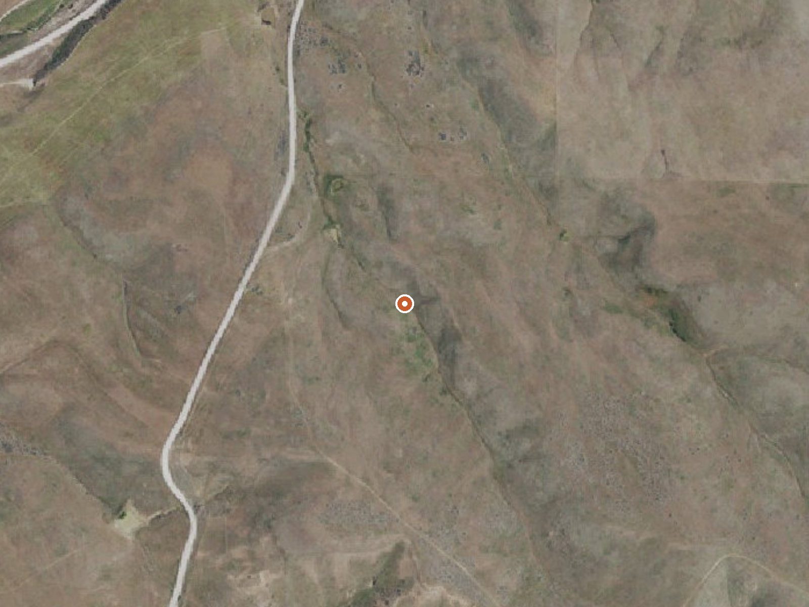
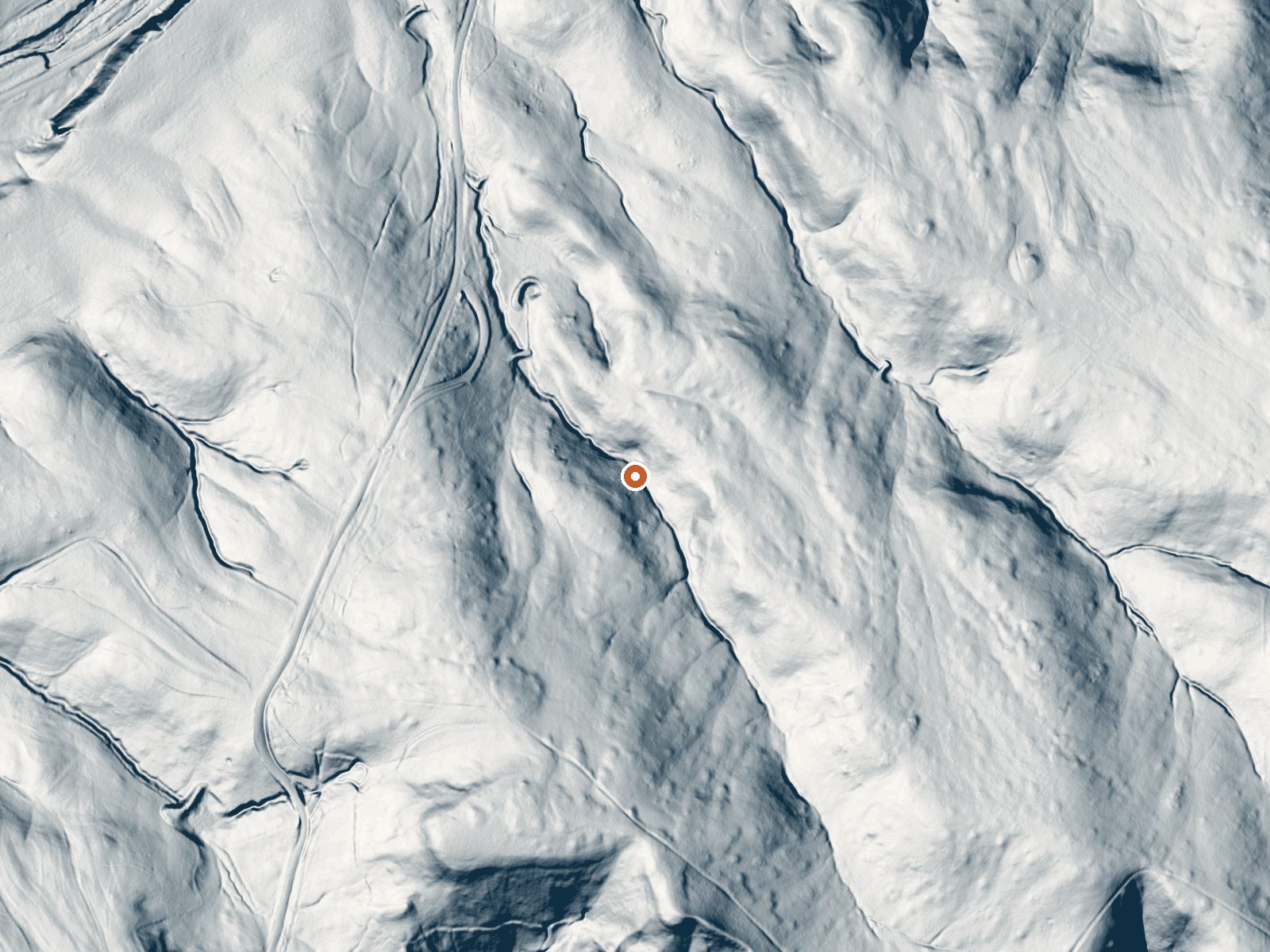
Drag the handle to compare the two views. The orange dot marks the spring, in a frame about three quarters of a mile wide.
This one carries a company name, Highland Land Co Warm Spring, and sits in Gem County a few miles outside Emmett. The water is barely warm, low seventies, the kind of temperature you notice on your hand and forget about. Ownership and public access are both blank in our records, and no water sample has ever been taken that we know of.
Low elevation for Idaho, under three thousand feet, in a dry valley that sees light snow, around seventeen inches in a typical winter. The spring lies about a tenth of a mile off the nearest road. We do not have that road's name. The closest campground on file is Shafer Butte, about sixteen miles off, which is a long way for a spring this cool.
Winter is the dry season here by our numbers, and the low snowfall means the approach should stay passable. Nobody has logged whether you can legally walk in, and with no sample on record the temperature and chemistry are both unconfirmed. Ask in Emmett before you make the trip.
Aircraft with laser scanners measured this ground to within inches. The scan strips out trees and buildings, leaving the bare shape of the land around Highland Land Co Warm Spring.
- Setting
- Valley floor
- Gentle slopes rise on both sides.
- Highest ground nearby
- 112 ft above the spring
- Within a quarter mile, to the southeast
A slice through the ground from northwest to southeast, about 0.6 miles end to end.
Elevation data: USGS 3D Elevation Program. Aerial imagery: USGS The National Map. Public domain.
That's about 1½ times the US average of 65. It's higher than at 39% of the springs on this site.
Heat flow measures the warmth working its way up through the ground from deep inside the earth. Where it runs high, rain and snowmelt that seep down through cracks in the rock come back up hot.
See every spring on the geothermal heat map →
Heat flow estimate: Stanford Thermal Earth Model (Aljubran & Horne, 2024), CC BY 4.0.
Overview Shafer Butte is located atop the scenic Boise Ridge Mountains, near Bogus Basin Mountain Recreation Area, at an elevation of 7,000 feet. Visitors enjoy hiking and biking on various trails in the surrounding area, and simply relaxing and taking in the area's beautiful views.Recreation Popular activities in the area include hiking and mountain biking, the Mores Mountain Trail begins in the campground. This 2-mile interpretive nature trail is family friendly. Facilities Shafer Butte con...
Springs Near Highland Land Co Warm Spring
More Springs Around 73°F
Hike 3 waterfalls near Highland Land Co Warm Spring
Looking for more outdoor adventures? Explore waterfall hikes near Highland Land Co Warm Spring, Idaho.