Leach Hot Springs
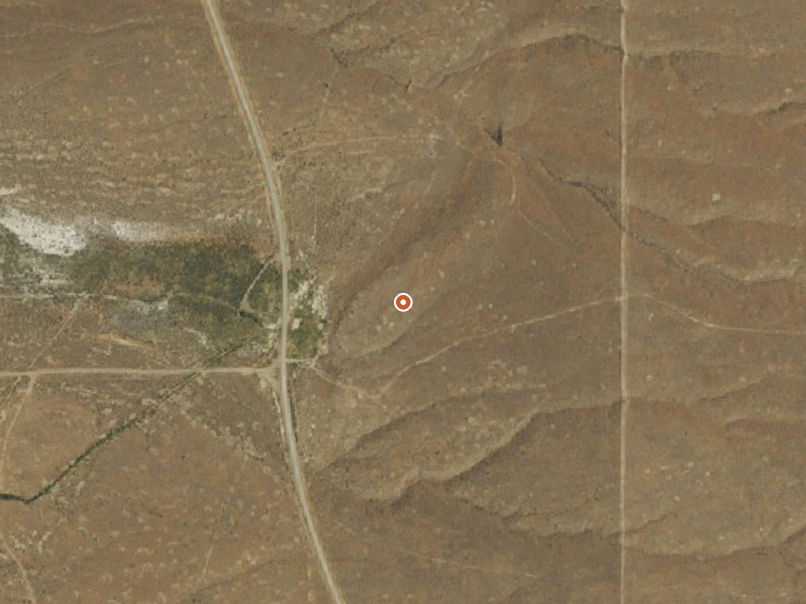
The orange dot marks the spring, in a frame about three quarters of a mile wide.
Leach Hot Springs, in Humboldt County, has water coming out close to boiling, which makes it a thermal site to look at and nothing more. It lies roughly twenty-five miles from Winnemucca, and it carries a USGS site number. Nobody should think of this as a soaking spot at the source. Access is not recorded, nor is who owns the land.
Roughly a tenth of a mile of walking separates the nearest road from the spring. The road itself is unnamed there. The ground is mid-elevation basin, dry, with about eleven inches of precipitation a year and enough snow most winters to matter. Neither a land unit nor a designation is on file.
Water above two hundred degrees will scald on contact. Keep children and dogs well back from the source and any outflow. The best months are given as December through February, when the desert is cold; the short walk in should be fine unless snow is deep. No campground is on record nearby, and neither ownership nor public access is documented.
USGS hasn't flown a detailed laser scan here yet, so this view comes from aerial photos and older elevation data.
- Setting
- Open ground
- Flat, open ground all around.
- Highest ground nearby
- 50 ft above the spring
- Within a quarter mile, to the east
A slice through the ground from west to east, about 0.6 miles end to end.
Elevation data: USGS 3D Elevation Program. Aerial imagery: USGS The National Map. Public domain.
That's about 1½ times the US average of 65. It's higher than at 41% of the springs on this site.
Heat flow measures the warmth working its way up through the ground from deep inside the earth. Where it runs high, rain and snowmelt that seep down through cracks in the rock come back up hot.
See every spring on the geothermal heat map →
Heat flow estimate: Stanford Thermal Earth Model (Aljubran & Horne, 2024), CC BY 4.0.