Spring
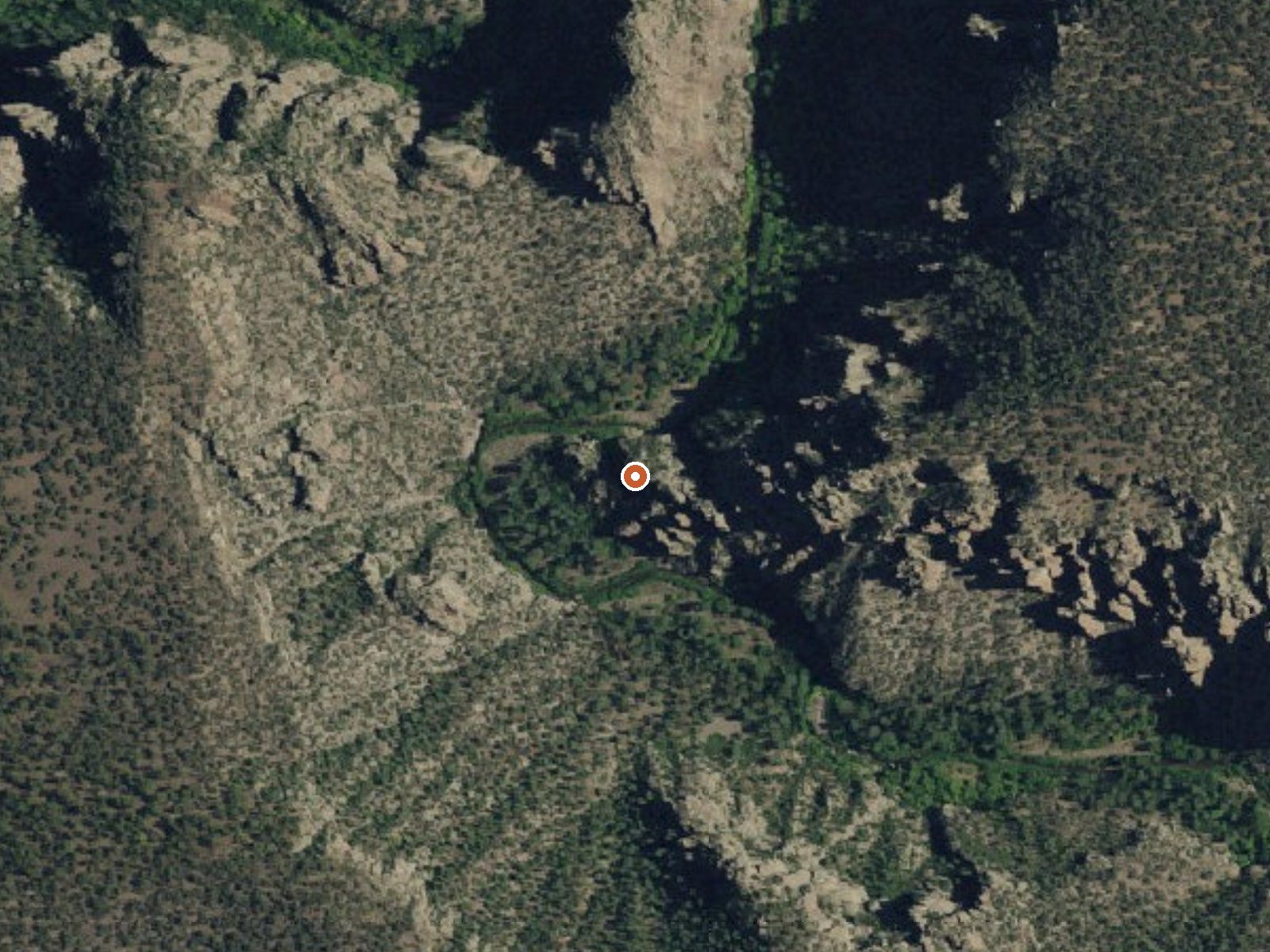
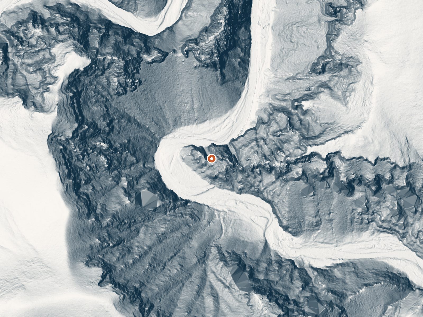
Drag the handle to compare the two views. The orange dot marks the spring, in a frame about three quarters of a mile wide.
Another Gila National Forest spring that the record names only as Spring. This one sits in Grant County about 36 miles out from Arenas Valley, and the temperature on file puts it at soaking warmth, a touch below a hot bath. The Forest Service owns the ground here and access is open. Reaching it means hiking around four and a half miles from the closest road.
The spring lies a little above six thousand feet in the Gila backcountry. Which road you start from is not stated, only how far it is, so plan on navigating from a map. Snow piles up in a normal winter and the rest of the year stays on the dry side for mountain country. Forks Campground sits nine miles or so away, the only camp the record mentions.
Winter months top the list of good times to visit, oddly enough, which points to hot summers down in this part of New Mexico. The hike is long enough that you want a full day for it. Camping at Forks Campground puts you within striking range. The record holds no water chemistry, no sample date, and no word on any kind of pool, so go in expecting to scout.
Aircraft with laser scanners measured this ground to within inches. The scan strips out trees and buildings, leaving the bare shape of the land around Spring.
- Setting
- Canyon floor
- Steep ground climbs away on both sides of the spring.
- Highest ground nearby
- 707 ft above the spring
- Within a quarter mile, to the west
A slice through the ground from northwest to southeast, about 0.6 miles end to end.
Elevation data: USGS 3D Elevation Program. Aerial imagery: USGS The National Map. Public domain.
That's about 1½ times the US average of 65. It's higher than at 51% of the springs on this site.
Heat flow measures the warmth working its way up through the ground from deep inside the earth. Where it runs high, rain and snowmelt that seep down through cracks in the rock come back up hot.
See every spring on the geothermal heat map →
Heat flow estimate: Stanford Thermal Earth Model (Aljubran & Horne, 2024), CC BY 4.0.
Some links are affiliate links. We may earn a commission at no extra cost to you.
This campground features beautiful cliffs along the West Fork of the Gila River.This campground is a great place to stop on the way to the Gila Cliff Dwellings National Monument (15 miles north). Overnight camping is allowed in the upper portion of Forks; however, the lower portion of the Forks Recreation Site along the West Fork of the Gila River is day use only.
Spring sits at 6,133 feet above sea level, way above the mile-high mark. You may not feel the altitude strongly, but hot water still dehydrates you faster at elevation. UV is about 25% stronger than at sea level, so bring sunscreen and drink more water than you normally would.



As an Amazon Associate, we earn from qualifying purchases.
Spring is road-accessible, so you can bring more gear.






As an Amazon Associate, we earn from qualifying purchases.
Springs Near Spring
More Springs Around 99°F
Hike 1 waterfall near Spring
Looking for more outdoor adventures? Explore waterfall hikes near Spring, New Mexico.