Unnamed Thermal Spring
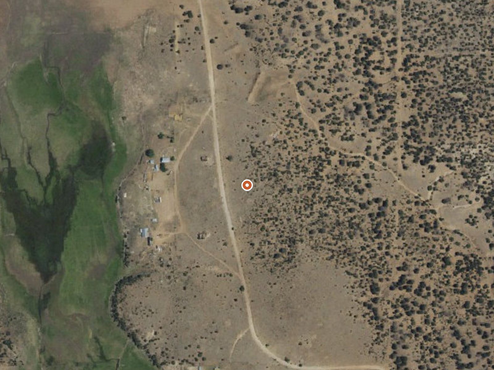
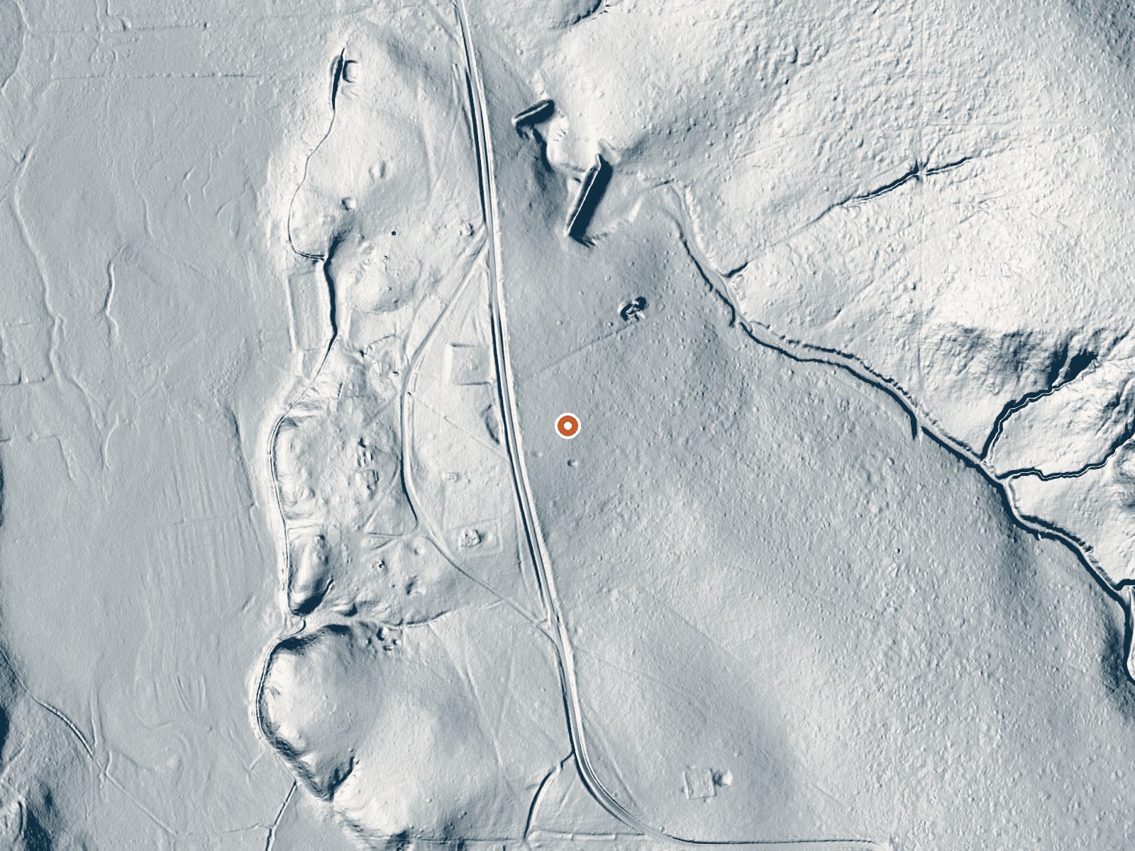
Drag the handle to compare the two views. The orange dot marks the spring, in a frame about three quarters of a mile wide.
An unnamed thermal point in Catron County, New Mexico, far from anywhere; Reserve, the closest town, is some forty miles off. The water is tepid, warm enough to register and well short of a soak. What the record does have going for it is location: Catron County Road 214 passes within a couple hundred feet. Land ownership and public access are blank.
The spring sits high, above 7,300 feet, so winter means snow and the cool months can be cold. Yearly moisture is moderate. From the county road it is a roadside stop, a short step off the shoulder. El Caso campground, listed as El Caso I through IV, lies about nine miles away. Who owns the ground beneath the spring is not on file.
Check ownership before you leave the road; nothing on record says this is public. Winter rates best in the record, though at this elevation pick a clear day. The temperature is tepid, so there is no risk of burns. No sample, no pool described, no fee. The campground at El Caso is the nearest camp.
Aircraft with laser scanners measured this ground to within inches. The scan strips out trees and buildings, leaving the bare shape of the land around this spring.
- Setting
- Open ground
- Flat, open ground all around.
- Highest ground nearby
- 17 ft above the spring
- Within a quarter mile, to the east
A slice through the ground from north to south, about 0.6 miles end to end.
Elevation data: USGS 3D Elevation Program. Aerial imagery: USGS The National Map. Public domain.
That's about 1½ times the US average of 65. It's higher than at 27% of the springs on this site.
Heat flow measures the warmth working its way up through the ground from deep inside the earth. Where it runs high, rain and snowmelt that seep down through cracks in the rock come back up hot.
See every spring on the geothermal heat map →
Heat flow estimate: Stanford Thermal Earth Model (Aljubran & Horne, 2024), CC BY 4.0.
Some links are affiliate links. We may earn a commission at no extra cost to you.
This are partially developed, shady campgrounds within hiking distance of the lake.The El Caso Campgounds are partially developed campgrounds located at the east end of Quemado Lake, approximately .25 miles east of the Piñon CG. They are nestled in a valley stretching alongside an intermittent stream and are surrounded by ponderosa pine and cottonwood trees. The El Caso Campgrounds are popular with hunters, groups, and campers desiring a more primitive camping experience.
this spring sits at 7,371 feet above sea level, way above the mile-high mark. You may not feel the altitude strongly, but hot water still dehydrates you faster at elevation. UV is about 29% stronger than at sea level, so bring sunscreen and drink more water than you normally would.



As an Amazon Associate, we earn from qualifying purchases.
this spring is road-accessible, so you can bring more gear.






As an Amazon Associate, we earn from qualifying purchases.