Boron Spring
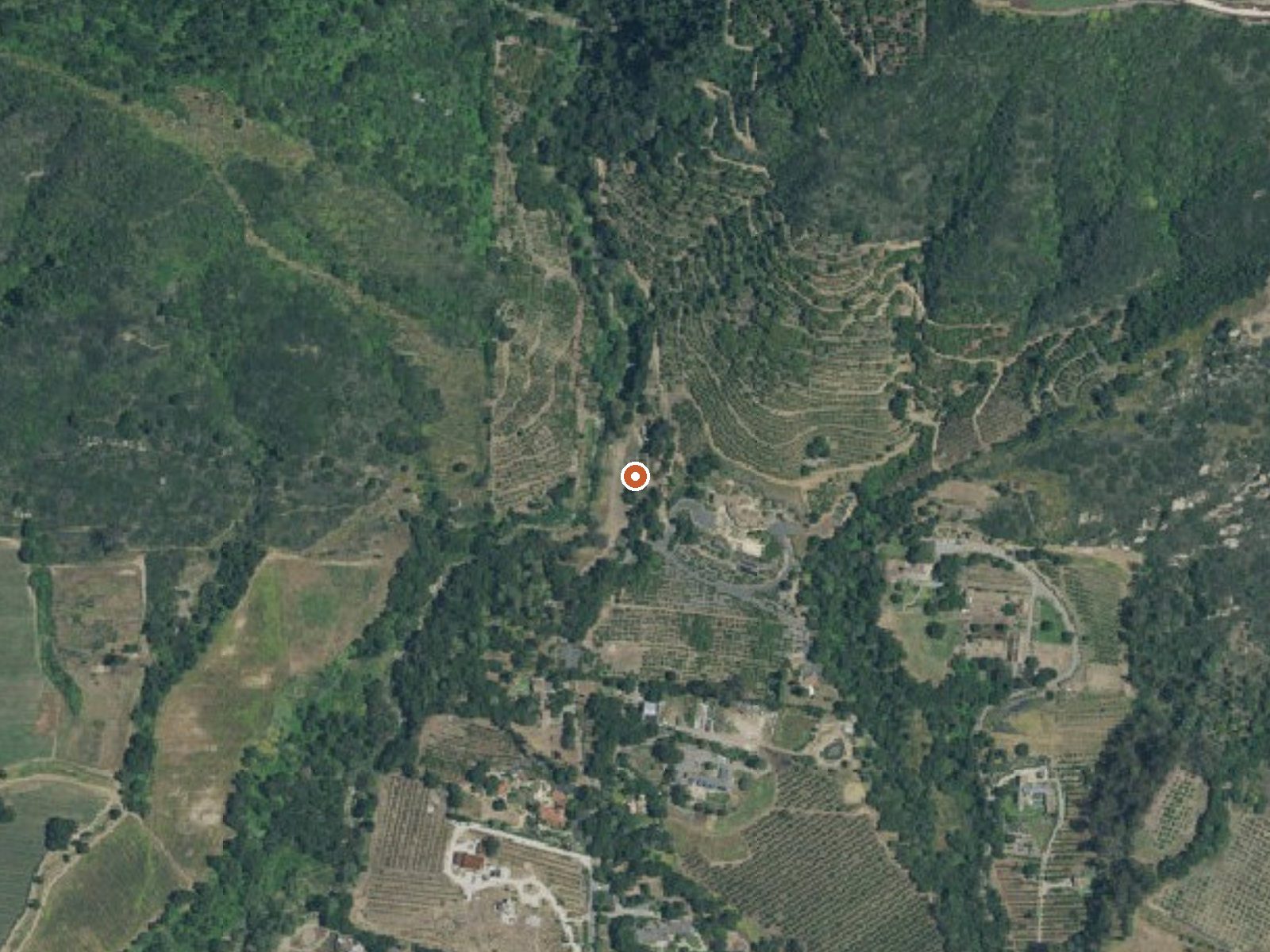
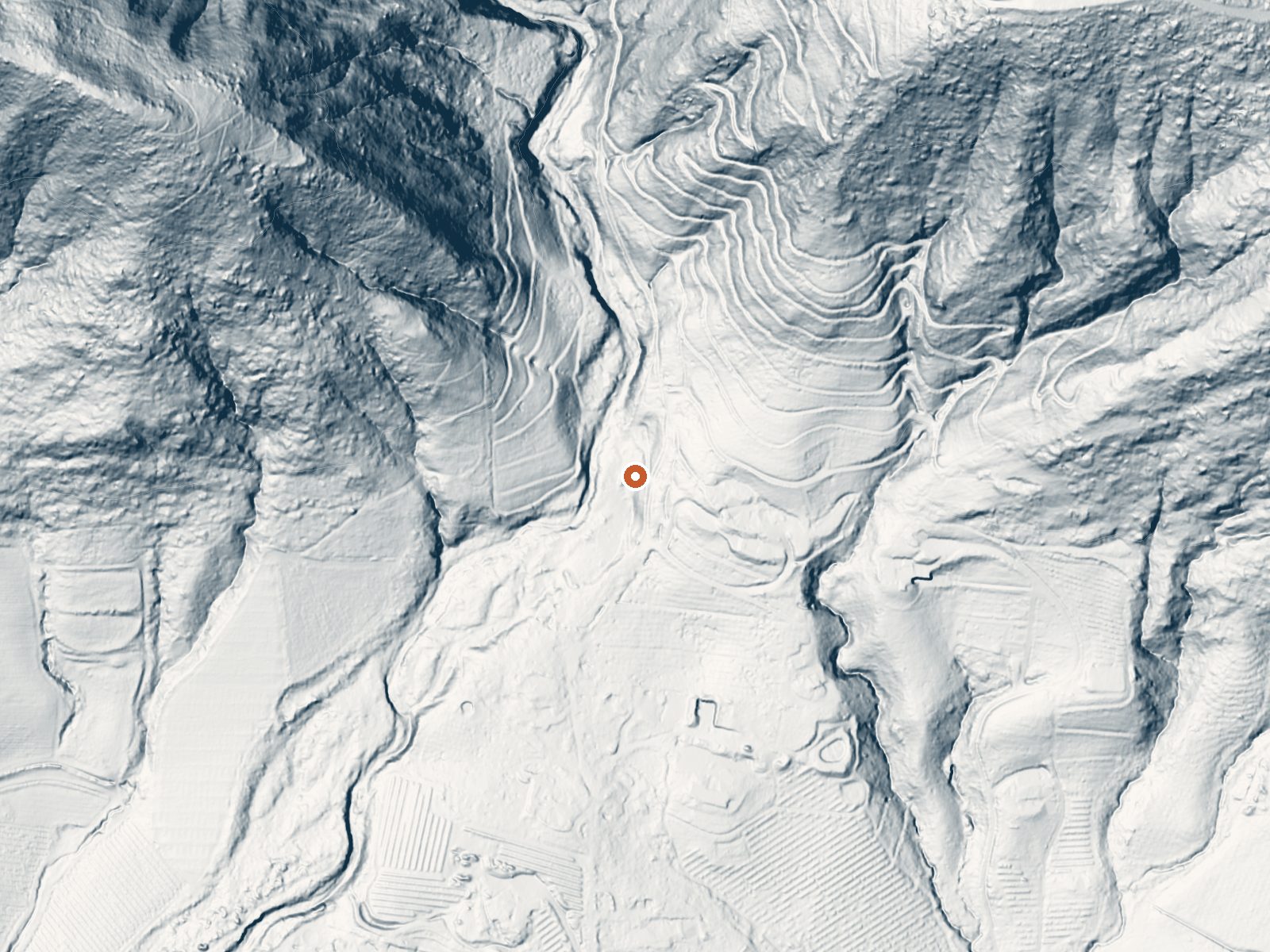
Drag the handle to compare the two views. The orange dot marks the spring, in a frame about three quarters of a mile wide.
Boron Spring, in Santa Barbara County a mile or so from Toro Canyon, is tepid by the reading on file, barely warm. Owner and access status are both unrecorded. The chemistry comes from a USGS sample taken in 1934, and the record gives no date for the temperature, so treat both as history more than current condition.
Cravens Lane sits about five hundred feet away, a short walk. Elevation is low, a couple hundred feet above sea level. Rain comes to around fourteen inches yearly, and snow is close to nonexistent, so the climate is gentle year round. Nothing is attached by way of land unit, and no agency is on record for the ground.
Winter months are the listed best. Upper Oso Campground, fifteen miles away, is the closest camping listed. The 1934 sample shows alkaline water carrying calcium and sodium, with sulfate and chloride also present. Nobody has recorded public access, and nothing says what is on the ground now. Fee unknown.
Aircraft with laser scanners measured this ground to within inches. The scan strips out trees and buildings, leaving the bare shape of the land around Boron Spring.
- Setting
- Canyon floor
- Steep ground climbs away on both sides of the spring.
- Highest ground nearby
- 429 ft above the spring
- Within a quarter mile, to the northwest
A slice through the ground from northwest to southeast, about 0.6 miles end to end.
Elevation data: USGS 3D Elevation Program. Aerial imagery: USGS The National Map. Public domain.
That's close to the US average of 65. It's higher than at 5% of the springs on this site.
Heat flow measures the warmth working its way up through the ground from deep inside the earth. Where it runs high, rain and snowmelt that seep down through cracks in the rock come back up hot.
See every spring on the geothermal heat map →
Heat flow estimate: Stanford Thermal Earth Model (Aljubran & Horne, 2024), CC BY 4.0.
The water at Boron Spring is slightly alkaline (pH 8.5). It is notably rich in sodium (supports circulation and skin hydration) and chloride (natural antiseptic with skin health benefits).
Overview Upper Oso Campground provides ample opportunity for exploration of California's coastal mountains. It is a family-friendly campground, equipped with equestrian sites, and is close to a variety of trails and several mountain streams.Recreation A variety of hiking, mountain biking and horseback riding trails begin in and around the campground, including the Santa Cruz Trail, which traverses 18 miles north to the San Rafael Wilderness. The 2.5-mile Aliso National Recreation Trail leads...
Springs Near Boron Spring
More Springs Around 72°F
Slightly Alkaline Springs (pH ~8.5)
Hike 6 waterfalls near Boron Spring
Looking for more outdoor adventures? Explore waterfall hikes near Boron Spring, California.