Warm Springs (Moffat County, Colorado)
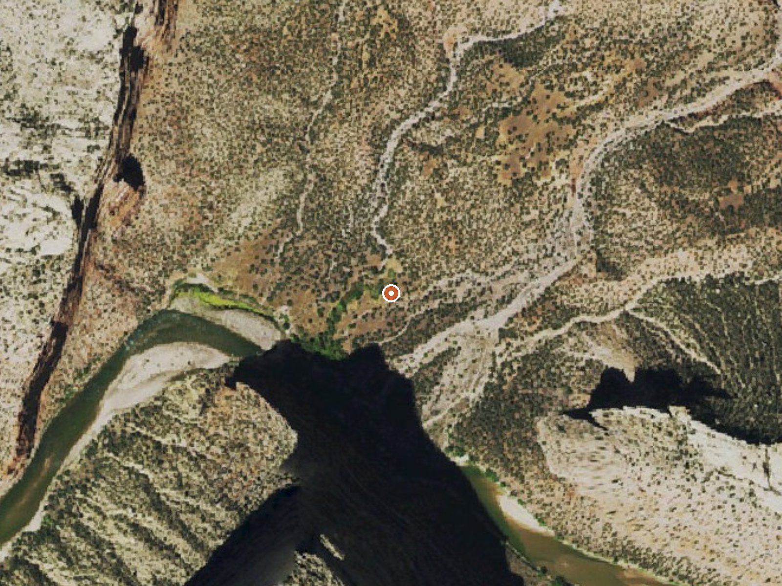
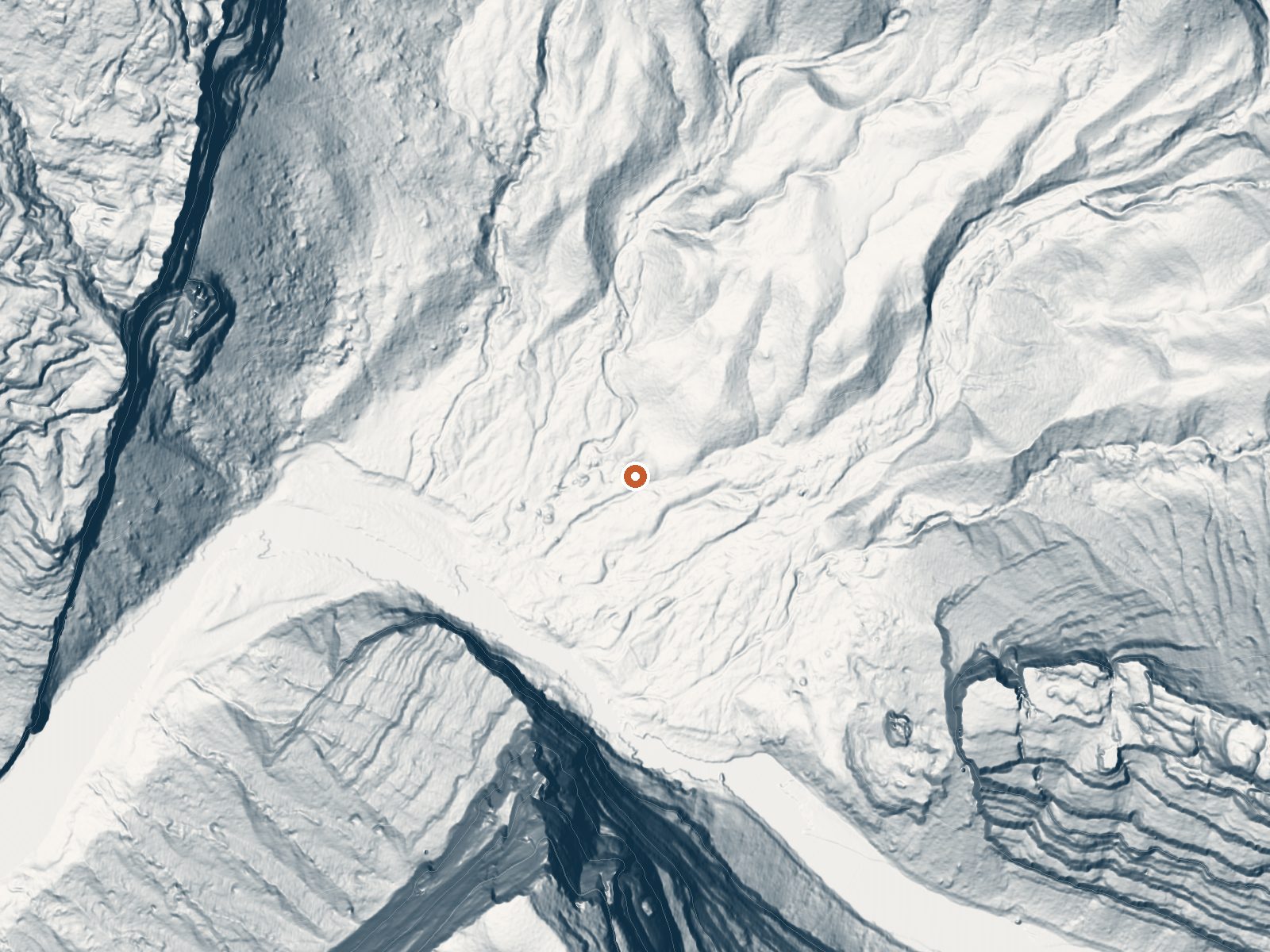
Drag the handle to compare the two views. The orange dot marks the spring, in a frame about three quarters of a mile wide.
The name says Moffat County and the record files it under Rio Blanco County. Either way this is a thermal point inside Dinosaur National Monument, on National Park Service land, with Rangely the closest town at thirty-odd miles. No temperature is recorded. Water chemistry from a 1983 sample runs alkaline with low dissolved solids. Access is open, subject to the monument's rules.
Dry country. Annual precipitation comes in around a foot and snowfall a few feet. The average temperature is mild for Colorado. You reach the spring on foot, a little over a mile from the nearest road. Echo Park Campground sits about three and a half miles away, the natural base if you are already in that corner of the monument.
National monument rules apply. Echo Park is the listed campground. No best months appear in the record because no temperature does. Do not count on warm water. The 1983 sample is the only chemistry on file and it says nothing about heat. The walk in is over a mile each way on Park Service ground.
Aircraft with laser scanners measured this ground to within inches. The scan strips out trees and buildings, leaving the bare shape of the land around Warm Springs (Moffat County, Colorado).
- Setting
- Canyon floor
- Steep ground climbs away on both sides of the spring.
- Highest ground nearby
- 1,084 ft above the spring
- Within a quarter mile, to the southwest
A slice through the ground from southwest to northeast, about 0.6 miles end to end.
Elevation data: USGS 3D Elevation Program. Aerial imagery: USGS The National Map. Public domain.
That's about 1½ times the US average of 65. It's higher than at 29% of the springs on this site.
Heat flow measures the warmth working its way up through the ground from deep inside the earth. Where it runs high, rain and snowmelt that seep down through cracks in the rock come back up hot.
See every spring on the geothermal heat map →
Heat flow estimate: Stanford Thermal Earth Model (Aljubran & Horne, 2024), CC BY 4.0.
The water at Warm Springs (Moffat County, Colorado) is alkaline (pH 8.8) with 211 mg/L total dissolved solids. It is notably rich in magnesium (known for muscle relaxation and stress relief).
Overview Echo Park Campground is located adjacent to the Green River. There are vault toilets, drinking water spigots (seasonal), and a self-pay station. This location has both first-come first-served individual sites and a group site: Individual sites. Individual sites are all first come, first served. Visitors are required to physically arrive at the campground to purchase and claim a first-come first-served site. Once on site, you can pay for your campsite(s) by scanning a QR code using...
Springs Near Warm Springs (Moffat County, Colorado)
Alkaline Springs (pH ~8.8)
Hike 4 waterfalls near Warm Springs (Moffat County, Colorado)
Looking for more outdoor adventures? Explore waterfall hikes near Warm Springs (Moffat County, Colorado), Colorado.