Bear Creek Hot Spring
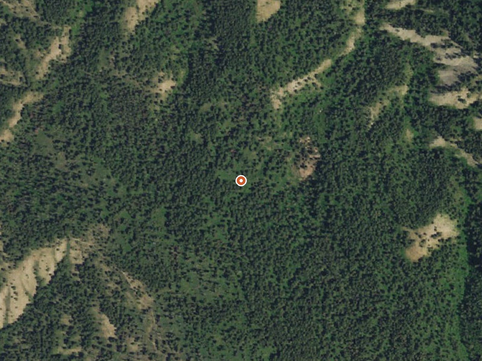
The orange dot marks the spring, in a frame about three quarters of a mile wide.
Nobody has ever recorded a temperature at Bear Creek Hot Spring. It sits in the Caribou National Forest, Teton County, Idaho, some twenty-five miles from Victor, and the word hot in the name is all there is to go on. Public land, open. Reached by a hike of three miles and change.
High. Around seven thousand feet, which is cold country: the average year sits in the high thirties and snow tops ten feet. The nearest road is National Forest Development Road 063, and the trail runs 3.4 miles from it by the record. Precipitation is moderate, around two and a half feet. Calamity campground is around six miles away.
Nothing on file says when to go, no best months, no fee. The snowfall points to a summer trip. Do not count on a soak, since the temperature is unknown. The land is Forest Service and open. The hike starts from Road 063. Calamity is the listed camping.
USGS hasn't flown a detailed laser scan here yet, so this view comes from aerial photos and older elevation data.
- Setting
- Hillside
- The spring sits on a steep slope that climbs to the south.
- Highest ground nearby
- 434 ft above the spring
- Within a quarter mile, to the south
A slice through the ground from southwest to northeast, about 0.6 miles end to end.
Elevation data: USGS 3D Elevation Program. Aerial imagery: USGS The National Map. Public domain.
That's about 1½ times the US average of 65. It's higher than at 50% of the springs on this site.
Heat flow measures the warmth working its way up through the ground from deep inside the earth. Where it runs high, rain and snowmelt that seep down through cracks in the rock come back up hot.
See every spring on the geothermal heat map →
Heat flow estimate: Stanford Thermal Earth Model (Aljubran & Horne, 2024), CC BY 4.0.
Overview Calamity Campground is located along the Snake River drainage at the north end of beautiful Palisades Reservoir at an elevation of 5,700 feet, just 55 miles east of Idaho Falls, Idaho. Visitors enjoy boating, water skiing, fishing and canoeing.Recreation Palisades Reservoir offers excellent boating, water skiing, swimming and canoeing. Lake and shore fishing are very popular here as well, with wild and stocked cutthroat trout as the predominate species. Kokanee salmon, brown and Mack...
Bear Creek Hot Spring sits at 7,004 feet above sea level, way above the mile-high mark. You may not feel the altitude strongly, but hot water still dehydrates you faster at elevation. UV is about 28% stronger than at sea level, so bring sunscreen and drink more water than you normally would.



As an Amazon Associate, we earn from qualifying purchases.
Springs Near Bear Creek Hot Spring
Hike 6 waterfalls near Bear Creek Hot Spring
Looking for more outdoor adventures? Explore waterfall hikes near Bear Creek Hot Spring, Idaho.