Portneuf River Warm Spring
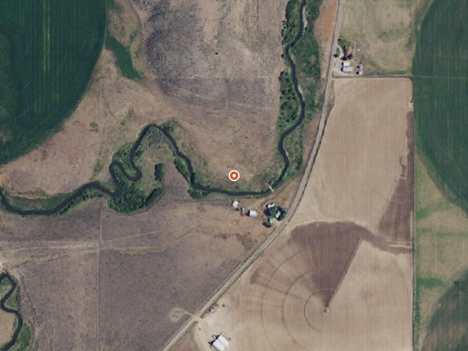
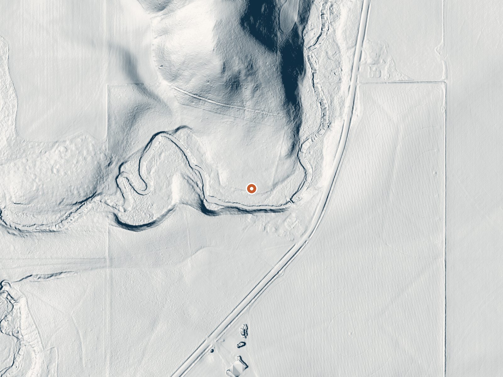
Drag the handle to compare the two views. The orange dot marks the spring, in a frame about three quarters of a mile wide.
Portneuf River Warm Spring, in Caribou County, is about 22 miles from Soda Springs. Soaking warm is the category here, low nineties when measured in 1977, with a trickle of flow and slightly acidic water. Who holds the land is unknown, and so is your right to be there. OpenStreetMap has no second name for it.
Kelly Toponce Road is the approach, roughly five hundred feet away, which makes for a short walk. The country is high, averaging in the mid forties across the year, with close to six feet of snow each winter and modest precipitation otherwise.
Pebble Guard Station is the nearest camp on record, five or six miles off. Winter months are the ones the record recommends. Flow was measured at a tenth of a cubic foot per second, which is very little, so the volume of water is small. Land status is unknown; find out before you go. The reading is from 1977.
Aircraft with laser scanners measured this ground to within inches. The scan strips out trees and buildings, leaving the bare shape of the land around Portneuf River Warm Spring.
- Setting
- Gentle slope
- The ground tilts gently up to the north.
- Highest ground nearby
- 116 ft above the spring
- Within a quarter mile, to the north
A slice through the ground from south to north, about 0.6 miles end to end.
Elevation data: USGS 3D Elevation Program. Aerial imagery: USGS The National Map. Public domain.
That's about 1½ times the US average of 65. It's higher than at 42% of the springs on this site.
Heat flow measures the warmth working its way up through the ground from deep inside the earth. Where it runs high, rain and snowmelt that seep down through cracks in the rock come back up hot.
See every spring on the geothermal heat map →
Heat flow estimate: Stanford Thermal Earth Model (Aljubran & Horne, 2024), CC BY 4.0.
The water at Portneuf River Warm Spring is slightly acidic (pH 6.2). It is notably rich in calcium (may support bone density and joint health), magnesium (known for muscle relaxation and stress relief), and sulfate (traditionally used for skin conditions and inflammation).
Overview Pebble Guard Station is located at the base of Bonneville Peak along beautiful Pebble Creek, a tributary of the Portneuf River. The rustic one-room cabin offers a secluded retreat on four fenced acres, surrounded by high mountain vistas. The original Pebble Guard Station was built in 1908. The current structure stands at a higher altitude and was built in 1933.Guests can drive to Pebble Guard Station during warmer months, but it can only be accessed by snowmobile or other snow means...
Portneuf River Warm Spring sits at 5,308 feet above sea level, way above the mile-high mark. You may not feel the altitude strongly, but hot water still dehydrates you faster at elevation. UV is about 21% stronger than at sea level, so bring sunscreen and drink more water than you normally would.



As an Amazon Associate, we earn from qualifying purchases.
Springs Near Portneuf River Warm Spring
More Springs Around 93°F
Slightly Acidic Springs (pH ~6.2)
Hike 1 waterfall near Portneuf River Warm Spring
Looking for more outdoor adventures? Explore waterfall hikes near Portneuf River Warm Spring, Idaho.