Lava Hot Springs (Thermal Mineral Springs)
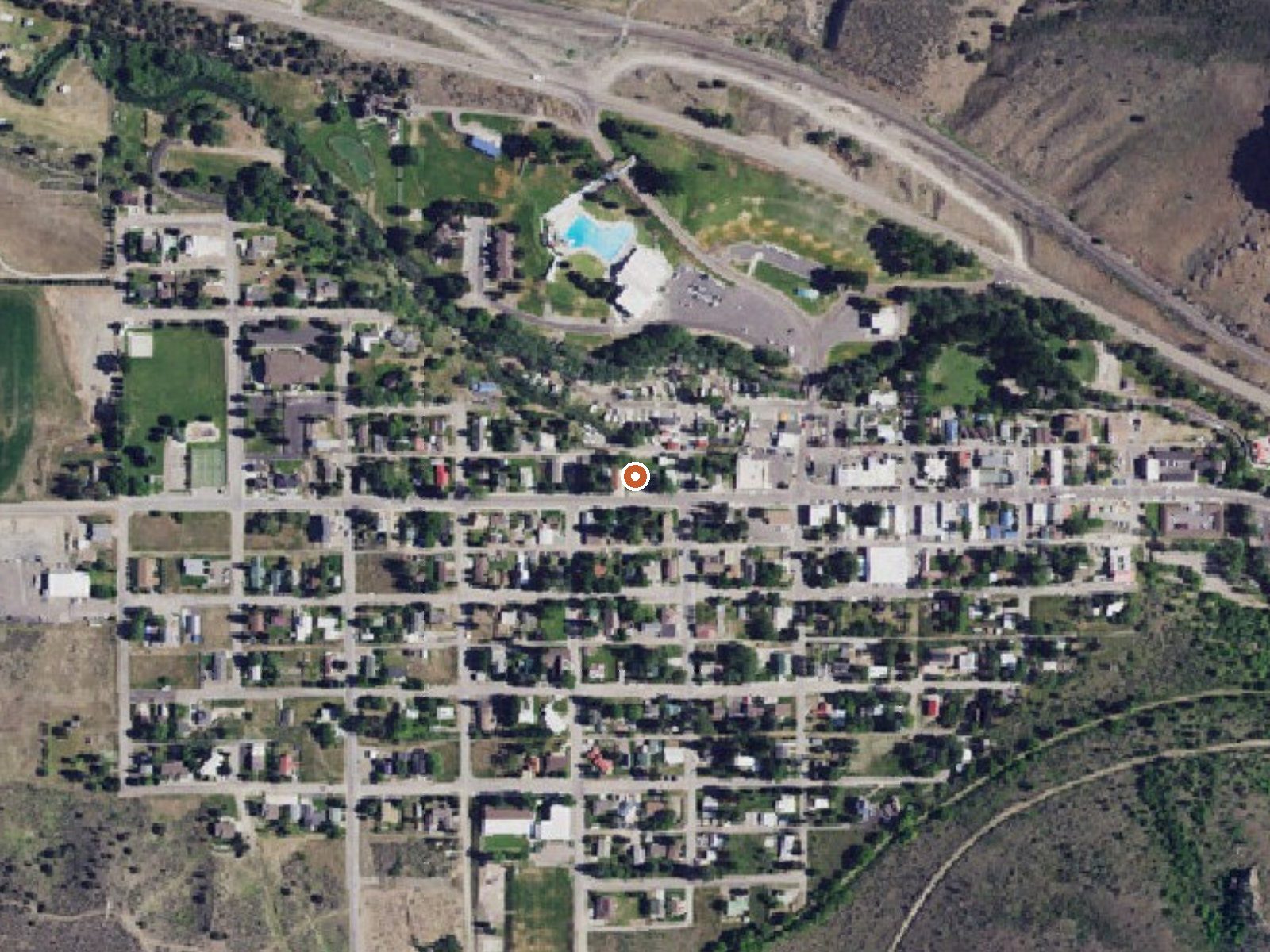
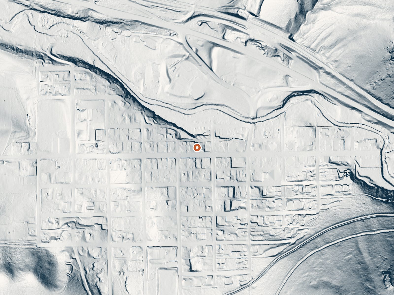
Drag the handle to compare the two views. The orange dot marks the spring, in a frame about three quarters of a mile wide.
This listing covers the Lava Hot Springs thermal mineral springs as a system, the geothermal springs Wikipedia describes in and around the Idaho town of the same name. No temperature is attached to this record, so the page makes no claim about how hot the water is. What is on file is a 1976 chemistry sample with a high mineral load, some iron among it, and a position on Main Street in town. The record places it in Caribou County, with Soda Springs as the nearest city, roughly twenty-two miles.
Main Street runs about seventy feet from the point on record, which is to say the springs are in town. No land owner or public access status is attached to this entry. The climate here is moderate, with winters that are snowy without being extreme and a year that leans dry. Elevation is not recorded.
No best season is listed. Pebble Guard Station, about eleven miles away, is the only campground on file. Without a temperature on record there is no heat warning to give beyond the usual care around thermal water. Ownership and access are not recorded here, so look to the city itself for current arrangements.
The springs gave the city of Lava Hot Springs its name, according to Wikipedia, which places the system in Bannock County, Idaho. A USGS thermal site number is attached to the record.
Aircraft with laser scanners measured this ground to within inches. The scan strips out trees and buildings, leaving the bare shape of the land around Lava Hot Springs (Thermal Mineral Springs).
- Setting
- Gentle slope
- The ground tilts gently up to the south.
- Highest ground nearby
- 117 ft above the spring
- Within a quarter mile, to the south
A slice through the ground from west to east, about 0.6 miles end to end.
Elevation data: USGS 3D Elevation Program. Aerial imagery: USGS The National Map. Public domain.
That's about 1½ times the US average of 65. It's higher than at 27% of the springs on this site.
Heat flow measures the warmth working its way up through the ground from deep inside the earth. Where it runs high, rain and snowmelt that seep down through cracks in the rock come back up hot.
See every spring on the geothermal heat map →
Heat flow estimate: Stanford Thermal Earth Model (Aljubran & Horne, 2024), CC BY 4.0.
The water at Lava Hot Springs (Thermal Mineral Springs) is neutral (pH 6.8) with 776 mg/L total dissolved solids. It is notably rich in calcium (may support bone density and joint health), magnesium (known for muscle relaxation and stress relief), and chloride (natural antiseptic with skin health benefits).
Some links are affiliate links. We may earn a commission at no extra cost to you.
Overview Pebble Guard Station is located at the base of Bonneville Peak along beautiful Pebble Creek, a tributary of the Portneuf River. The rustic one-room cabin offers a secluded retreat on four fenced acres, surrounded by high mountain vistas. The original Pebble Guard Station was built in 1908. The current structure stands at a higher altitude and was built in 1933.Guests can drive to Pebble Guard Station during warmer months, but it can only be accessed by snowmobile or other snow means...
Lava Hot Springs (Thermal Mineral Springs) is road-accessible, so you can bring more gear.






As an Amazon Associate, we earn from qualifying purchases.
Springs Near Lava Hot Springs (Thermal Mineral Springs)
Neutral Springs (pH ~6.8)
Hike 1 waterfall near Lava Hot Springs (Thermal Mineral Springs)
Looking for more outdoor adventures? Explore waterfall hikes near Lava Hot Springs (Thermal Mineral Springs), Idaho.