Weiser Warm Springs
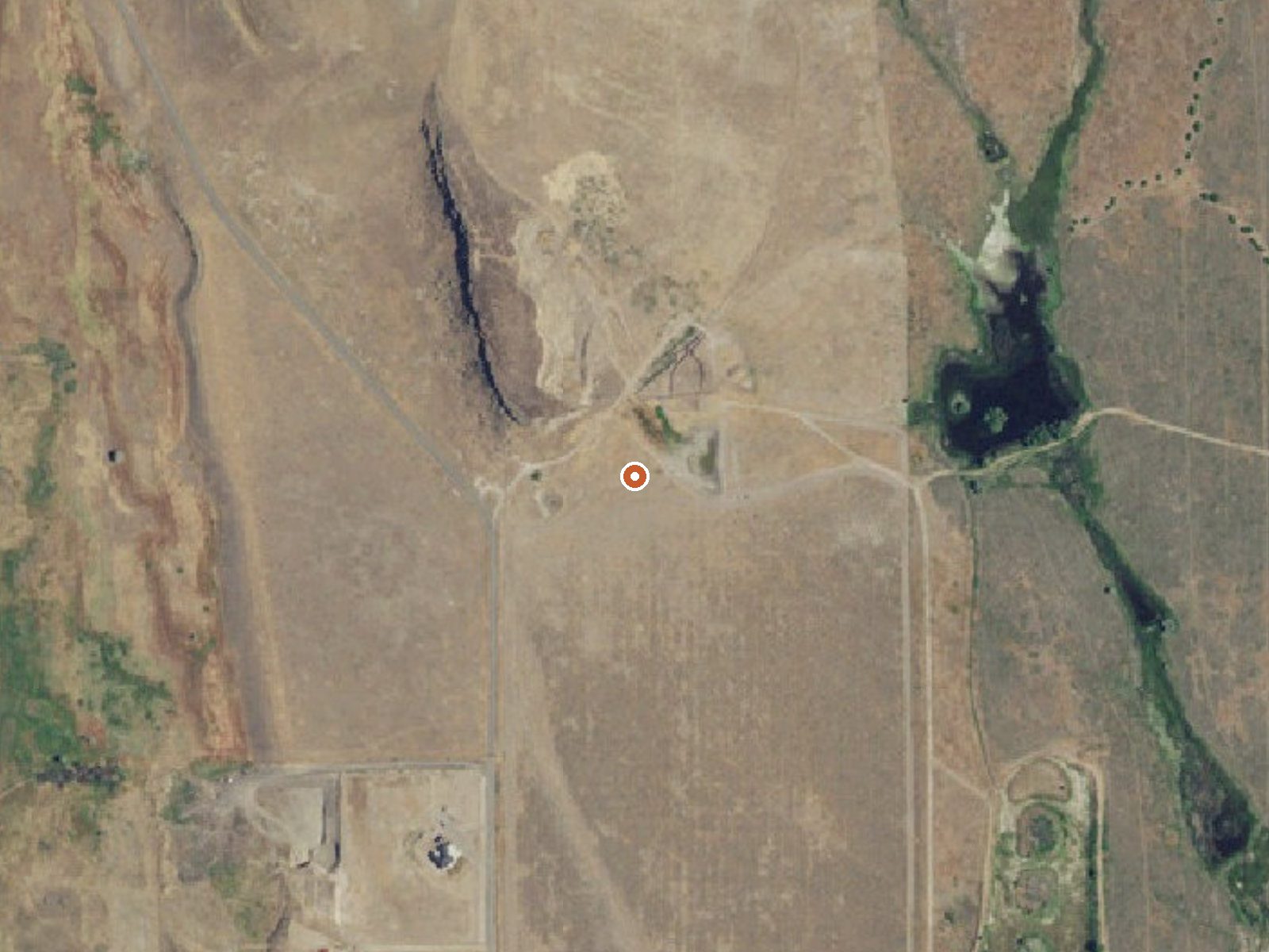
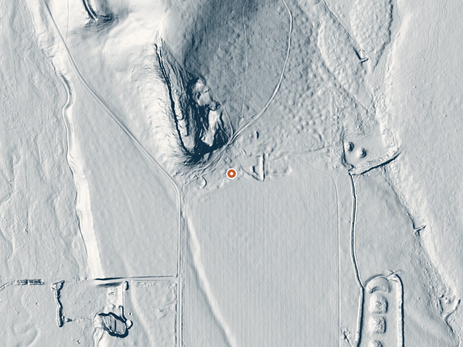
Drag the handle to compare the two views. The orange dot marks the spring, in a frame about three quarters of a mile wide.
Weiser Warm Springs is a tepid spring in Washington County, Idaho, about five miles out from the town of Weiser. The USGS logs it as a thermal point and measured the flow at a trickle, a few hundredths of a cubic foot per second. Water at this temperature feels cooler than your skin on a summer afternoon. Public access is not on record, and the record is empty.
It sits low in dry country, the kind of Idaho that sees about a foot of rain a year and a light dusting of snow by mountain standards. The spring is a roadside stop. Under two hundred feet separate it from the nearest road, though that road has no name in our records.
Winter is the listed season, December through February. The few steps from the road are the easy part. What you cannot check from here is ownership, because nothing was filed, and the same goes for permission to visit. The chemistry dates to a sample taken in 1973, so treat the temperature as historical. Mann Creek Campground is the closest camping, roughly ten miles away.
Aircraft with laser scanners measured this ground to within inches. The scan strips out trees and buildings, leaving the bare shape of the land around Weiser Warm Springs.
- Setting
- Gentle slope
- The ground tilts gently up to the north.
- Highest ground nearby
- 116 ft above the spring
- Within a quarter mile, to the north
A slice through the ground from northwest to southeast, about 0.6 miles end to end.
Elevation data: USGS 3D Elevation Program. Aerial imagery: USGS The National Map. Public domain.
That's about 1½ times the US average of 65. It's higher than at 31% of the springs on this site.
Heat flow measures the warmth working its way up through the ground from deep inside the earth. Where it runs high, rain and snowmelt that seep down through cracks in the rock come back up hot.
See every spring on the geothermal heat map →
Heat flow estimate: Stanford Thermal Earth Model (Aljubran & Horne, 2024), CC BY 4.0.
The water at Weiser Warm Springs is slightly acidic (pH 6.6).
Some links are affiliate links. We may earn a commission at no extra cost to you.
Overview Mann Creek Campground is located near the Mann Creek Reservoir in the foothills of the West Central Mountains in western Idaho near the Payette National Forest. The reservoir is a popular boating and fishing destination. Once on-site, you may be able to pay for your campsite(s) by scanning a QR code using the Recreation.gov mobile app, and the Scan and Pay feature. If this option is available, you will need to first download the free Recreation.gov mobile app https://www.recreation....
Weiser Warm Springs is road-accessible, so you can bring more gear.






As an Amazon Associate, we earn from qualifying purchases.
Springs Near Weiser Warm Springs
More Springs Around 72°F
Slightly Acidic Springs (pH ~6.6)
Hike 3 waterfalls near Weiser Warm Springs
Looking for more outdoor adventures? Explore waterfall hikes near Weiser Warm Springs, Idaho.