Warm Springs
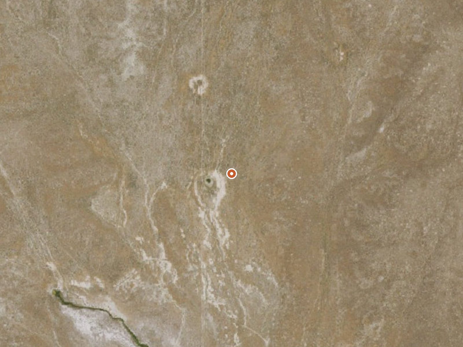
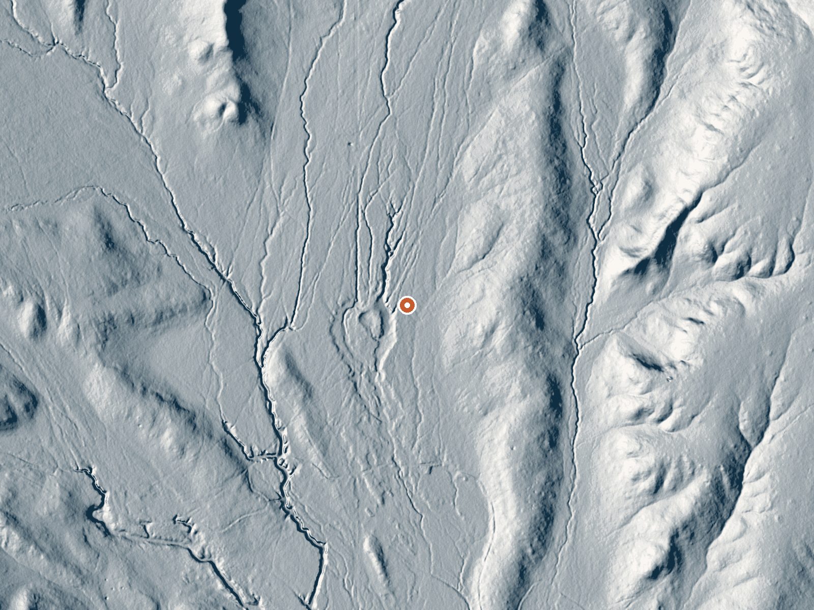
Drag the handle to compare the two views. The orange dot marks the spring, in a frame about three quarters of a mile wide.
Warm Springs, plural, in Elko County, about twenty five miles from Spring Creek. The survey entry calls the water warm and stops there. No owner, no access status, no chemistry. It is the kind of entry that exists because somebody once marked a thermal point on a map, and the page here is mostly an invitation to go find out what it amounts to.
Three quarters of a mile or so separates the spring from the closest road, one with no name recorded, so you walk the last stretch. A bit under five and a half thousand feet up. Close to three feet of snow drops in a winter, and the yearly moisture is modest. For camping, the nearest listed is the Angel Lake campground in the Humboldt-Toiyabe National Forest, around sixteen miles away.
There is no month ranking. Snow will cover the approach through the heart of winter and the walk will be muddy when it goes. Because ownership is unrecorded you should confirm you are allowed on the land before setting out. The temperature is one word, warm. Angel Lake is the fallback for a night out.
Aircraft with laser scanners measured this ground to within inches. The scan strips out trees and buildings, leaving the bare shape of the land around Warm Springs.
- Setting
- Open ground
- Flat, open ground all around.
- Highest ground nearby
- 25 ft above the spring
- Within a quarter mile, to the southeast
A slice through the ground from southwest to northeast, about 0.6 miles end to end.
Elevation data: USGS 3D Elevation Program. Aerial imagery: USGS The National Map. Public domain.
That's about 1½ times the US average of 65. It's higher than at 34% of the springs on this site.
Heat flow measures the warmth working its way up through the ground from deep inside the earth. Where it runs high, rain and snowmelt that seep down through cracks in the rock come back up hot.
See every spring on the geothermal heat map →
Heat flow estimate: Stanford Thermal Earth Model (Aljubran & Horne, 2024), CC BY 4.0.
Some links are affiliate links. We may earn a commission at no extra cost to you.
Overview Angel Lake Campground is located next to beautiful Angel Lake, high on the East Humboldt Mountain Range. It sits at an elevation of 8,400 feet, just 12 miles from the city of Wells, in northeast Nevada. Visitors enjoy canoeing, fishing, hiking and viewing wildlife.Recreation Angel Lake offers great canoeing and fishing for rainbow and brook trout. Smith Lake Trail begins at the campground entrance. Facilities The campground offers single and double campsites, some of which have lake...
Warm Springs sits at 5,363 feet above sea level, way above the mile-high mark. You may not feel the altitude strongly, but hot water still dehydrates you faster at elevation. UV is about 21% stronger than at sea level, so bring sunscreen and drink more water than you normally would.



As an Amazon Associate, we earn from qualifying purchases.
Warm Springs is road-accessible, so you can bring more gear.






As an Amazon Associate, we earn from qualifying purchases.