Unnamed Thermal Spring
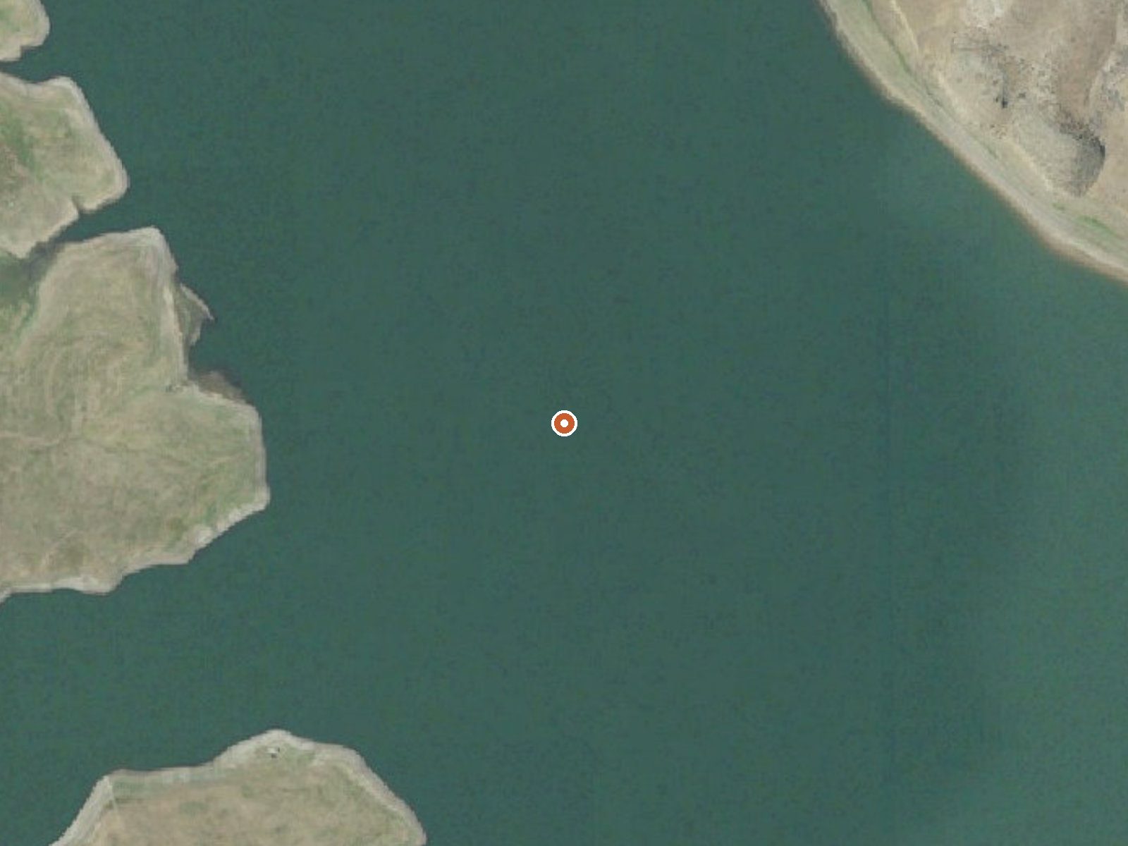

Drag the handle to compare the two views. The orange dot marks the spring, in a frame about three quarters of a mile wide.
On Bureau of Reclamation ground at Warm Springs Reservoir, in Harney County, Oregon, sits an unnamed thermal point that the survey logged as scalding. Burns is the nearest town and it is a bit over 40 miles off. The water comes out well past anything you could put a hand in, so this is a place to look at and keep your distance from. Access is listed as open.
The reservoir lies at moderate elevation in the high desert, and the record shows a dry year with modest snow, so winter is rarely the obstacle it would be higher in the mountains. Reaching the spring means leaving the car and walking most of a mile. The road it leaves from is unnamed on file. The land is managed as part of the reservoir, which is about all the record says about the immediate surroundings.
Winter months carry the best rating on file, December through February. Plan for a short walk in from the road. Chukar Park Campground is the nearest camping listed, around a dozen miles away. The water chemistry comes from a single sample taken in 1977, so treat the pH reading as historical. Do not try to touch the water; at this temperature it burns skin on contact.
Aircraft with laser scanners measured this ground to within inches. The scan strips out trees and buildings, leaving the bare shape of the land around this spring.
- Setting
- Open ground
- Flat, open ground all around.
- Highest ground nearby
- Level with the spring
- Within a quarter mile
Elevation data: USGS 3D Elevation Program. Aerial imagery: USGS The National Map. Public domain.
That's about 1½ times the US average of 65. It's higher than at 27% of the springs on this site.
Heat flow measures the warmth working its way up through the ground from deep inside the earth. Where it runs high, rain and snowmelt that seep down through cracks in the rock come back up hot.
See every spring on the geothermal heat map →
Heat flow estimate: Stanford Thermal Earth Model (Aljubran & Horne, 2024), CC BY 4.0.
The water at This spring is slightly alkaline (pH 8.2).
Some links are affiliate links. We may earn a commission at no extra cost to you.
Let the sounds of the babbling North Fork of the Malheur River lull you to sleep at one of the riverside campsites of Chukar Park Campground. This primitive facility offers 19 campsites, seven of which are situated along the shady, lush riparian vegetation. Popular as a base camp with birders, hunters and fishers as well as those venturing through along nearby highway 20, Chukar Park has campsites with partial shade and in full sun. Note that the high-standard, graded county road leading to t...
this spring is road-accessible, so you can bring more gear. The water is dangerously hot, so bring water shoes and test pools carefully.





As an Amazon Associate, we earn from qualifying purchases.
Springs Near This Spring
More Springs Around 144°F
Slightly Alkaline Springs (pH ~8.2)
Hike 1 waterfall near this spring
Looking for more outdoor adventures? Explore waterfall hikes near this spring, Oregon.