Luce Hot Springs

Harney County, Oregon · Near Burns
43.4690°N, 118.2020°W · 3,480 ft
145°F 32°F air · Good soaking weather 3,480 ft Roadside Camping nearby (23.2 mi)
Very Hot Source, Use Extreme Caution

At 145°F, the source water at Luce Hot Springs is hot enough to cause burns. Some hot springs this hot have cooler side pools or downstream areas suitable for soaking. Always test the water temperature before entering.

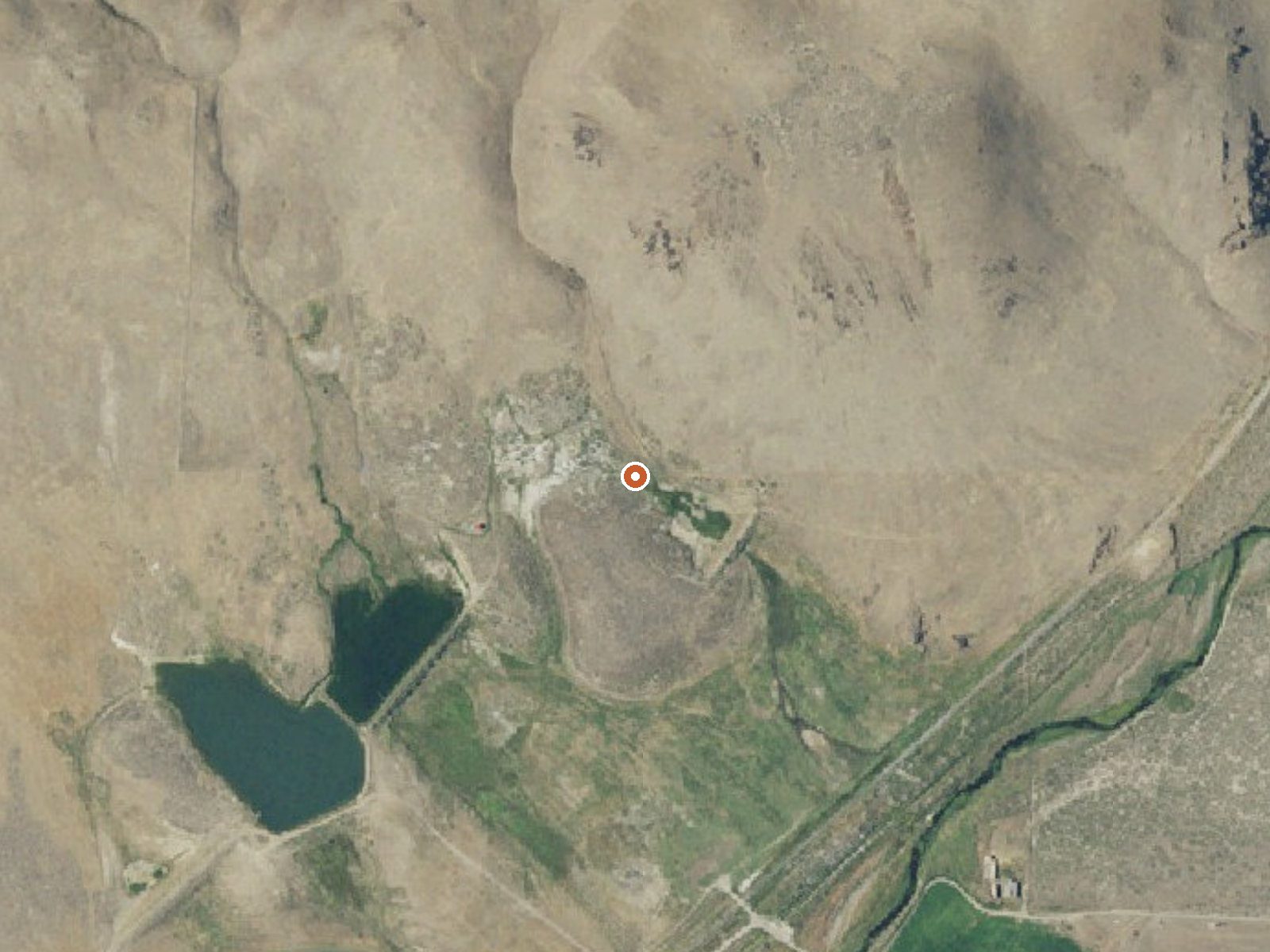
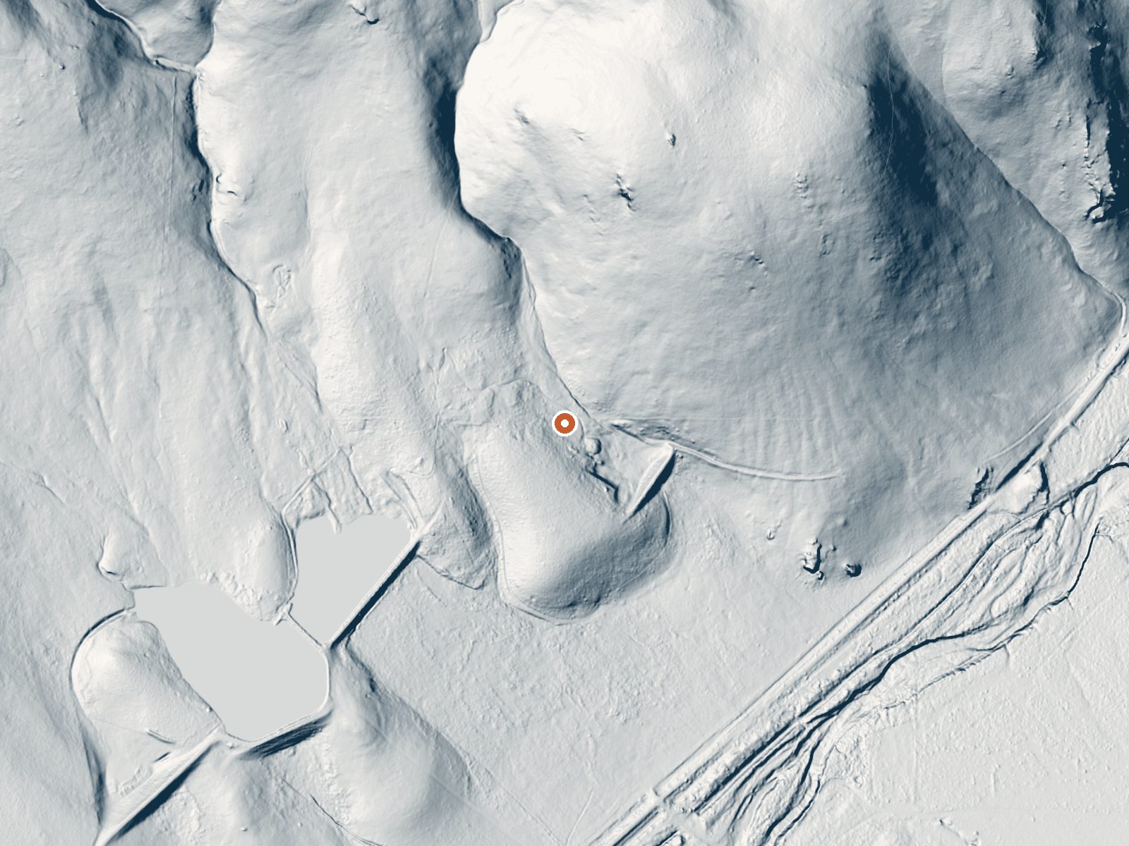
Aerial view of the ground around Luce Hot Springs LiDAR bare-earth view of the same ground around Luce Hot Springs
Aerial LiDAR bare earth

Drag the handle to compare the two views. The orange dot marks the spring, in a frame about three quarters of a mile wide.

Luce Hot Springs comes out of the ground in Harney County hot enough to burn skin on contact. Burns is the nearest town, some forty-four miles away. Who owns the land is not on record, and neither is whether the public can visit. The U.S. Geological Survey carries it as a numbered thermal site, which is most of why it is listed here at all.

Location

The spring lies at moderate desert elevation, under four thousand feet, with a road passing a couple hundred feet away. No name for that road is on file. Ownership is blank too, so assume nothing about fences or gates until you have looked for yourself. Snow in winter is light to moderate. The year as a whole is dry.

Winter gets the recommendation. The water scalds, so the source and everything flowing out of it are off limits to skin. Chukar Park Campground is the nearest listed camping, a bit over twenty miles off. Nothing in the record says if you are allowed in, so confirm that before making the drive.

Terrain

Aircraft with laser scanners measured this ground to within inches. The scan strips out trees and buildings, leaving the bare shape of the land around Luce Hot Springs.

Setting
Valley floor
Gentle slopes rise on both sides.
Highest ground nearby
204 ft above the spring
Within a quarter mile, to the northeast
Cross-section through the spring

A slice through the ground from northwest to southeast, about 0.6 miles end to end.

Elevation data: USGS 3D Elevation Program. Aerial imagery: USGS The National Map. Public domain.

Heat Below
67 milliwatts per square meter of heat flow

That's close to the US average of 65. It's higher than at 3% of the springs on this site.

Heat flow measures the warmth working its way up through the ground from deep inside the earth. Where it runs high, rain and snowmelt that seep down through cracks in the rock come back up hot.

Heat flow estimate: Stanford Thermal Earth Model (Aljubran & Horne, 2024), CC BY 4.0.

Monthly Climate
30°
Jan
35°
Feb
43°
Mar
50°
Apr
59°
May
68°
Jun
79°
Jul
78°
Aug
67°
Sep
53°
Oct
40°
Nov
31°
Dec
Annual Precip: 12.0 in Annual Snow: 25.3 in
Best Time to Visit
January Air 30°F · Water 145°F · +115° contrast
December Air 31°F · Water 145°F · +114° contrast
February Air 35°F · Water 145°F · +110° contrast
January offers 49°F more contrast than July
Current Conditions
32°F
Clear N 0.0 mph 86% Good soaking weather
Today 75° Low 46° Mostly Sunny
Spring is +70° warmer
Wednesday 76° Low 47° Sunny 2% precip
Spring is +69° warmer
Thursday 72° Low 46° Chance Rain Showers 48% precip
Spring is +73° warmer
Friday 76° Low 47° Sunny 5% precip
Spring is +69° warmer
Saturday 79° Low 48° Sunny 1% precip
Spring is +66° warmer
USGS Field Measurements
Recent Temperature 143.6°F (62.0°C) Measured Aug 21, 1991
Nearby Camping
Nearby Camping
Chukar Park Campground 23.2 mi away

Let the sounds of the babbling North Fork of the Malheur River lull you to sleep at one of the riverside campsites of Chukar Park Campground. This primitive facility offers 19 campsites, seven of which are situated along the shady, lush riparian vegetation. Popular as a base camp with birders, hunters and fishers as well as those venturing through along nearby highway 20, Chukar Park has campsites with partial shade and in full sun. Note that the high-standard, graded county road leading to t...

Fee $5 per night.
Stay limit 14 days.
Reserve on Recreation.gov →
Temperature
145°F
Warm Hot Boiling
Water Temp 145°F (63°C)
Avg Air Temp 53°F
Above Ambient +92°F
Great soaking conditions September
Access
Road Access Roadside
Distance to Road 244 ft
Frequently Asked Questions
What is the water temperature at Luce Hot Springs?
Luce Hot Springs has a water temperature of 145°F (63°C). This is considered a hot spring, well above body temperature.
Where is Luce Hot Springs located?
Luce Hot Springs is located in Harney County, Oregon at 3,480 feet elevation, near Burns. Coordinates: 43.4690°N, 118.2020°W.
How do I get to Luce Hot Springs?
Luce Hot Springs has Roadside road access (244 ft from the road).
Can I camp near Luce Hot Springs?
Yes, Chukar Park Campground is located nearby (23.2 miles away). $5 per night..
Is it safe to soak at Luce Hot Springs?
No, not at the source. The water at Luce Hot Springs reaches 145°F, which can cause severe burns within seconds. Look for cooled side pools or downstream stretches, and test with a hand before anything else.
Sources: USGS NWIS