Little Antelope Flat Warm Spring
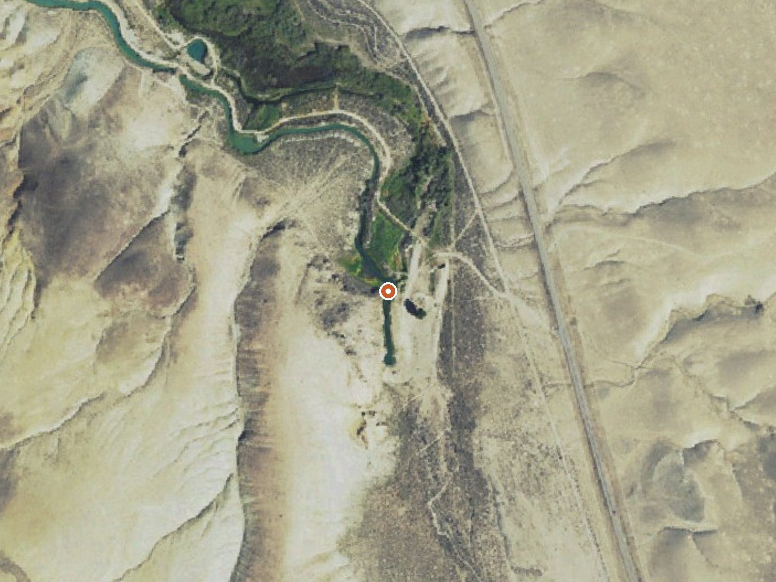
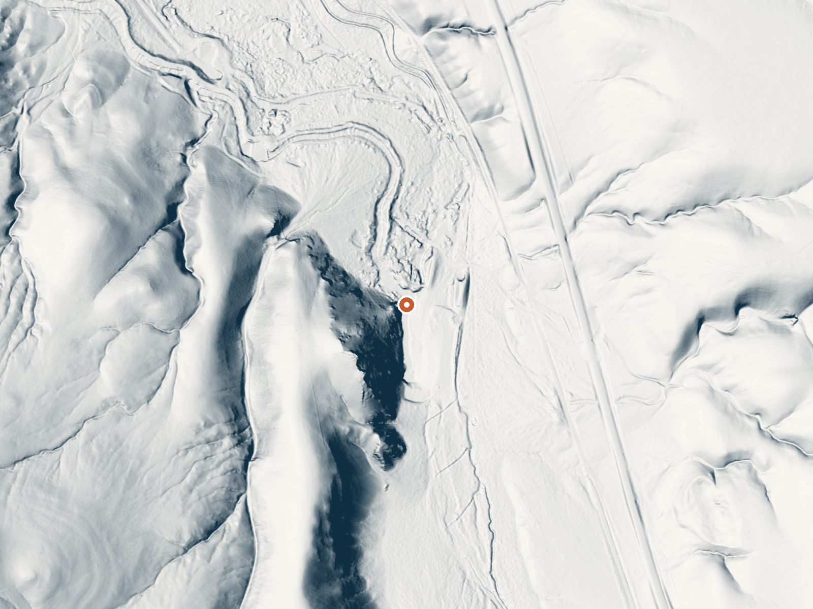
Drag the handle to compare the two views. The orange dot marks the spring, in a frame about three quarters of a mile wide.
Little Antelope Flat Warm Spring is a roadside thermal point in Custer County, eleven miles from Challis. Soaking warm water, low nineties, that tested close to neutral in 1984. Owner and access status are blank. It has a USGS site number, a temperature, one old chemistry sample, and not much else on record.
Ninety feet or so separates the spring from the road. We cannot tell you which road. Elevation is fifty-six hundred feet. Snow is moderate, five feet or so a year, in a dry climate. Herd Lake Campground, twenty miles off, is the closest campground our data has. Nobody has entered a land unit for it.
By our numbers midwinter is driest. Roadside access means no walk. Check for posting, because access has never been recorded here. The 1984 sample is the most recent information we have, and the temperature came from that same visit, so treat both as dated.
Aircraft with laser scanners measured this ground to within inches. The scan strips out trees and buildings, leaving the bare shape of the land around Little Antelope Flat Warm Spring.
- Setting
- Hillside
- The spring sits on a steep slope that climbs to the southwest.
- Highest ground nearby
- 202 ft above the spring
- Within a quarter mile, to the southwest
A slice through the ground from southwest to northeast, about 0.6 miles end to end.
Elevation data: USGS 3D Elevation Program. Aerial imagery: USGS The National Map. Public domain.
That's about twice the US average of 65. It's higher than at 92% of the springs on this site.
Heat flow measures the warmth working its way up through the ground from deep inside the earth. Where it runs high, rain and snowmelt that seep down through cracks in the rock come back up hot.
See every spring on the geothermal heat map →
Heat flow estimate: Stanford Thermal Earth Model (Aljubran & Horne, 2024), CC BY 4.0.
The water at Little Antelope Flat Warm Spring is slightly alkaline (pH 7.4).
Herd Lake Campsite is adjacent to Jerry Peak-Jim McClure Wilderness. There is one (1) first come, first served campsite located 10 miles southeast of the East Fork Road on Herd Lake Road. The site is located about 1 mile north of Herd Lake, tucked down below the road and next to Herd Creek. The access road to the campsite is narrow with limited turn-around space. Use caution with trailers. A trail provides non-motorized access to the lake. Amenities include: 1 campsite with picnic table and...
Little Antelope Flat Warm Spring sits at 5,640 feet above sea level, way above the mile-high mark. You may not feel the altitude strongly, but hot water still dehydrates you faster at elevation. UV is about 23% stronger than at sea level, so bring sunscreen and drink more water than you normally would.



As an Amazon Associate, we earn from qualifying purchases.
Springs Near Little Antelope Flat Warm Spring
More Springs Around 93°F
Slightly Alkaline Springs (pH ~7.4)
Hike 2 waterfalls near Little Antelope Flat Warm Spring
Looking for more outdoor adventures? Explore waterfall hikes near Little Antelope Flat Warm Spring, Idaho.