Warm Springs

Warm Springs, about twenty five miles from Wells in Elko County, is a thermal point the USGS tracks under its own site number. The water is logged as warm without a figure. There is a photograph attached. Ownership and public access are both missing, so a stranger's right to walk up to it is an open question.
Close to the Great Basin Highway, about a hundred and fifty yards off the pavement. The spring lies a little under six thousand feet up. Snow accumulates to better than three feet across an average winter and the annual moisture is moderate. The Terraces campground and picnic area, some nineteen miles distant, is the nearest overnight spot the record lists.
No best months were scored. A short walk from a main highway makes this one easy to check on a drive through, and the snowfall suggests spring through autumn for the walk itself. Ownership is unrecorded, so be ready for a fence. The USGS listing means the point has been formally located even if nobody measured the heat.
USGS hasn't flown a detailed laser scan here yet, so this view comes from aerial photos and older elevation data.
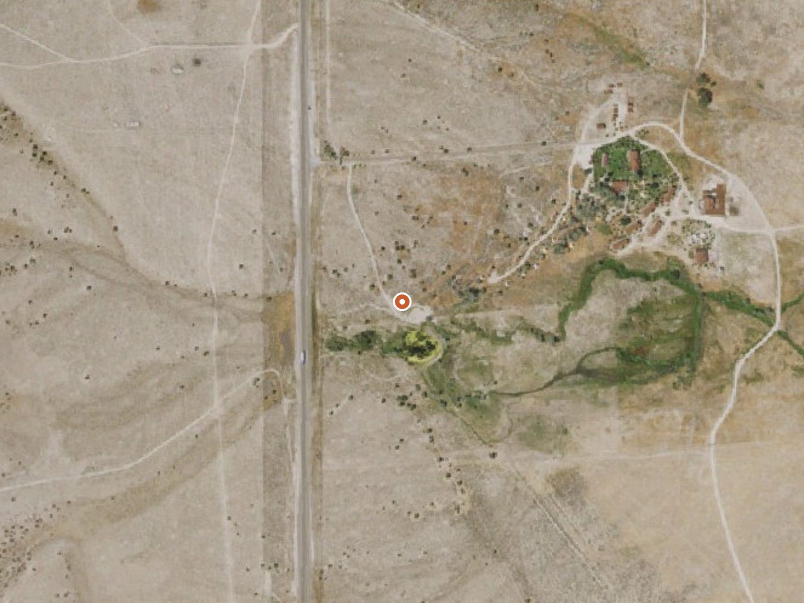
The orange dot marks the spring, in a frame about three quarters of a mile wide.
- Setting
- Open ground
- Flat, open ground all around.
- Highest ground nearby
- 62 ft above the spring
- Within a quarter mile, to the northwest
A slice through the ground from northwest to southeast, about 0.6 miles end to end.
Elevation data: USGS 3D Elevation Program. Aerial imagery: USGS The National Map. Public domain.
That's about 1½ times the US average of 65. It's higher than at 46% of the springs on this site.
Heat flow measures the warmth working its way up through the ground from deep inside the earth. Where it runs high, rain and snowmelt that seep down through cracks in the rock come back up hot.
See every spring on the geothermal heat map →
Heat flow estimate: Stanford Thermal Earth Model (Aljubran & Horne, 2024), CC BY 4.0.
Some links are affiliate links. We may earn a commission at no extra cost to you.
Overview Terraces Overnight Group Area is a popular location for weddings, church activities, family reunions and company picnics. It is located in scenic Lamoille Canyon, 35 miles southeast of Elko, Nevada. Visitors enjoy fishing in Lamoille Creek and hiking on many local trails. Recreation Lamoille Creek runs just outside the picnic area and is a popular stream among fly-fishermen. The creek contains brook and wild rainbow trout.Lamoille Canyon offers numerous hiking and horseback riding t...
Warm Springs sits at 5,759 feet above sea level, way above the mile-high mark. You may not feel the altitude strongly, but hot water still dehydrates you faster at elevation. UV is about 23% stronger than at sea level, so bring sunscreen and drink more water than you normally would.



As an Amazon Associate, we earn from qualifying purchases.
Warm Springs is road-accessible, so you can bring more gear.






As an Amazon Associate, we earn from qualifying purchases.