Williams Hot Spring
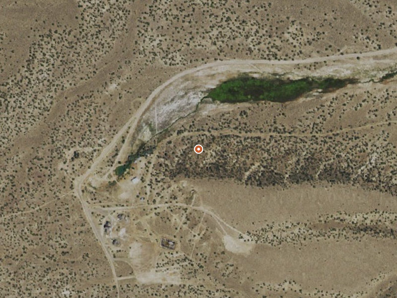
The orange dot marks the spring, in a frame about three quarters of a mile wide.
Williams Hot Spring sits at over six thousand feet in White Pine County, on Bristlecone Field Office land, about twenty-nine miles from Ely. The water is hot, too hot to sit in straight. A 1982 sample shows it strongly alkaline, with a pH above nine. Access is open. No photograph is on file, and the one Wikipedia link attached points at the wrong spring.
4H Camp Road gets you within about five hundred feet; the rest is on foot. High country. Winters bring around forty inches of snow, and precipitation is moderate. Public land, no designation. Ward Mountain Campground at Murray Summit is listed about twenty-three miles off, the sole camping entry.
The season on file is winter. At this heat the water burns, so test before getting in. A short walk, open access, no fee recorded. Ward Mountain is the camping to aim for. The chemistry is over forty years old, and the temperature may be too.
The Wikipedia article attached to the record is about Wilbur Hot Springs near Williams, California, a different place. Nothing in it applies here.
USGS hasn't flown a detailed laser scan here yet, so this view comes from aerial photos and older elevation data.
- Setting
- Hillside
- The spring sits on a steep slope that climbs to the southwest.
- Highest ground nearby
- 86 ft above the spring
- Within a quarter mile, to the southwest
A slice through the ground from southwest to northeast, about 0.6 miles end to end.
Elevation data: USGS 3D Elevation Program. Aerial imagery: USGS The National Map. Public domain.
That's about 1½ times the US average of 65. It's higher than at 31% of the springs on this site.
Heat flow measures the warmth working its way up through the ground from deep inside the earth. Where it runs high, rain and snowmelt that seep down through cracks in the rock come back up hot.
See every spring on the geothermal heat map →
Heat flow estimate: Stanford Thermal Earth Model (Aljubran & Horne, 2024), CC BY 4.0.
The water at Williams Hot Spring is alkaline (pH 9.2).
Some links are affiliate links. We may earn a commission at no extra cost to you.
Overview Ward Mountain Recreation Area and Campground sits in the shadow of its namesake, just 10 miles southwest from the city of Ely, in eastern Nevada. It sits at an elevation of 7,400 feet. Many trails are available for hiking, mountain biking and horseback riding. Recreation Ward Mountain and the surrounding area offers miles of trails for hiking, mountain biking and horseback riding. Many of the trails offer scenic views of the surrounding high desert terrain. Facilities This campgr...
Williams Hot Spring sits at 6,293 feet above sea level, way above the mile-high mark. You may not feel the altitude strongly, but hot water still dehydrates you faster at elevation. UV is about 25% stronger than at sea level, so bring sunscreen and drink more water than you normally would.



As an Amazon Associate, we earn from qualifying purchases.
Williams Hot Spring is road-accessible, so you can bring more gear. The water runs hot, so extra hydration is key.





As an Amazon Associate, we earn from qualifying purchases.