Unnamed Thermal Spring
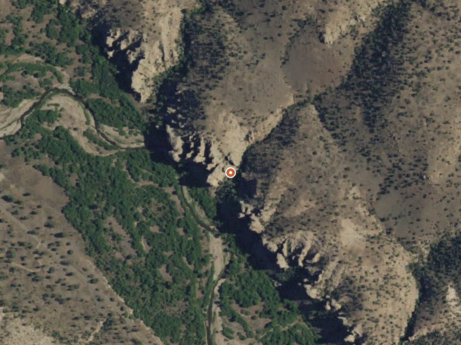
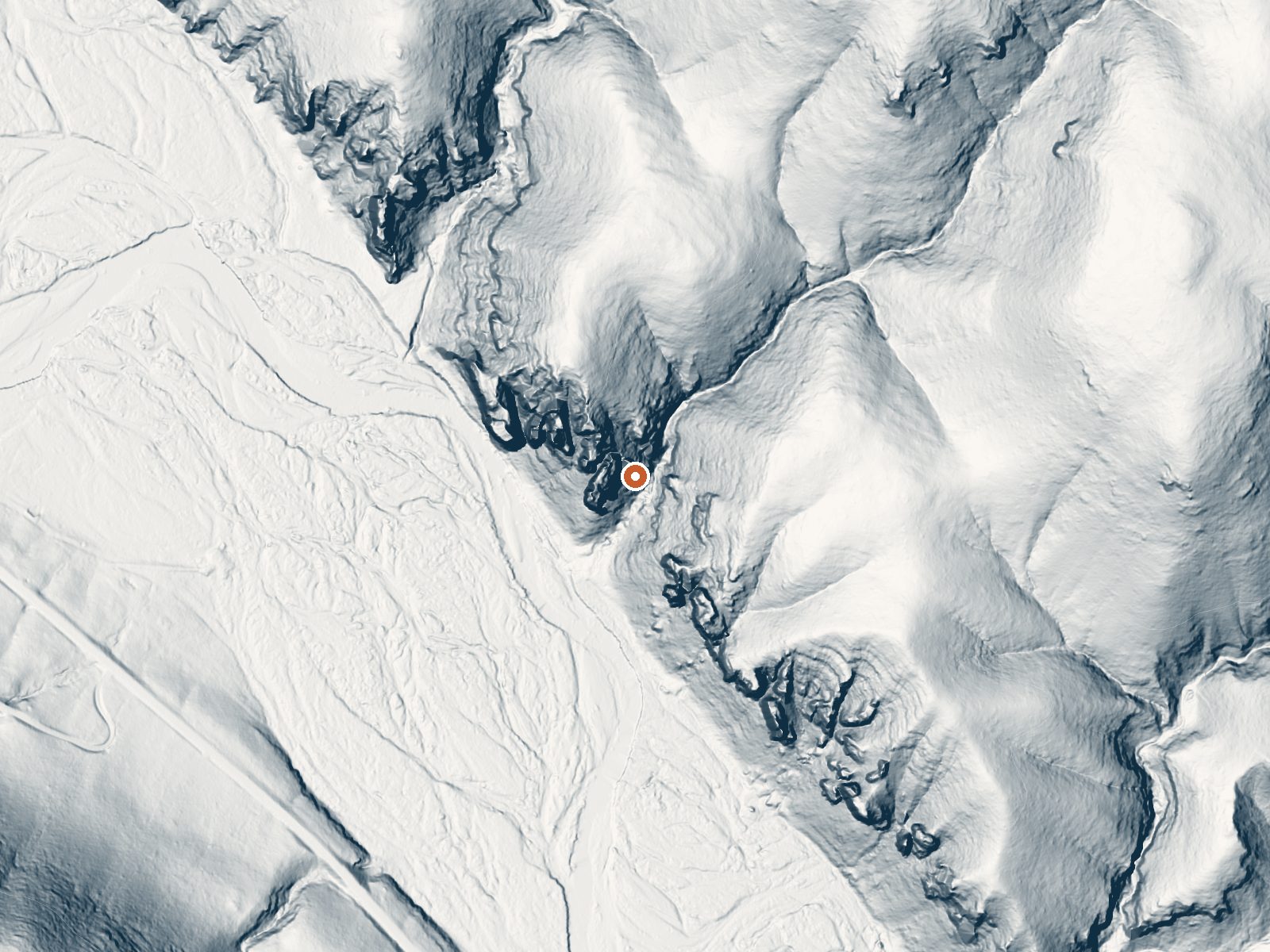
Drag the handle to compare the two views. The orange dot marks the spring, in a frame about three quarters of a mile wide.
Scalding water. That is the first thing to know about this unnamed thermal point in the Gila National Forest, Grant County, thirty miles from Arenas Valley. The reading on file is well above the temperature that burns skin on contact. The land is Forest Service, access open, a short walk of a third of a mile from the nearest road, and Forks Campground is close by.
About 5,700 feet, forested, with real snow in winter and a fairly wet year by regional standards. The road carries no name on file. Forks Campground sits around two and a half miles off. Nothing describes the source itself, a vent or a pool or a seep, and nothing says how the water cools once it leaves the ground.
Do not get in. Water this hot will scald in seconds, and there is no record of a cooled pool. Watch any dog or small child closely near it. The cold months are when to come. Camp at Forks. A 1967 sample came back near neutral with sodium and sulfate present. No fee recorded.
Aircraft with laser scanners measured this ground to within inches. The scan strips out trees and buildings, leaving the bare shape of the land around this spring.
- Setting
- Canyon floor
- Steep ground climbs away on both sides of the spring.
- Highest ground nearby
- 329 ft above the spring
- Within a quarter mile, to the east
A slice through the ground from northwest to southeast, about 0.6 miles end to end.
Elevation data: USGS 3D Elevation Program. Aerial imagery: USGS The National Map. Public domain.
That's about 1½ times the US average of 65. It's higher than at 59% of the springs on this site.
Heat flow measures the warmth working its way up through the ground from deep inside the earth. Where it runs high, rain and snowmelt that seep down through cracks in the rock come back up hot.
See every spring on the geothermal heat map →
Heat flow estimate: Stanford Thermal Earth Model (Aljubran & Horne, 2024), CC BY 4.0.
The water at This spring is slightly alkaline (pH 7.9). It is notably rich in chloride (natural antiseptic with skin health benefits).
This campground features beautiful cliffs along the West Fork of the Gila River.This campground is a great place to stop on the way to the Gila Cliff Dwellings National Monument (15 miles north). Overnight camping is allowed in the upper portion of Forks; however, the lower portion of the Forks Recreation Site along the West Fork of the Gila River is day use only.
this spring sits at 5,737 feet above sea level, way above the mile-high mark. You may not feel the altitude strongly, but hot water still dehydrates you faster at elevation. UV is about 23% stronger than at sea level, so bring sunscreen and drink more water than you normally would.



As an Amazon Associate, we earn from qualifying purchases.
Springs Near This Spring
More Springs Around 149°F
Slightly Alkaline Springs (pH ~7.9)
Hike 1 waterfall near this spring
Looking for more outdoor adventures? Explore waterfall hikes near this spring, New Mexico.