North Springs

Millard County, Utah · Near Delta
39.8870°N, 113.4130°W · 4,303 ft
82°F 48°F air · Good soaking weather 4,303 ft Restricted Roadside US Fish and Wildlife Service
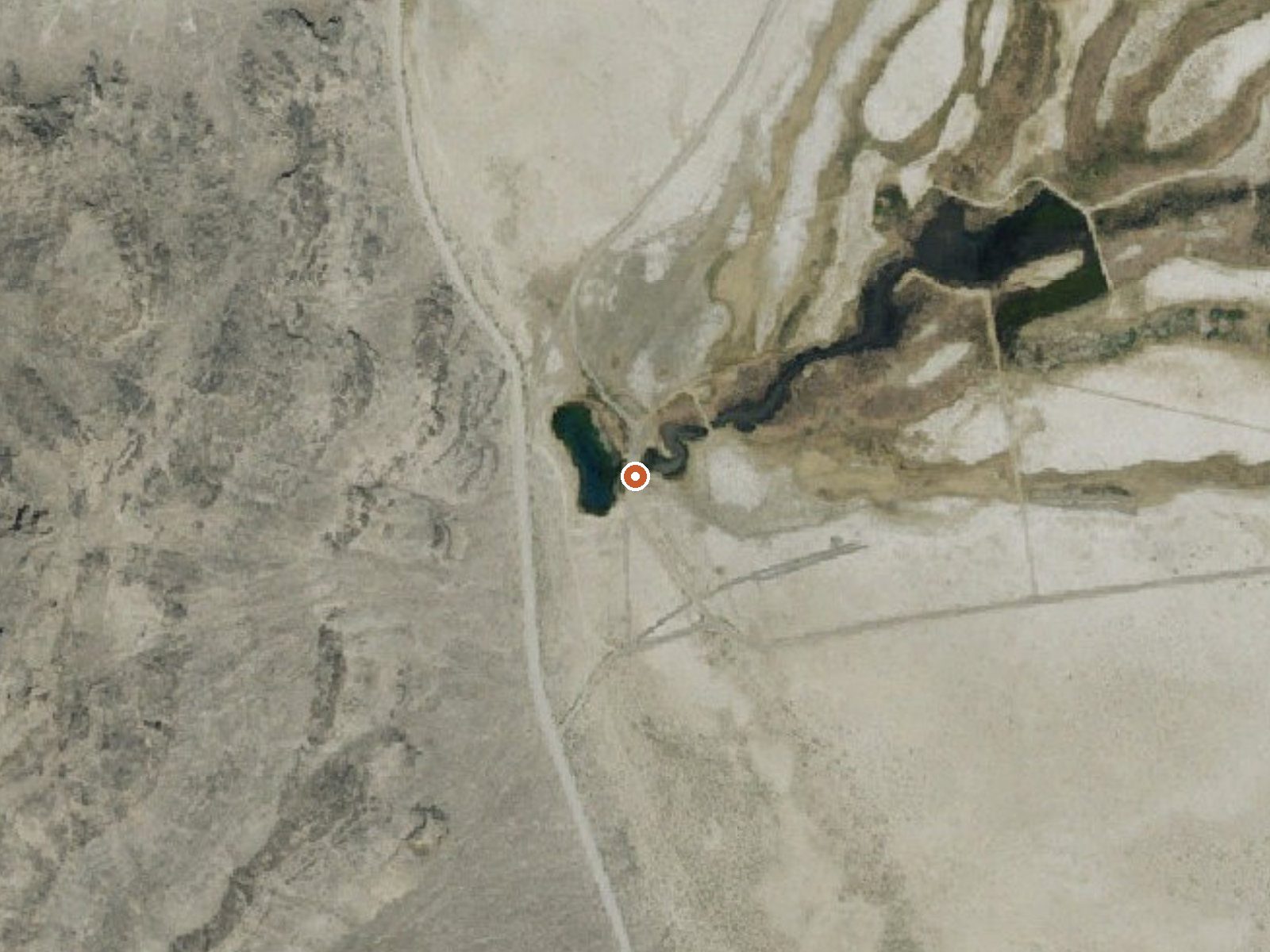
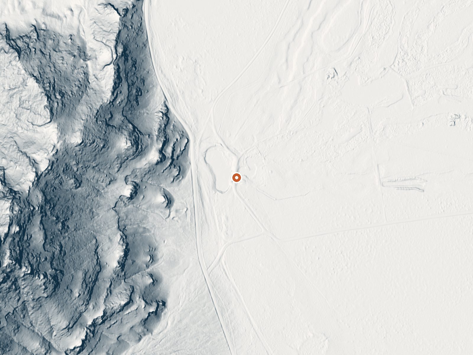
Aerial view of the ground around North Springs LiDAR bare-earth view of the same ground around North Springs
Aerial LiDAR bare earth

Drag the handle to compare the two views. The orange dot marks the spring, in a frame about three quarters of a mile wide.

Inside Fish Springs National Wildlife Refuge, in Millard County, Utah, North Springs is one of several. Nothing is nearby. Delta, the closest town anyone recorded, sits almost sixty miles off. The water comes out warm, about what a tepid bath feels like. Access is restricted, and the ground is a National Wildlife Refuge held by the federal Fish and Wildlife Service.

Location

The spring is almost on top of the road, fifteen feet off, inside the refuge. This is low desert, a bit over 4,300 feet, and very dry: around seven inches of rain a year and little snow. The refuge is federal land with a wildlife designation, so the rules are the refuge's rules.

Restricted access is the headline. Do not plan on soaking; plan on checking with the refuge before you go and following what they allow. Winter months are the best listed, and the dry climate makes that a reasonable window for the drive. No campground is on file. The water is mineral-heavy, sampled in 1990 with iron present.

Terrain

Aircraft with laser scanners measured this ground to within inches. The scan strips out trees and buildings, leaving the bare shape of the land around North Springs.

Setting
Hillside
The spring sits on a steep slope that climbs to the northwest.
Highest ground nearby
335 ft above the spring
Within a quarter mile, to the northwest
Cross-section through the spring

A slice through the ground from northwest to southeast, about 0.6 miles end to end.

Elevation data: USGS 3D Elevation Program. Aerial imagery: USGS The National Map. Public domain.

Heat Below
106 milliwatts per square meter of heat flow

That's about 1½ times the US average of 65. It's higher than at 56% of the springs on this site.

Heat flow measures the warmth working its way up through the ground from deep inside the earth. Where it runs high, rain and snowmelt that seep down through cracks in the rock come back up hot.

Heat flow estimate: Stanford Thermal Earth Model (Aljubran & Horne, 2024), CC BY 4.0.

Monthly Climate
30°
Jan
36°
Feb
46°
Mar
53°
Apr
61°
May
75°
Jun
83°
Jul
81°
Aug
70°
Sep
54°
Oct
41°
Nov
30°
Dec
Annual Precip: 7.3 in Annual Snow: 15.2 in
Best Time to Visit
January Air 30°F · Water 82°F · +52° contrast
December Air 30°F · Water 82°F · +52° contrast
February Air 36°F · Water 82°F · +46° contrast
January offers 53°F more contrast than July
Current Conditions
48°F
Clear N 0.0 mph 46% Good soaking weather
Today 85° Low 61° Partly Sunny
Wednesday 87° Low 62° Sunny 1% precip
Thursday 86° Low 57° Sunny 3% precip
Friday 80° Low 53° Sunny 2% precip
Spring is +2° warmer
Saturday 80° Low 54° Sunny
Spring is +2° warmer
Water Chemistry Sampled 1990-05-10

The water at North Springs is slightly alkaline (pH 7.9) with 2910 mg/L total dissolved solids. It is notably rich in calcium (may support bone density and joint health), magnesium (known for muscle relaxation and stress relief), and sodium (supports circulation and skin hydration).

pH 7.9 Slightly Alkaline
pH influences mineral absorption through skin
Higher mineral concentration for therapeutic soaking
Calcium 120 mg/L
May support bone density and joint health
Magnesium 72 mg/L
Known for muscle relaxation and stress relief
Sodium 850 mg/L
Supports circulation and skin hydration
Sulfate 370 mg/L
Traditionally used for skin conditions and inflammation
Chloride 1,300 mg/L
Natural antiseptic with skin health benefits
Iron 20 µg/L
Iron-rich springs may support circulation
Temperature
82°F
Warm Hot Boiling
Water Temp 82°F (28°C)
Avg Air Temp 55°F
Above Ambient +27°F
Mild soaking conditions September
Access
Restricted
Road Access Roadside
Distance to Road 15 ft
Land
Ownership Federal
Agency US Fish and Wildlife Service
Designation National Wildlife Refuge
Unit Fish Springs National Wildlife Refuge
Manager US Fish and Wildlife Service
Protection 1 - Permanent protection, natural state
Frequently Asked Questions
What is the water temperature at North Springs?
North Springs has a water temperature of 82°F (28°C). This is a warm thermal spring.
Where is North Springs located?
North Springs is located in Millard County, Utah at 4,303 feet elevation, near Delta. Coordinates: 39.8870°N, 113.4130°W.
How do I get to North Springs?
North Springs has Roadside road access (15 ft from the road).
Is North Springs free to visit?
North Springs has Restricted access. It is managed by US Fish and Wildlife Service.
What minerals are in the water at North Springs?
Water chemistry analysis shows the presence of pH, Total Dissolved Solids, Calcium, Magnesium, Sodium, Sulfate, Chloride, Iron. The pH is 7.9 (slightly alkaline). Total dissolved solids measure 2,910 mg/L.
Sources: USGS NWIS