Unnamed Thermal Spring
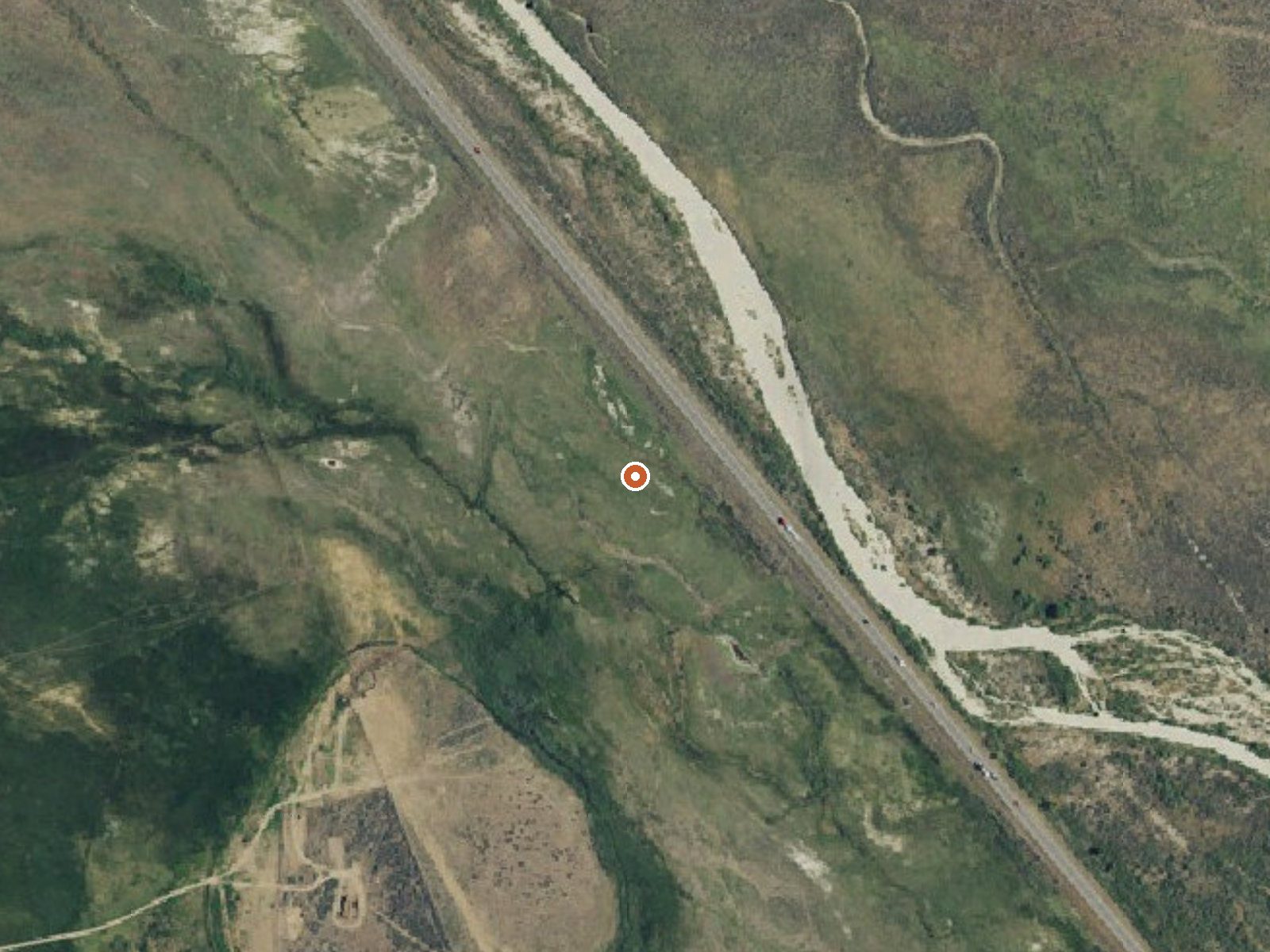
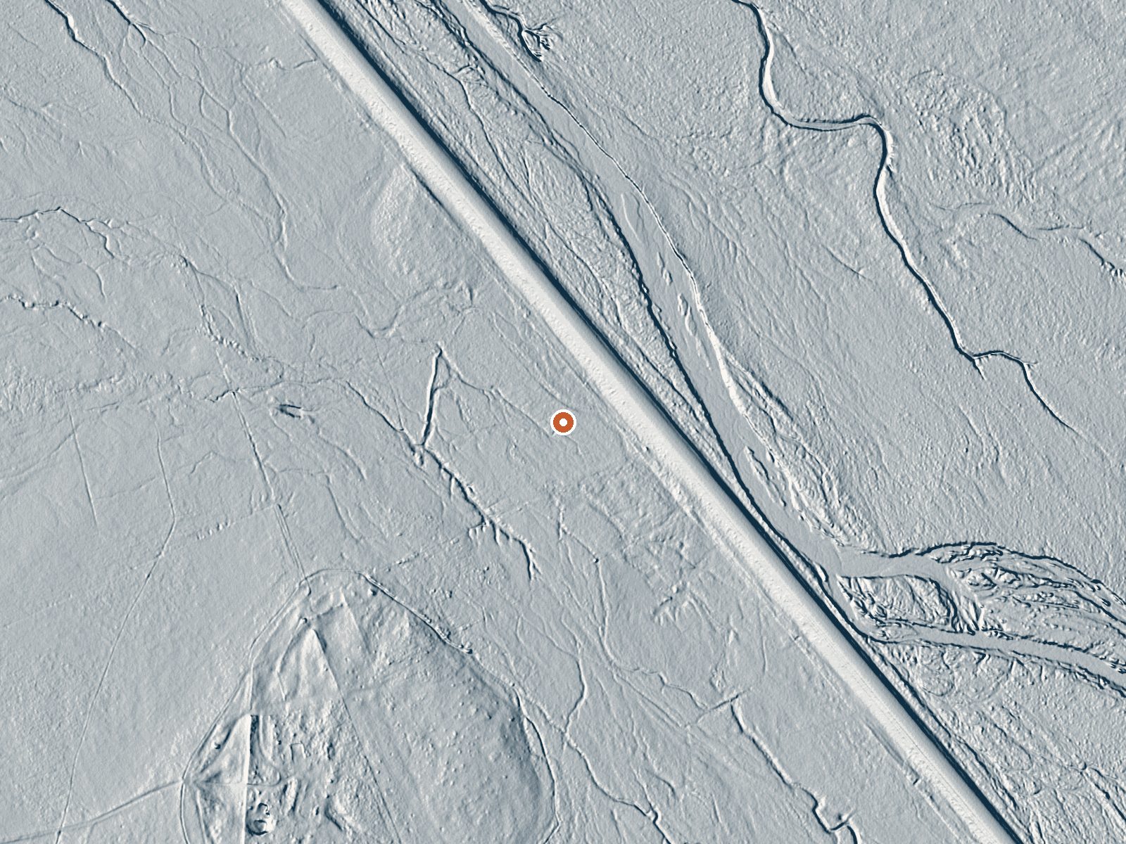
Drag the handle to compare the two views. The orange dot marks the spring, in a frame about three quarters of a mile wide.
This unnamed thermal point is filed under Washoe County in the California records, and it is hot. The recorded temperature is 108, warm enough that most people would call it a bath. The nearest town the record can attach to it is Cold Springs, almost a hundred miles away, which tells you how empty this stretch of country is. Access status and land owner are both unrecorded.
Route 395 runs within a few hundred feet, so reaching the spring is a matter of pulling over and walking a bit. The country is high desert at over four thousand feet, and winter is real here, with fifty-odd inches of snow most winters. Rain adds up to maybe seventeen inches. Summers are dry and warm. No land unit or designation is attached, so who manages the ground is an open question.
The listed months are the dead of winter, December through February, when steam off the water earns its keep, but that is also when the snow comes, so watch the highway forecast. Big Cove campground in Plumas National Forest is the closest camping on file, around eight miles away. No fee is recorded. Since nobody has written down if the public is welcome, look for signs before you leave the shoulder.
Aircraft with laser scanners measured this ground to within inches. The scan strips out trees and buildings, leaving the bare shape of the land around this spring.
- Setting
- Open ground
- Flat, open ground all around.
- Highest ground nearby
- 9 ft above the spring
- Within a quarter mile, to the east
A slice through the ground from west to east, about 0.6 miles end to end.
Elevation data: USGS 3D Elevation Program. Aerial imagery: USGS The National Map. Public domain.
That's about 1½ times the US average of 65. It's higher than at 60% of the springs on this site.
Heat flow measures the warmth working its way up through the ground from deep inside the earth. Where it runs high, rain and snowmelt that seep down through cracks in the rock come back up hot.
See every spring on the geothermal heat map →
Heat flow estimate: Stanford Thermal Earth Model (Aljubran & Horne, 2024), CC BY 4.0.
Some links are affiliate links. We may earn a commission at no extra cost to you.
Overview Big Cove Campground (5,700 feet) is located near the shores of Frenchman Lake in Northeastern California. Some families have been returning here for more than thirty years. Situated at the interface between the wild Sierra and the high desert, it's a perfect place to serve as hub for a wide range of recreation opportunities. Plumas National Forest has many back roads open for exploration. Take advantage of the beautiful blue waters of Frenchman Lake for boating, fishing and other wat...
this spring is road-accessible, so you can bring more gear.






As an Amazon Associate, we earn from qualifying purchases.
Springs Near This Spring
More Springs Around 108°F
Hike 6 waterfalls near this spring
Looking for more outdoor adventures? Explore waterfall hikes near this spring, California.