Landusky Springs
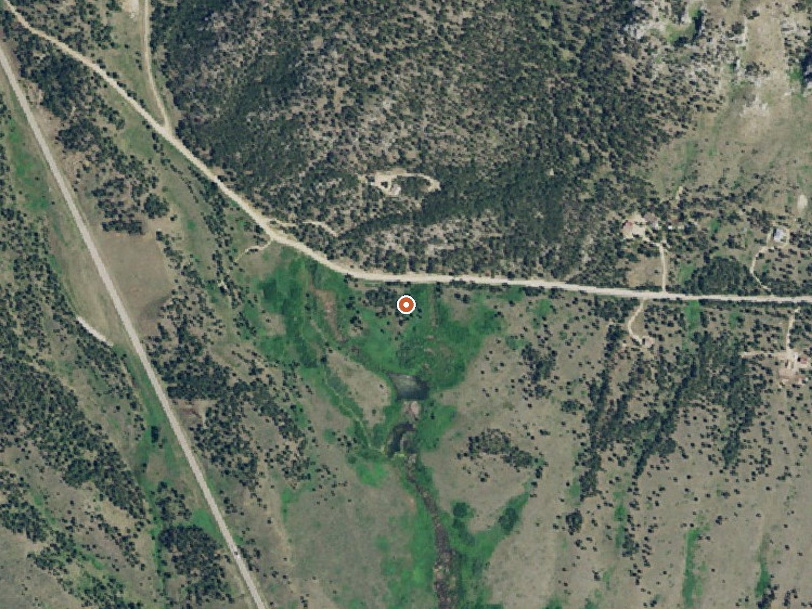
The orange dot marks the spring, in a frame about three quarters of a mile wide.
Landusky Springs runs barely warm in Blaine County, Montana, a long way from anything; Fort Belknap Agency is the nearest town on file at nearly forty miles. The water sits at the bottom of what anyone would call warm. What stands out is the chemistry: a 1977 USGS sample logged heavy dissolved solids, salty water by spring standards. Neither an owner nor an access status is recorded.
The road passes within a stone's throw, a bit over a hundred feet. Elevation is low for Montana. Snow is on the lighter side, around three and a half feet a winter, and rain is scarce. Camp Creek Campground is listed about eight miles away. Nothing describes the ground between road and water.
Do not come for a soak; the water is too cool. The row says winter, oddly, though the modest snow makes that workable. Camp Creek Campground is the only camping given. No fee or access information exists in the record, so ownership needs checking. The chemistry and temperature are from a single 1977 visit.
USGS hasn't flown a detailed laser scan here yet, so this view comes from aerial photos and older elevation data.
- Setting
- Hillside
- The spring sits on a steep slope that climbs to the north.
- Highest ground nearby
- 347 ft above the spring
- Within a quarter mile, to the north
A slice through the ground from southwest to northeast, about 0.6 miles end to end.
Elevation data: USGS 3D Elevation Program. Aerial imagery: USGS The National Map. Public domain.
That's close to the US average of 65. It's higher than at 10% of the springs on this site.
Heat flow measures the warmth working its way up through the ground from deep inside the earth. Where it runs high, rain and snowmelt that seep down through cracks in the rock come back up hot.
See every spring on the geothermal heat map →
Heat flow estimate: Stanford Thermal Earth Model (Aljubran & Horne, 2024), CC BY 4.0.
The water at Landusky Springs is neutral (pH 7.2) with 1680 mg/L total dissolved solids. It is notably rich in calcium (may support bone density and joint health), magnesium (known for muscle relaxation and stress relief), and sulfate (traditionally used for skin conditions and inflammation).
Camp Creek Recreation Area, located in the scenic Little Rockies, consists of Camp Creek Campground, Horse Corral Campground, and Buffington Day Use Area. A system of trails leads from the main campground, making this a popular destination for hikers, birders and OHV enthusiasts. Several small bass and trout fisheries are located within 30-minutes drives. The nearby town of Zortman offers a store, restaurant, fuel, and gold panning opportunities. This is a Watchable Wildlife area as well as a...