Berkeley Springs
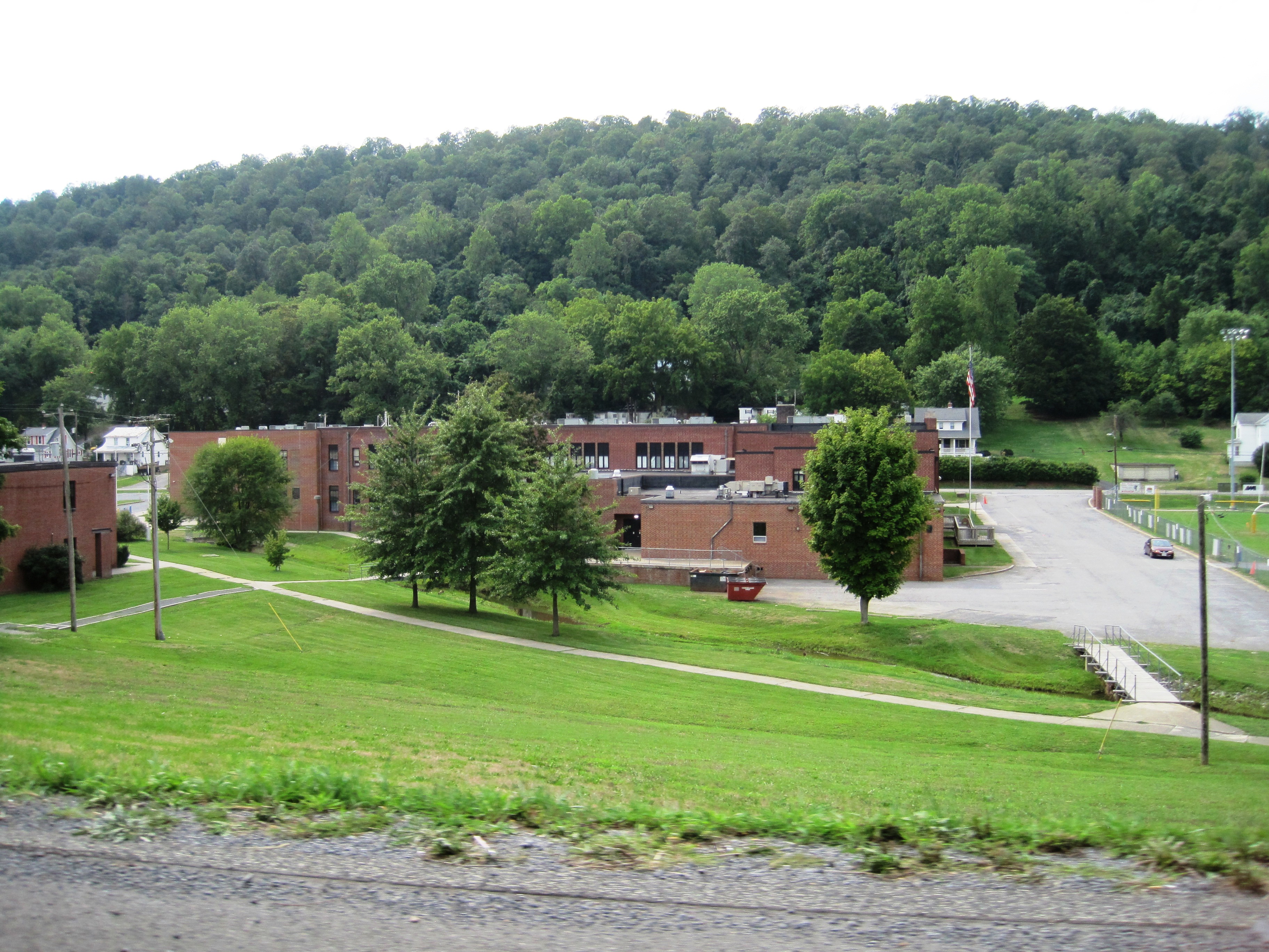
Berkeley Springs is a warm mineral spring in Morgan County, West Virginia, in the town that shares its name. The water on record is tepid, low seventies, neutral in pH, with a 2005 sample on file. It sits fifteen feet from the road. Ownership and access status are blank in the record.
In town, roadside, six hundred or so feet up. A moderate climate by the record: around forty inches of precipitation and two feet or so of snow most winters. With the spring this close to the road there is no approach to speak of.
Fifteen Mile Creek Campsite, about eight miles out, is the campsite the record names. The best months listed are in winter, and snow is light. The water is tepid and safe, far too cool for a hot soak. Access status is not recorded; confirm locally.
The chemistry in the record is from a March 2005 sample; USGS lists the spring by site number.
The main drinking spring in Berkeley Springs State Park, known today as the Gentlemen's Spring, still sits under its two-story pavilion. Brick paving has replaced the old gravel walk.

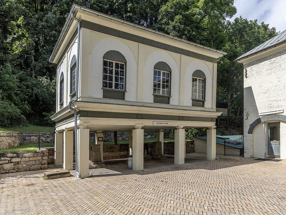
Drag to compare.
c. 1935: Tichnor Brothers postcard, Boston Public Library, public domain (published without notice). 2026: Acroterion, CC BY-SA 4.0.
Aircraft with laser scanners measured this ground to within inches. The scan strips out trees and buildings, leaving the bare shape of the land around Berkeley Springs.
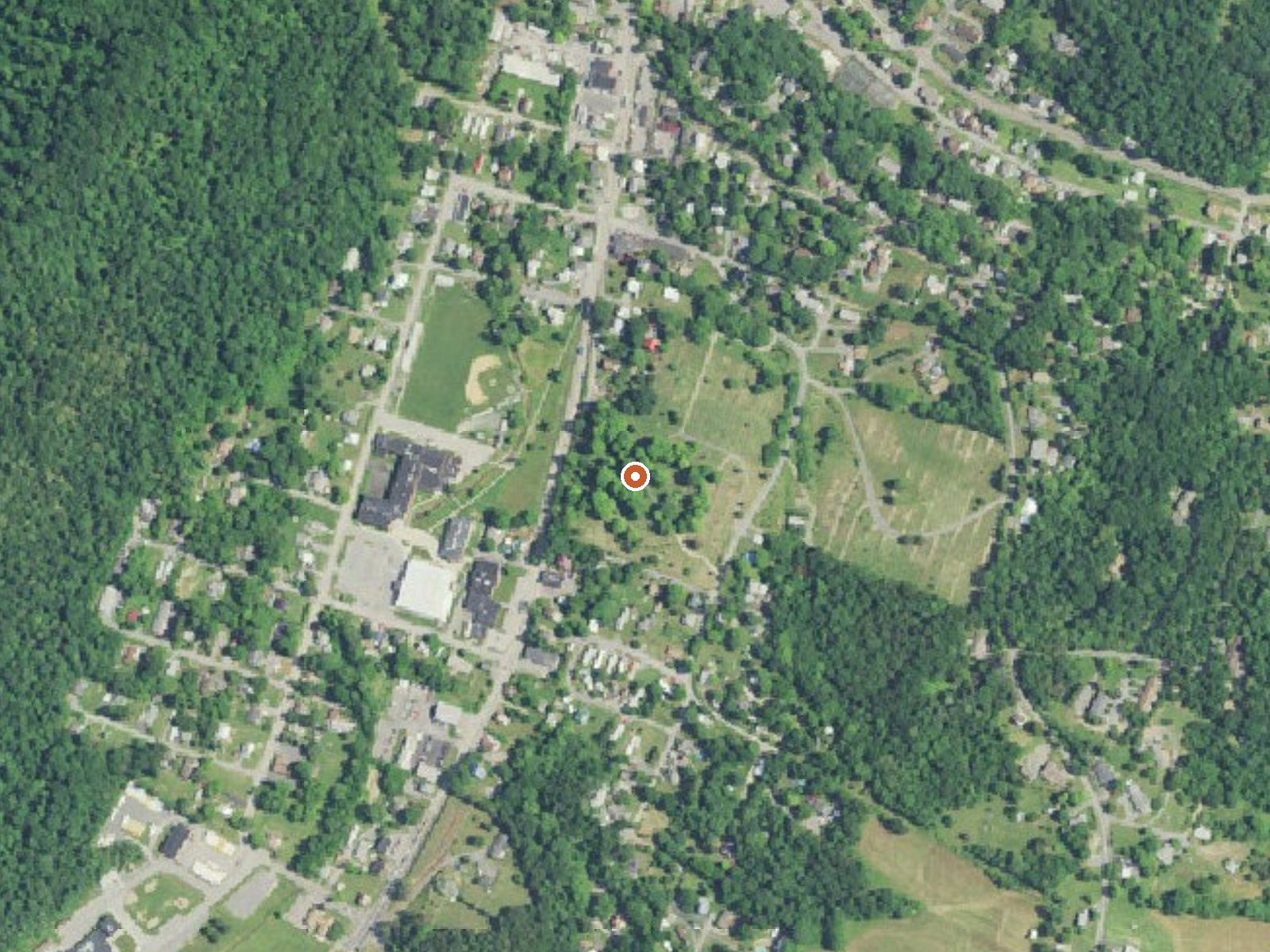
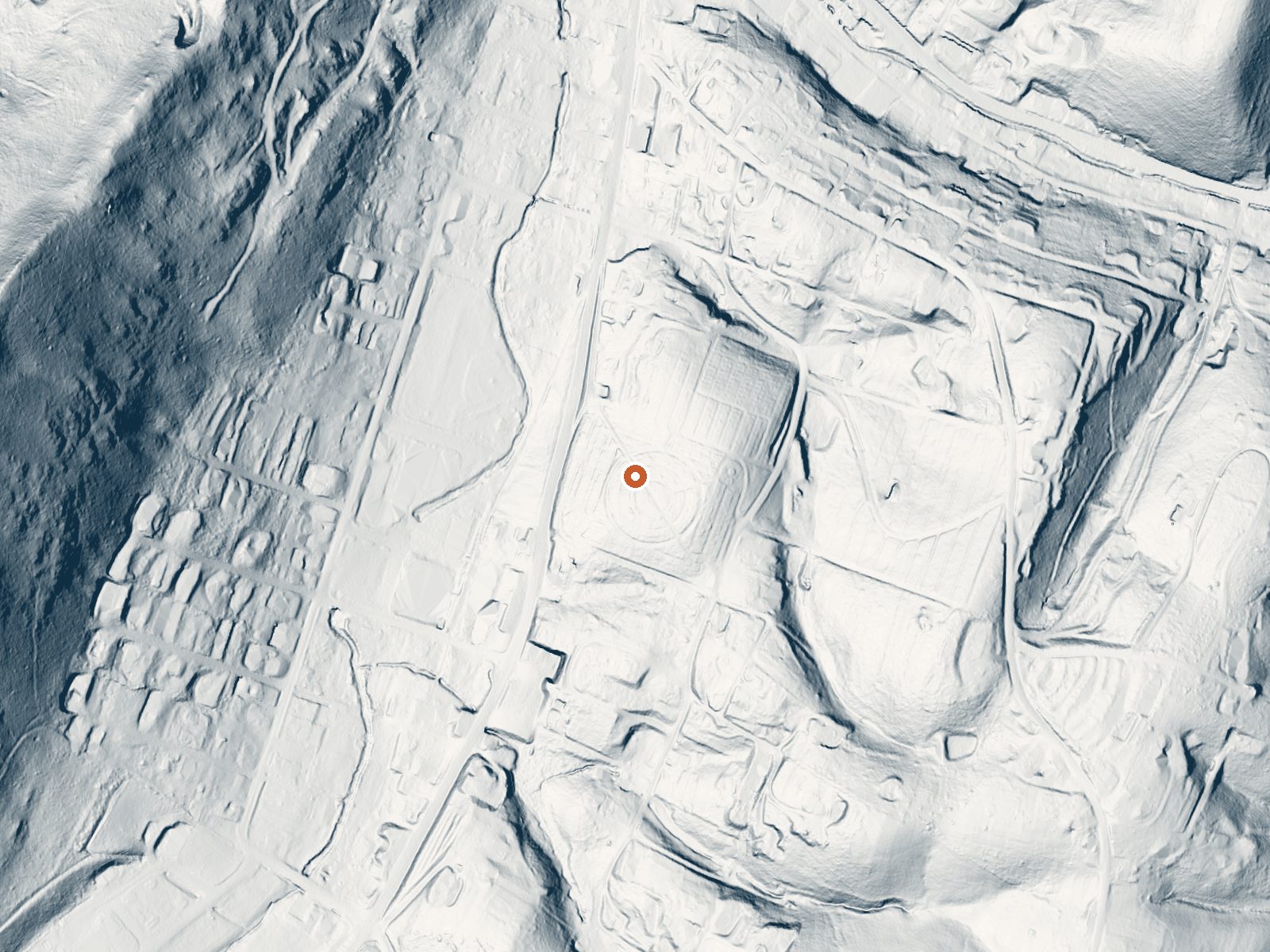
Drag the handle to compare the two views. The orange dot marks the spring, in a frame about three quarters of a mile wide.
- Setting
- Gentle slope
- The ground tilts gently up to the southeast.
- Highest ground nearby
- 87 ft above the spring
- Within a quarter mile, to the southeast
A slice through the ground from north to south, about 0.6 miles end to end.
Elevation data: USGS 3D Elevation Program. Aerial imagery: USGS The National Map. Public domain.
That's close to the US average of 65. It's higher than at 0% of the springs on this site.
Heat flow measures the warmth working its way up through the ground from deep inside the earth. Where it runs high, rain and snowmelt that seep down through cracks in the rock come back up hot.
See every spring on the geothermal heat map →
Heat flow estimate: Stanford Thermal Earth Model (Aljubran & Horne, 2024), CC BY 4.0.
The water at Berkeley Springs is neutral (pH 7.1) with 165 mg/L total dissolved solids.
Some links are affiliate links. We may earn a commission at no extra cost to you.
Overview The Fifteen Mile Creek Campground is located at Mile 140 on the C&O Canal Towpath, in the town of Little Orleans upstream of Hancock and downstream of Paw Paw, WV, on the Maryland side of the of the Potomac River. The campsites are drive-in, large enough to park a small fifth wheel/travel trailer/RV/pop-out with a 20' ft. maximum. Alcoholic beverages are prohibited.Recreation The most popular activity for Fifteen Mile Creek campers is boating and fishing. The campground has a boat ra...
Berkeley Springs is road-accessible, so you can bring more gear.






As an Amazon Associate, we earn from qualifying purchases.
Springs Near Berkeley Springs
More Springs Around 72°F
Neutral Springs (pH ~7.1)
Hike 2 waterfalls near Berkeley Springs
Looking for more outdoor adventures? Explore waterfall hikes near Berkeley Springs, West Virginia.