Chief Shakes Hot Springs
City and Borough of Wrangell County, Alaska · Near Wrangell
56.7170°N, 132.0050°W · 50 ft
122°F 46°F air · Good soaking weather 50 ft Open Backcountry US Forest Service Camping nearby (3.8 mi)
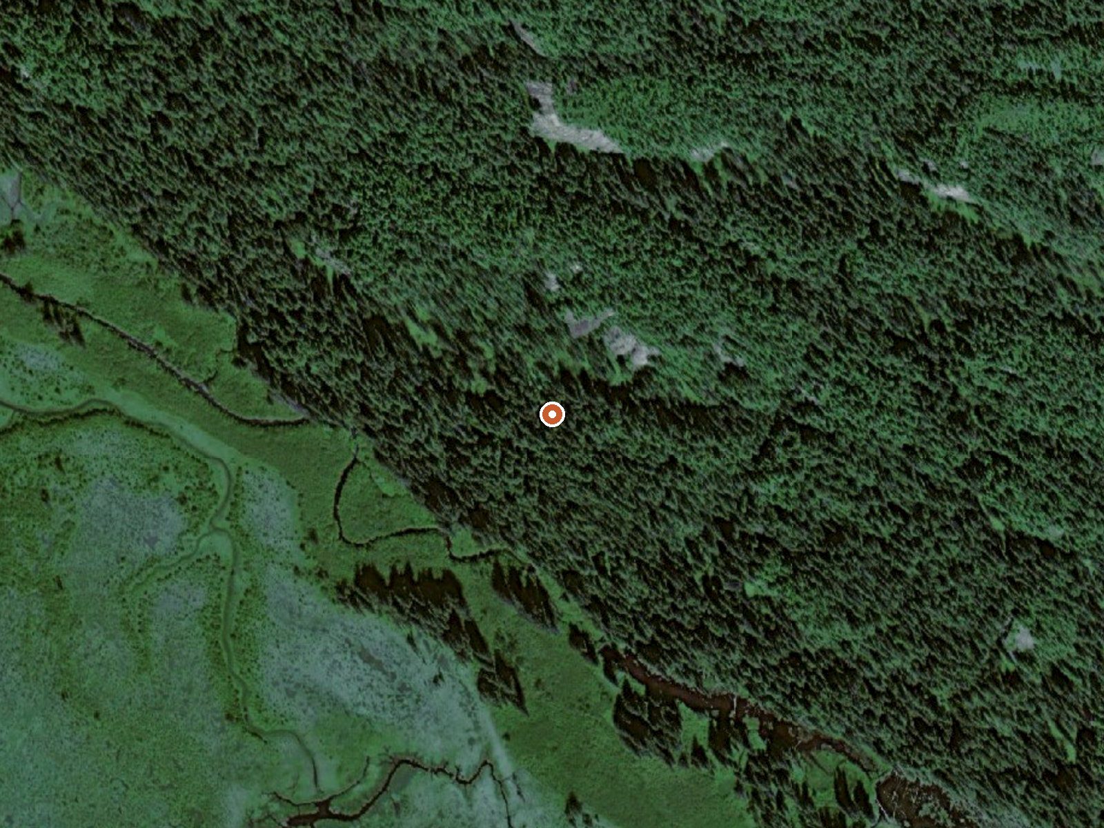
Aerial view of the ground around Chief Shakes Hot Springs

The orange dot marks the spring, in a frame about three quarters of a mile wide.

Hot, and a long way from anything with wheels. Chief Shakes Hot Springs lies in Tongass National Forest within the City and Borough of Wrangell; the town of Wrangell is the nearest community, a fair distance off. The water comes up hot enough that you would want cooler water mixed in before sitting down in it. Access is open. Sixteen miles separate the spring from the closest road.

Location

Low, wet country near sea level. The Forest Service cabin at Shakes Slough 2 is under four miles from the spring and is the closest lodging on record. Rain falls heavily through the year and the snowfall total in the record is very large. There is no route information on file, so the approach is by whatever means you can arrange.

December into February is the stretch the climate favors. Heat here runs past the range people sit in comfortably, so test it and count on wanting some cooler water mixed in. You plan around camping or the Shakes Slough cabin. The chemistry sample is decades old, and worth reading with that in mind.

History of Chief Shakes Hot Springs

The USGS logged this spring as a sampling site and drew water from it in July 1976. That sample showed a near neutral pH.

Terrain

USGS hasn't flown a detailed laser scan here yet, so this view comes from aerial photos and older elevation data.

Setting
Canyon floor
Steep ground climbs away on both sides of the spring.
Highest ground nearby
973 ft above the spring
Within a quarter mile, to the northeast
Cross-section through the spring

A slice through the ground from northwest to southeast, about 0.6 miles end to end.

Elevation data: USGS 3D Elevation Program. Aerial imagery: USGS The National Map. Public domain.

Monthly Climate
25°
Jan
27°
Feb
31°
Mar
38°
Apr
46°
May
54°
Jun
58°
Jul
58°
Aug
51°
Sep
40°
Oct
30°
Nov
26°
Dec
Annual Precip: 136.0 in Annual Snow: 527.6 in
Best Time to Visit
January Air 25°F · Water 122°F · +97° contrast
December Air 26°F · Water 122°F · +97° contrast
February Air 27°F · Water 122°F · +95° contrast
January offers 33°F more contrast than August
Current Conditions
46°F
Clear SSE 16.9 mph 100% Good soaking weather
Tuesday 58° Low 46° Mostly Sunny
Spring is +64° warmer
Wednesday 52° Low 46° Rain Showers 100% precip
Spring is +70° warmer
Thursday 53° Low 48° Light Rain Likely 71% precip
Spring is +69° warmer
Friday 52° Low 48° Heavy Rain 100% precip
Spring is +70° warmer
Saturday 52° Low 47° Rain 100% precip
Spring is +70° warmer
Water Chemistry Sampled 1976-07-07

The water at Chief Shakes Hot Springs is neutral (pH 7.1) with 409 mg/L total dissolved solids.

pH 7.1 Neutral
pH influences mineral absorption through skin
Higher mineral concentration for therapeutic soaking
Calcium 15 mg/L
May support bone density and joint health
Magnesium 0 mg/L
Known for muscle relaxation and stress relief
Sodium 73 mg/L
Supports circulation and skin hydration
Sulfate 140 mg/L
Traditionally used for skin conditions and inflammation
Chloride 6 mg/L
Natural antiseptic with skin health benefits
Where to Stay

Some links are affiliate links. We may earn a commission at no extra cost to you.

Nearby Camping
Shakes Slough 2 Cabin 3.8 mi away

Overview Shakes Slough 2 Cabin makes an excellent basecamp for exploring the Stikine River. It is located at the confluence of the Stikine River and Shakes Slough and within a few hundred feet of neighboring Shakes Slough 1 Cabin. These cabins offer spectacular views of the surrounding Stikine-LeConte Wilderness. The site can be accessed by float plane or shallow draft boat, depending on conditions. A tide of at least 14 feet is required to navigate the Stikine River tide flats. Guests are...

Reservable Yes
Reserve on Recreation.gov →
Temperature
122°F
Warm Hot Boiling
Water Temp 122°F (50°C)
Avg Air Temp 40°F
Above Ambient +82°F
Great soaking conditions September
Access
Open
Road Access Backcountry
Distance to Road 16.0 mi
Land
Ownership Federal
Agency US Forest Service
Designation National Forest
Unit Tongass National Forest
Manager US Forest Service
Protection 3 - Protected, subject to extractive use

Hike 1 waterfall near Chief Shakes Hot Springs
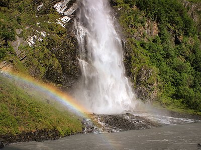
Looking for more outdoor adventures? Explore waterfall hikes near Chief Shakes Hot Springs, Alaska.

Frequently Asked Questions
What is the water temperature at Chief Shakes Hot Springs?
Chief Shakes Hot Springs has a water temperature of 122°F (50°C). This is considered a hot spring, well above body temperature.
Where is Chief Shakes Hot Springs located?
Chief Shakes Hot Springs is located in City and Borough of Wrangell, Alaska at 50 feet elevation, near Wrangell. Coordinates: 56.7170°N, 132.0050°W.
How do I get to Chief Shakes Hot Springs?
Chief Shakes Hot Springs has Backcountry road access (16.0 mi from the road).
Is Chief Shakes Hot Springs free to visit?
Chief Shakes Hot Springs has Open access. It is managed by US Forest Service.
Can I camp near Chief Shakes Hot Springs?
Yes, Shakes Slough 2 Cabin is located nearby (3.8 miles away).
What minerals are in the water at Chief Shakes Hot Springs?
Water chemistry analysis shows the presence of pH, Total Dissolved Solids, Calcium, Magnesium, Sodium, Sulfate, Chloride. The pH is 7.1 (neutral). Total dissolved solids measure 409 mg/L.
Is it safe to soak at Chief Shakes Hot Springs?
With care. At 122°F Chief Shakes Hot Springs is hot enough to need short sessions, fifteen to twenty minutes, and plenty of water. Enter slowly and get out if you feel light-headed.
Sources: USGS NWIS

