Whiterock Springs

Gallatin County, Wyoming · Near West Yellowstone
44.7810°N, 110.6990°W · 7,610 ft
144°F 38°F air · Good soaking weather 7,610 ft Open Hike National Park Service Camping nearby (7.5 mi)
Very Hot Source, Use Extreme Caution

At 144°F, the source water at Whiterock Springs is hot enough to cause burns. Some hot springs this hot have cooler side pools or downstream areas suitable for soaking. Always test the water temperature before entering.

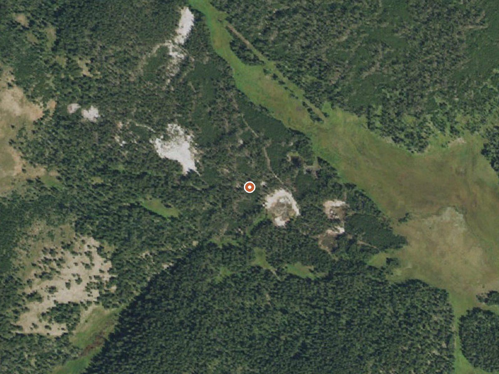
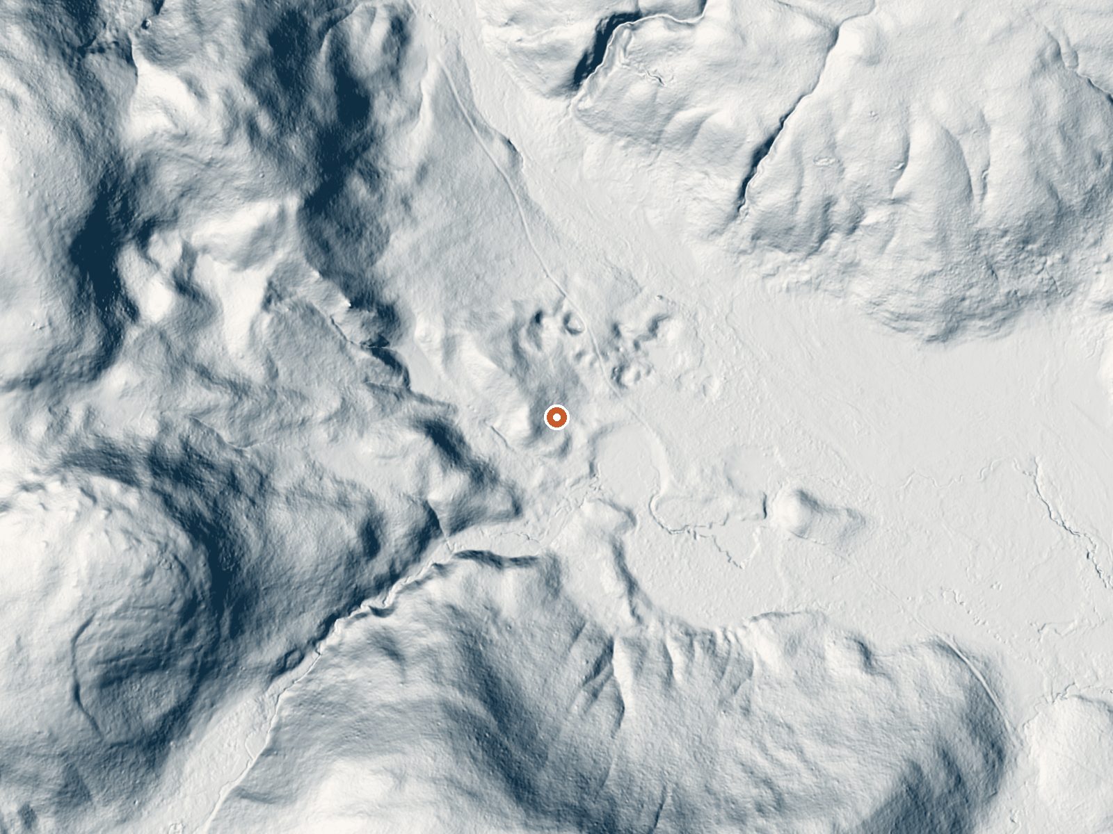
Aerial view of the ground around Whiterock Springs LiDAR bare-earth view of the same ground around Whiterock Springs
Aerial LiDAR bare earth

Drag the handle to compare the two views. The orange dot marks the spring, in a frame about three quarters of a mile wide.

Whiterock Springs, in Yellowstone National Park, is a scalding spring under two miles' walk from the nearest road and a few miles from West Yellowstone. Water hot enough to burn. Open access on Park Service land. Iron shows up in the chemistry sample.

Location

Yellowstone plateau at about 7,600 feet. A hike of about 1.7 miles, road unnamed on file. Snow near 137 inches, wet climate, cold mean temperature. Indian Creek Campground is seven and a half miles off.

Winter listed as best on file. Camp at Indian Creek, the nearest campground on record. Scalding water; do not touch. Chemistry is from a 2006 sample. Park thermal rules apply.

Terrain

Aircraft with laser scanners measured this ground to within inches. The scan strips out trees and buildings, leaving the bare shape of the land around Whiterock Springs.

Setting
Valley floor
Gentle slopes rise on both sides.
Highest ground nearby
227 ft above the spring
Within a quarter mile, to the southwest
Cross-section through the spring

A slice through the ground from northwest to southeast, about 0.6 miles end to end.

Elevation data: USGS 3D Elevation Program. Aerial imagery: USGS The National Map. Public domain.

Heat Below
124 milliwatts per square meter of heat flow

That's about twice the US average of 65. It's higher than at 74% of the springs on this site.

Heat flow measures the warmth working its way up through the ground from deep inside the earth. Where it runs high, rain and snowmelt that seep down through cracks in the rock come back up hot.

Heat flow estimate: Stanford Thermal Earth Model (Aljubran & Horne, 2024), CC BY 4.0.

Monthly Climate
15°
Jan
17°
Feb
25°
Mar
30°
Apr
38°
May
50°
Jun
60°
Jul
59°
Aug
50°
Sep
34°
Oct
22°
Nov
13°
Dec
Annual Precip: 27.4 in Annual Snow: 136.7 in
Best Time to Visit
December Air 13°F · Water 144°F · +131° contrast
January Air 15°F · Water 144°F · +129° contrast
February Air 17°F · Water 144°F · +127° contrast
December offers 47°F more contrast than July
Current Conditions
38°F
S 24.9 mph 62% Good soaking weather
Today 60° Low 32° Sunny
Spring is +84° warmer
Wednesday 66° Low 37° Sunny
Spring is +78° warmer
Thursday 64° Low 37° Showers And Thunderstorms Likely 74% precip
Spring is +80° warmer
Friday 57° Low 32° Rain Showers Likely 62% precip
Spring is +87° warmer
Saturday 59° Low 32° Chance Showers And Thunderstorms 30% precip
Spring is +85° warmer
Water Chemistry Sampled 2006-09-14

The water at Whiterock Springs is slightly acidic (pH 6.7).

pH 6.7 Slightly Acidic
pH influences mineral absorption through skin
Calcium 7 mg/L
May support bone density and joint health
Magnesium 1 mg/L
Known for muscle relaxation and stress relief
Sodium 11 mg/L
Supports circulation and skin hydration
Sulfate 4 mg/L
Traditionally used for skin conditions and inflammation
Chloride 1 mg/L
Natural antiseptic with skin health benefits
Iron 20 µg/L
Iron-rich springs may support circulation
Nearby Camping
Nearby Camping
Indian Creek Campground (Wy) 7.5 mi away

Overview Located about eight miles (13 km) south of Mammoth Hot Springs on the road to Norris, Indian Creek Campground—elevation 7,300 feet (2225 m)—sits near the base of the Gallatin Mountains and offers breathtaking views of Electric Peak. The area offers easy access to fishing and hiking. The campground is away from the main road and provides a quieter, more primitive, experience than many other locations.  For reservations at the campgrounds managed by Yellowstone National Park Lodges (Fi...

Reservable Yes
Reserve on Recreation.gov →
Mile-High Advisory 7,610 ft

Whiterock Springs sits at 7,610 feet above sea level, way above the mile-high mark. You may not feel the altitude strongly, but hot water still dehydrates you faster at elevation. UV is about 30% stronger than at sea level, so bring sunscreen and drink more water than you normally would.

As an Amazon Associate, we earn from qualifying purchases.

Temperature
144°F
Warm Hot Boiling
Water Temp 144°F (62°C)
Avg Air Temp 34°F
Above Ambient +110°F
Great soaking conditions September
Access
Open
Road Access Hike
Distance to Road 1.7 mi
Land
Ownership Federal
Agency National Park Service
Designation National Park
Unit Yellowstone National Park
Manager National Park Service
Protection 1 - Permanent protection, natural state
Frequently Asked Questions
What is the water temperature at Whiterock Springs?
Whiterock Springs has a water temperature of 144°F (62°C). This is considered a hot spring, well above body temperature.
Where is Whiterock Springs located?
Whiterock Springs is located in Gallatin County, Wyoming at 7,610 feet elevation, near West Yellowstone. Coordinates: 44.7810°N, 110.6990°W.
How do I get to Whiterock Springs?
Whiterock Springs has Hike road access (1.7 mi from the road).
Is Whiterock Springs free to visit?
Whiterock Springs has Open access. It is managed by National Park Service.
Can I camp near Whiterock Springs?
Yes, Indian Creek Campground (Wy) is located nearby (7.5 miles away).
What minerals are in the water at Whiterock Springs?
Water chemistry analysis shows the presence of pH, Calcium, Magnesium, Sodium, Sulfate, Chloride, Iron. The pH is 6.7 (slightly acidic).
Is it safe to soak at Whiterock Springs?
No, not at the source. The water at Whiterock Springs reaches 144°F, which can cause severe burns within seconds. Look for cooled side pools or downstream stretches, and test with a hand before anything else.
Sources: USGS NWIS