Caliche Spring
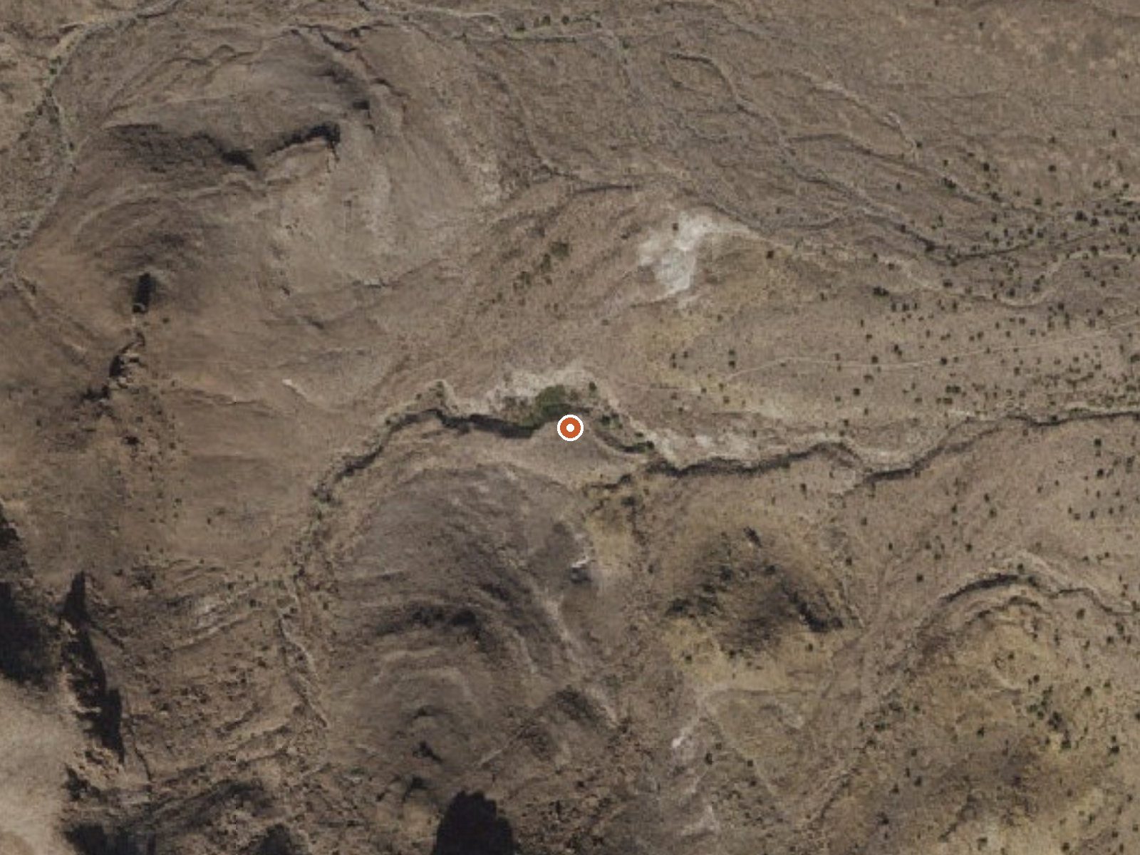
The orange dot marks the spring, in a frame about three quarters of a mile wide.
Caliche Spring, a tepid spring in Mohave County, Arizona, is on BLM land under the Kingman Field Office, about 19 miles from Golden Valley. Access is open. The water reading is warmish on the skin and nothing to soak in. A USGS site record exists, with a single dissolved-solids figure from a 1979 visit and nothing else in the chemistry.
Roadside, about 150 feet off the road, on BLM ground that carries no designation beyond public. The elevation is moderate. The climate row is desert, with a warm yearly average and very little rain. Wild Cow Springs Campground, around 22 miles away, is the only camping in the record.
Winter is when the record says to go. Open BLM ground means you can walk up to it. The only water measurement is one number from 1979, so treat the chemistry as a footnote. No fee is listed. The campground is far enough away that it is a separate stop.
USGS hasn't flown a detailed laser scan here yet, so this view comes from aerial photos and older elevation data.
- Setting
- Hillside
- The spring sits on a steep slope that climbs to the southwest.
- Highest ground nearby
- 299 ft above the spring
- Within a quarter mile, to the southwest
A slice through the ground from southwest to northeast, about 0.6 miles end to end.
Elevation data: USGS 3D Elevation Program. Aerial imagery: USGS The National Map. Public domain.
That's about 1½ times the US average of 65. It's higher than at 31% of the springs on this site.
Heat flow measures the warmth working its way up through the ground from deep inside the earth. Where it runs high, rain and snowmelt that seep down through cracks in the rock come back up hot.
See every spring on the geothermal heat map →
Heat flow estimate: Stanford Thermal Earth Model (Aljubran & Horne, 2024), CC BY 4.0.
The water at Caliche Spring contains 272 mg/L total dissolved solids.
Wild Cow Springs Campground is situated in a grove of oak and large ponderosa pines within the Hualapai Mountains, at an elevation of 6,200 ft. This site becomes especially attractive during the summer months, with temperatures here averaging 20 degrees cooler than the nearby desert valleys located over 3,000 feet below. The site has an accessible campsite and vault toilet and most camping and picnic areas have fire rings, grills, trash cans, and picnic tables.All sites are filled on a firs...
Springs Near Caliche Spring
More Springs Around 79°F
Hike 1 waterfall near Caliche Spring
Looking for more outdoor adventures? Explore waterfall hikes near Caliche Spring, Arizona.