Warm Springs
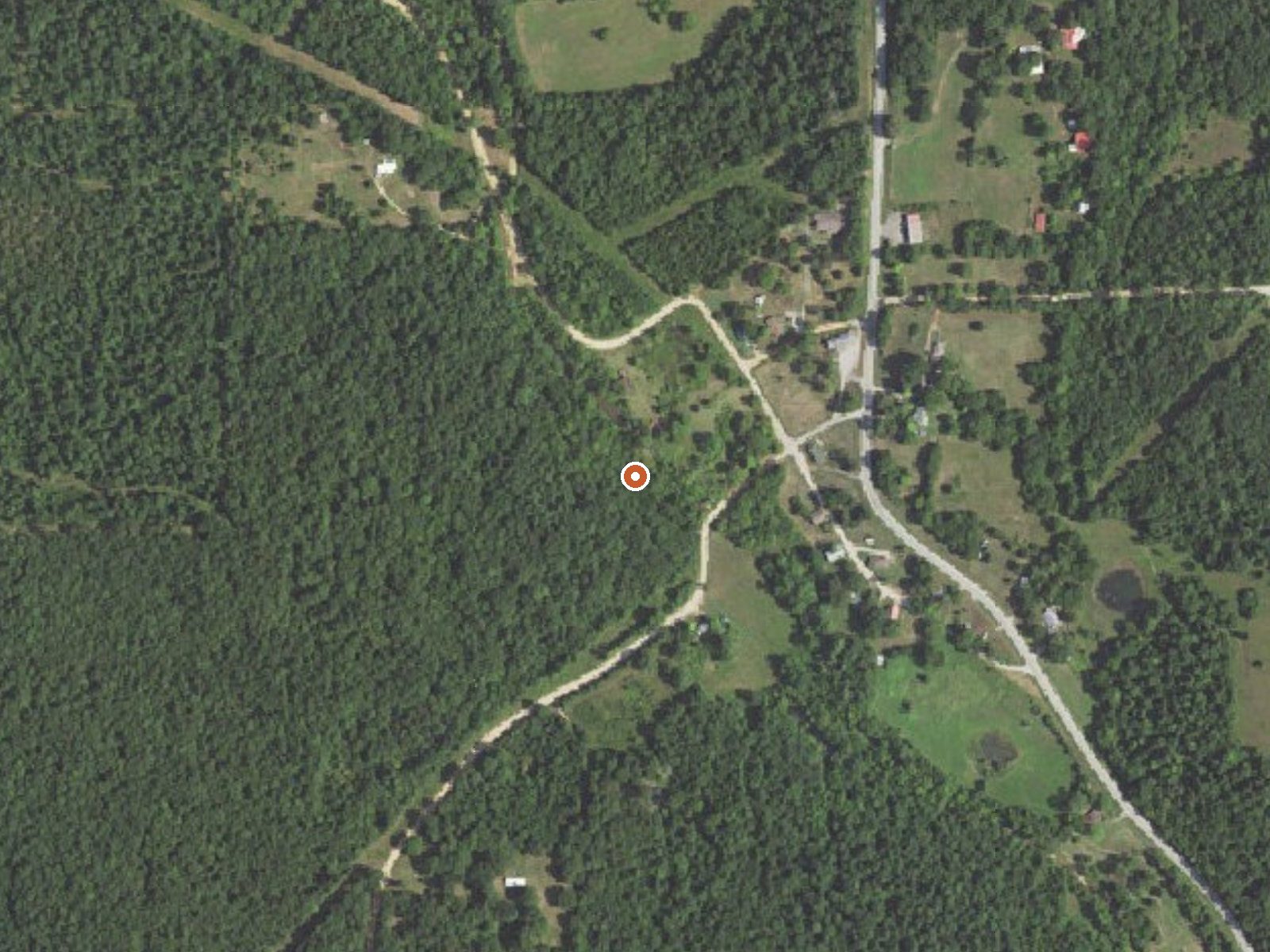
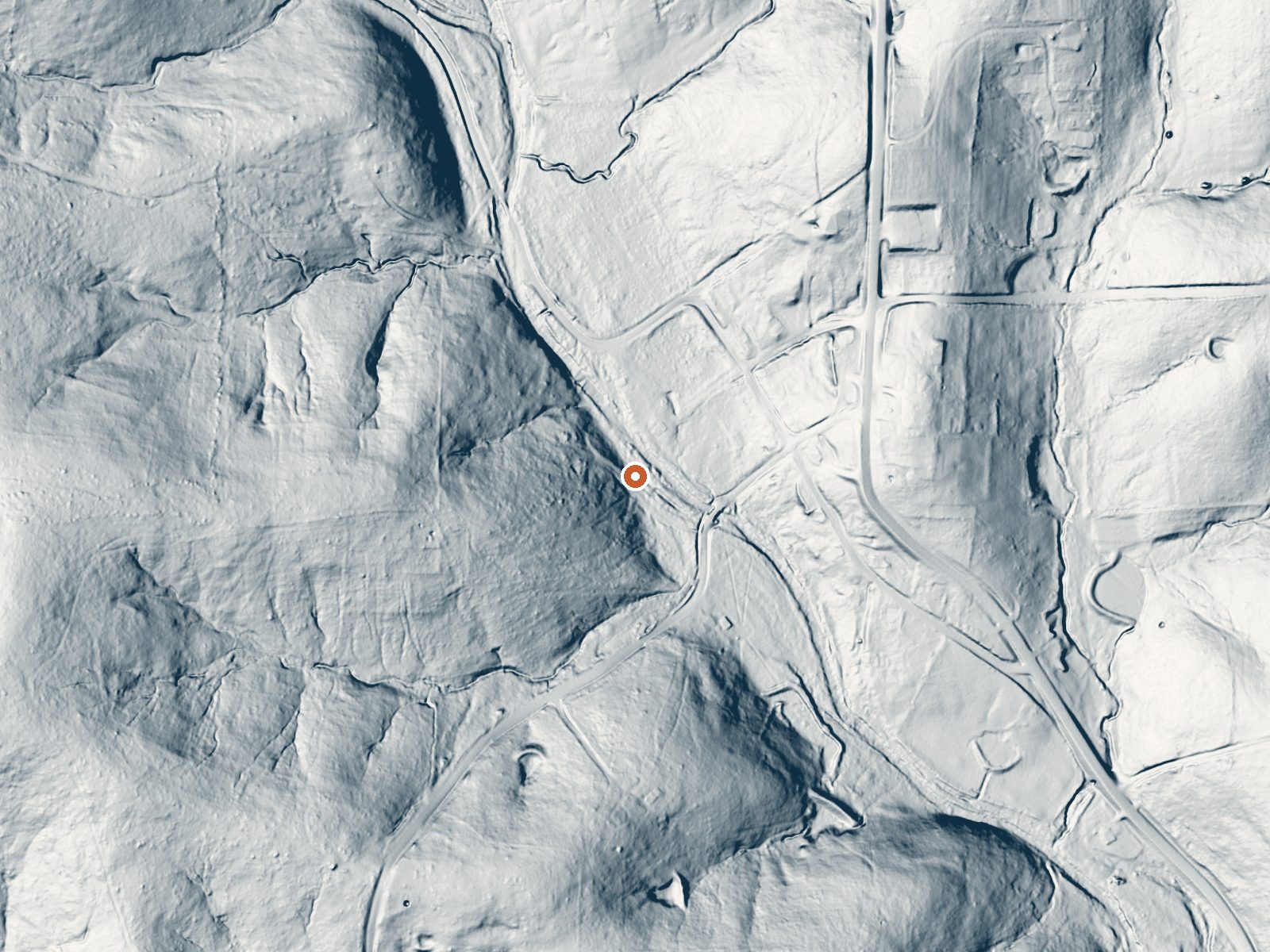
Drag the handle to compare the two views. The orange dot marks the spring, in a frame about three quarters of a mile wide.
Warm Springs in Randolph County, Arkansas, about 16 miles from Pocahontas, is what the name says: warm water, low eighties, at low elevation. The land owner and the access status are both missing from the record, so the spring is known to exist and not much more. No image is on file.
Roadside, under three hundred feet from Blackwell Den Road, at an elevation so low it hardly registers. Mild winters with a little snow, and a wet year overall. The nearest listed camping is the Float Camp Picnic Area, around sixteen miles away. Nothing is recorded about who manages the ground.
Winter months are what the file recommends. Expect water that feels warm on the hand and nothing more, so think of it as something to find. Since nobody has recorded access or ownership, ask locally before crossing onto the ground. The USGS number is the only water-related record; no chemistry sample is attached. No fee is recorded.
Aircraft with laser scanners measured this ground to within inches. The scan strips out trees and buildings, leaving the bare shape of the land around Warm Springs.
- Setting
- Gentle slope
- The ground tilts gently up to the southwest.
- Highest ground nearby
- 105 ft above the spring
- Within a quarter mile, to the southwest
A slice through the ground from west to east, about 0.6 miles end to end.
Elevation data: USGS 3D Elevation Program. Aerial imagery: USGS The National Map. Public domain.
That's close to the US average of 65. It's higher than at 2% of the springs on this site.
Heat flow measures the warmth working its way up through the ground from deep inside the earth. Where it runs high, rain and snowmelt that seep down through cracks in the rock come back up hot.
See every spring on the geothermal heat map →
Heat flow estimate: Stanford Thermal Earth Model (Aljubran & Horne, 2024), CC BY 4.0.
Some links are affiliate links. We may earn a commission at no extra cost to you.
Overview Float Camp Picnic Area is located only 150 feet from the cool waters of the crystal clear Current River. Visitors enjoy floating the river, fishing and hiking. A campground is only a half-mile away for those who want to stay longer than a day.Recreation The swift-moving river allows for enjoyable float trips, as well as canoeing and great fishing. Swimming is also a popular pastime. Visitors enjoy horseshoe pits and volleyball courts, as well as hiking and other recreational opport...
Warm Springs is road-accessible, so you can bring more gear.




As an Amazon Associate, we earn from qualifying purchases.
Springs Near Warm Springs
More Springs Around 82°F
Hike 2 waterfalls near Warm Springs
Looking for more outdoor adventures? Explore waterfall hikes near Warm Springs, Arkansas.