Guyer Hot Springs
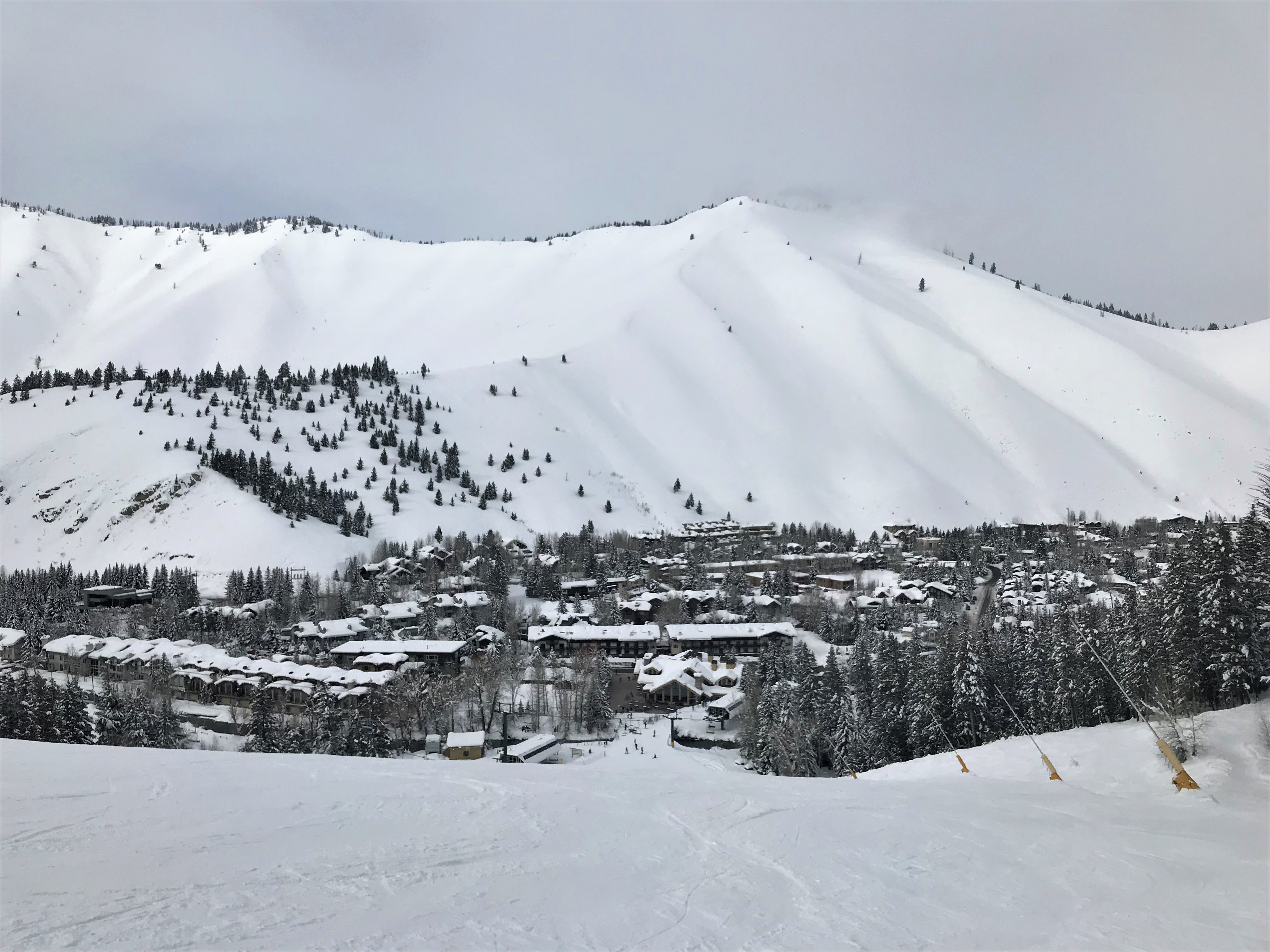
Guyer Hot Springs comes up about two miles outside Ketchum in Blaine County, Idaho, close enough to town that it barely counts as a drive. The water is the thing to know about. The survey on file puts it far above anything a person could sit in, hot enough to scald on contact. Public access at the source is not recorded, and no land owner is listed, so check on both before treating it as somewhere to visit.
Warm Springs Road runs right past it, and the source sits a few steps off the pavement. You barely leave the car. This is mountain country around Ketchum, high enough that the winters are long and cold, and the snowfall on file is heavy, over nine feet in an average year. Summers stay short and fairly dry. Nobody has recorded who manages the ground around the spring.
The record lists winter as the best season. Do not put a hand in it. At the temperature on record this water will burn skin in seconds, and any soak would depend on cooling it, which nothing on file says is possible. North Fork is the closest campground in the record, roughly seven miles off. Check access before you go, since the public's standing at the source is unrecorded, and the chemistry reading dates to 1988.
Aircraft with laser scanners measured this ground to within inches. The scan strips out trees and buildings, leaving the bare shape of the land around Guyer Hot Springs.
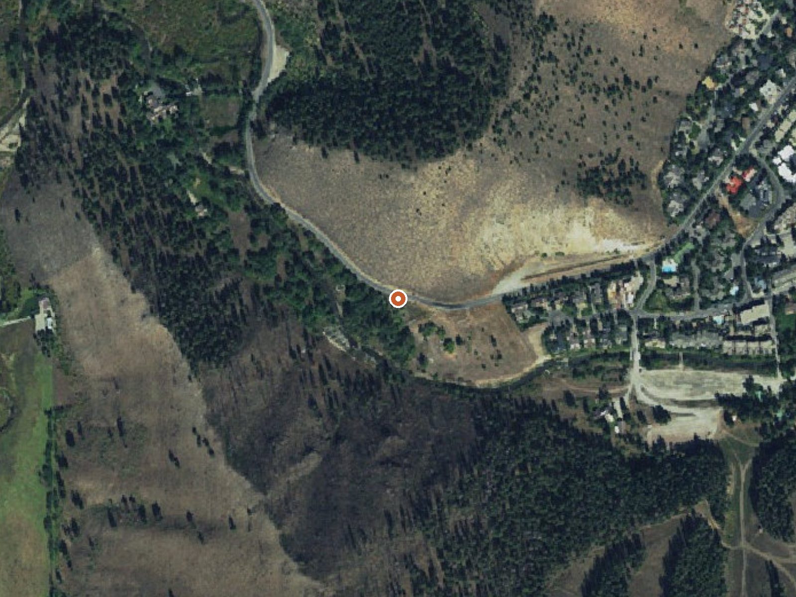
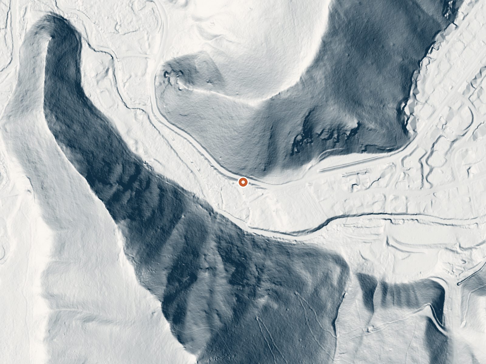
Drag the handle to compare the two views. The orange dot marks the spring, in a frame about three quarters of a mile wide.
- Setting
- Canyon floor
- Steep ground climbs away on both sides of the spring.
- Highest ground nearby
- 640 ft above the spring
- Within a quarter mile, to the southwest
A slice through the ground from southwest to northeast, about 0.6 miles end to end.
Elevation data: USGS 3D Elevation Program. Aerial imagery: USGS The National Map. Public domain.
That's about 1½ times the US average of 65. It's higher than at 34% of the springs on this site.
Heat flow measures the warmth working its way up through the ground from deep inside the earth. Where it runs high, rain and snowmelt that seep down through cracks in the rock come back up hot.
See every spring on the geothermal heat map →
Heat flow estimate: Stanford Thermal Earth Model (Aljubran & Horne, 2024), CC BY 4.0.
The water at Guyer Hot Springs is alkaline (pH 9.1).
Some links are affiliate links. We may earn a commission at no extra cost to you.
Overview North Fork Campground is situated on the banks of the beautiful Big Wood River at an elevation of 6,300 feet. Visitors enjoy fishing and tubing on the river and exploring the Harriman Trail.Recreation This site is part of the Sawtooth National Recreation Area, where outdoor activities abound. Fly-fishing for rainbow, brown and brook trout is popular on the Big Wood River, as is float tubing. The 20-mile Harriman Trail leads past the campground, offering excellent hiking and biking...
Guyer Hot Springs sits at 5,920 feet above sea level, way above the mile-high mark. You may not feel the altitude strongly, but hot water still dehydrates you faster at elevation. UV is about 24% stronger than at sea level, so bring sunscreen and drink more water than you normally would.



As an Amazon Associate, we earn from qualifying purchases.
Guyer Hot Springs is road-accessible, so you can bring more gear. The water is dangerously hot, so bring water shoes and test pools carefully. Cold air temperatures make a changing robe or warm layers essential.





As an Amazon Associate, we earn from qualifying purchases.
Springs Near Guyer Hot Springs
More Springs Around 158°F
Alkaline Springs (pH ~9.1)
Hike 5 waterfalls near Guyer Hot Springs
Looking for more outdoor adventures? Explore waterfall hikes near Guyer Hot Springs, Idaho.