Clarendon Hot Springs
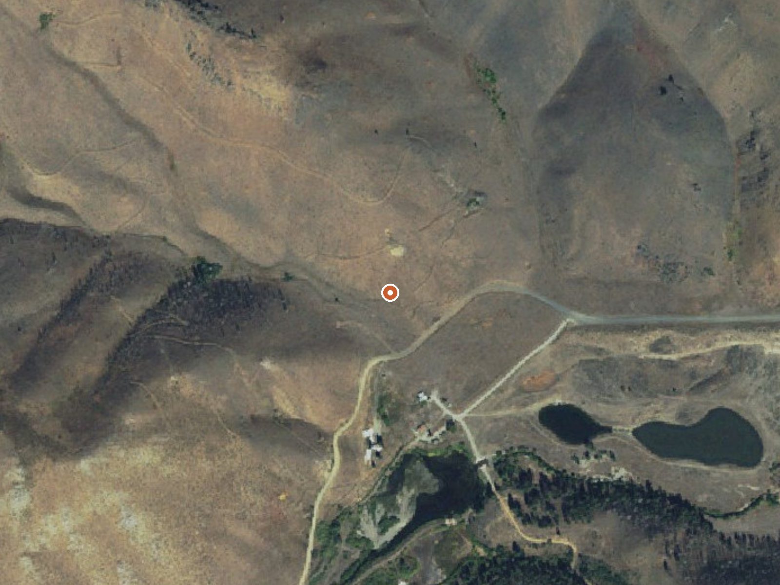
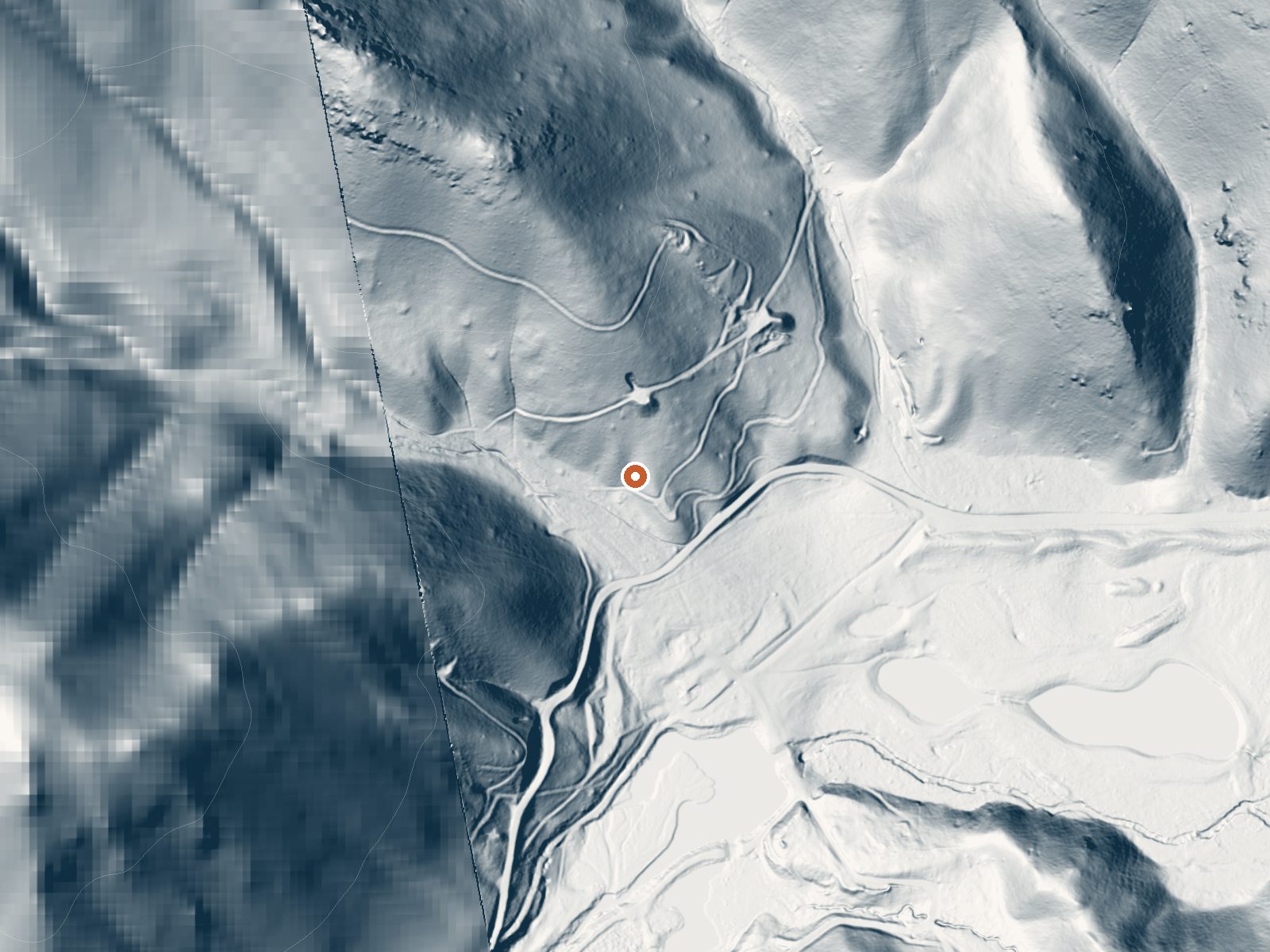
Drag the handle to compare the two views. The orange dot marks the spring, in a frame about three quarters of a mile wide.
Clarendon Hot Springs sits closer to a town than most Idaho springs, under seven miles from Hailey in Blaine County, inside the Sawtooth National Forest. The water runs in the mid 120s, hot, and access is listed as open. The chemistry sample on file is unusually complete, with iron among the dissolved minerals and a total dissolved solids figure recorded.
The spring is about 280 feet off National Forest Development Road 097, so roadside by any measure. Cool mountain country, fairly high. Roughly six feet of snow falls in a winter and the yearly average temperature sits in the low 40s, with moderate precipitation. The nearest developed campground, North Fork, is a fair drive at nearly sixteen miles.
On record, winter is the best time. A Forest Service road at this elevation with six feet of snow may or may not be driveable in January, so ask the Sawtooth ranger district. The water needs cooling before you get in. The sample dates from 1988, so treat the chemistry as a snapshot from that year. No picture on record.
Aircraft with laser scanners measured this ground to within inches. The scan strips out trees and buildings, leaving the bare shape of the land around Clarendon Hot Springs.
- Setting
- Canyon floor
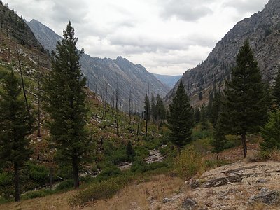
- Steep ground climbs away on both sides of the spring.
- Highest ground nearby
- 469 ft above the spring
- Within a quarter mile, to the west
A slice through the ground from southwest to northeast, about 0.6 miles end to end.
Elevation data: USGS 3D Elevation Program. Aerial imagery: USGS The National Map. Public domain.
That's about 1½ times the US average of 65. It's higher than at 41% of the springs on this site.
Heat flow measures the warmth working its way up through the ground from deep inside the earth. Where it runs high, rain and snowmelt that seep down through cracks in the rock come back up hot.
See every spring on the geothermal heat map →
Heat flow estimate: Stanford Thermal Earth Model (Aljubran & Horne, 2024), CC BY 4.0.
The water at Clarendon Hot Springs is alkaline (pH 9.1) with 318 mg/L total dissolved solids.
Overview North Fork Campground is situated on the banks of the beautiful Big Wood River at an elevation of 6,300 feet. Visitors enjoy fishing and tubing on the river and exploring the Harriman Trail.Recreation This site is part of the Sawtooth National Recreation Area, where outdoor activities abound. Fly-fishing for rainbow, brown and brook trout is popular on the Big Wood River, as is float tubing. The 20-mile Harriman Trail leads past the campground, offering excellent hiking and biking...
Clarendon Hot Springs sits at 5,720 feet above sea level, way above the mile-high mark. You may not feel the altitude strongly, but hot water still dehydrates you faster at elevation. UV is about 23% stronger than at sea level, so bring sunscreen and drink more water than you normally would.



As an Amazon Associate, we earn from qualifying purchases.
Springs Near Clarendon Hot Springs
More Springs Around 126°F
Alkaline Springs (pH ~9.1)
Hike 5 waterfalls near Clarendon Hot Springs
Looking for more outdoor adventures? Explore waterfall hikes near Clarendon Hot Springs, Idaho.