Wardrop Hot Spring
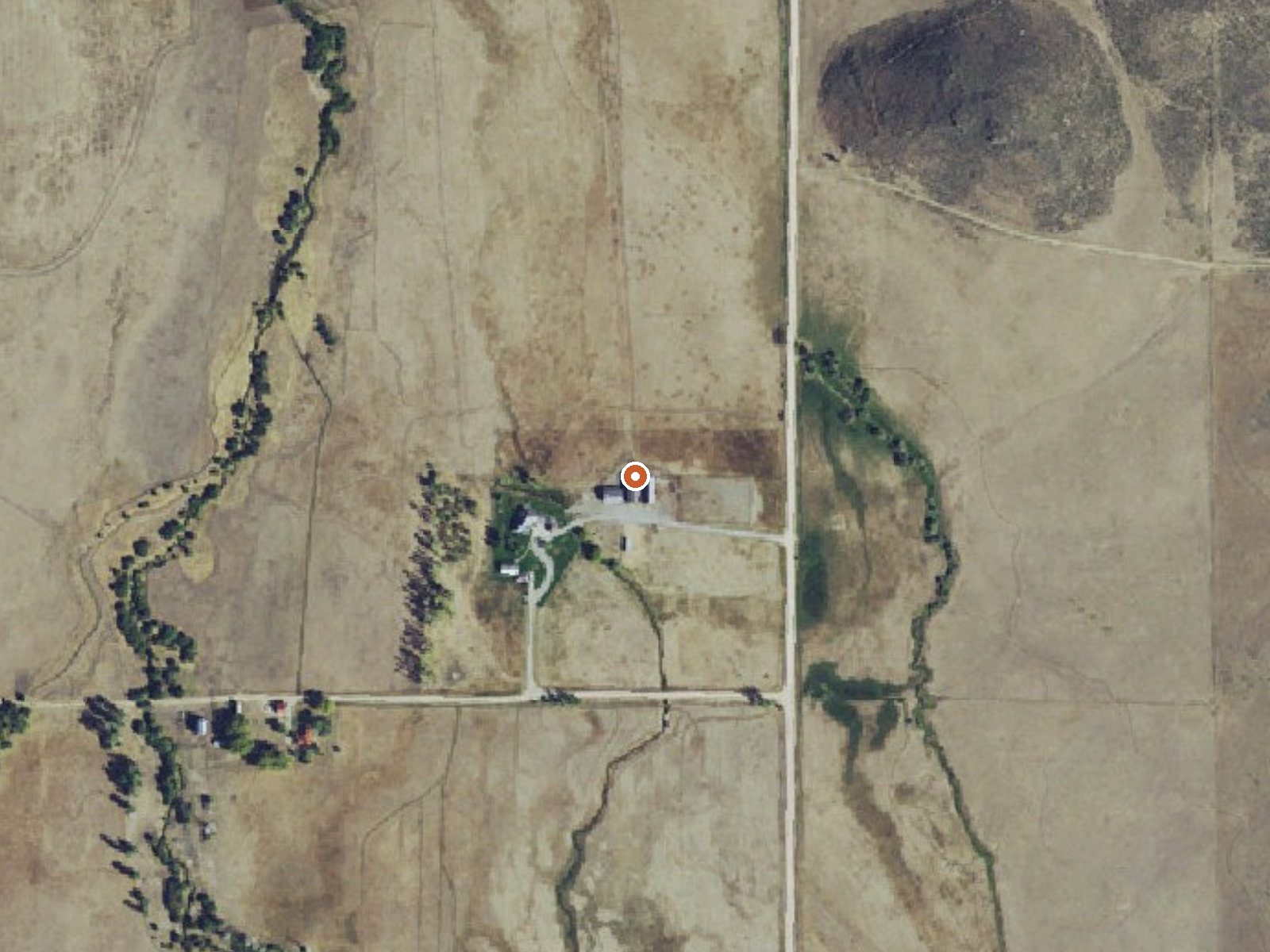
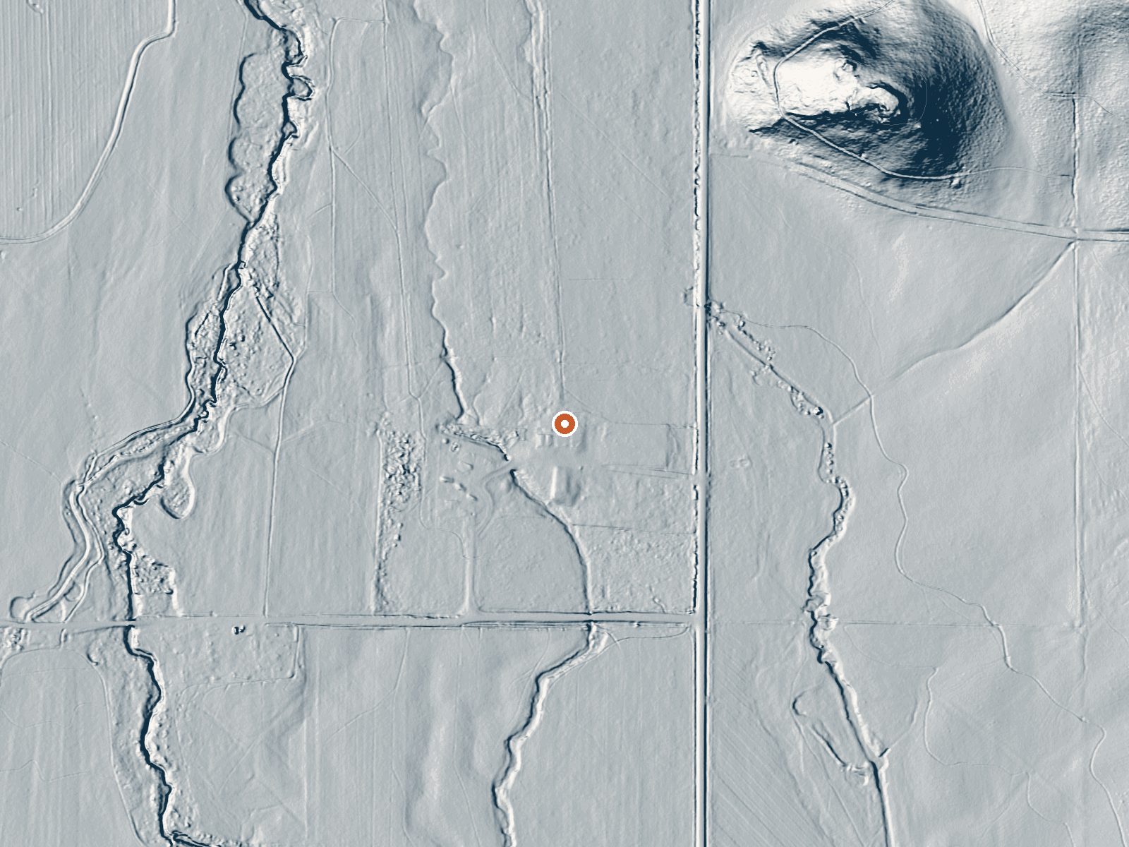
Drag the handle to compare the two views. The orange dot marks the spring, in a frame about three quarters of a mile wide.
Seven miles from Fairfield in Camas County, Wardrop Hot Spring is a scalding source off Corral Creek Road. The water on record is far too hot for skin. Nobody is recorded as owner, and the access status is blank too, which matters here because the spring is close to town and easy to reach. Dissolved solids are low and the water is quite alkaline in the 1989 sample.
Corral Creek Road comes within a hundred and fifty yards or so, and you walk the rest. The spring sits above five thousand feet. A typical winter drops about ninety inches of snow, and the year as a whole is dry. The record gives no land unit and no owner, so you could be stepping onto private ground without knowing it.
On record, the season to come is winter, December to February. Bowns Campground is the nearest camping listed, and it is nearly sixteen miles off. It is scalding where it surfaces; stay back from that point and never enter water you have not checked. Before going at all, find out who owns the land and whether visitors are allowed, because the record does not say. The reading is from May 1989.
Aircraft with laser scanners measured this ground to within inches. The scan strips out trees and buildings, leaving the bare shape of the land around Wardrop Hot Spring.
- Setting
- Open ground
- Flat, open ground all around.
- Highest ground nearby
- 24 ft above the spring
- Within a quarter mile, to the northeast
A slice through the ground from southwest to northeast, about 0.6 miles end to end.
Elevation data: USGS 3D Elevation Program. Aerial imagery: USGS The National Map. Public domain.
That's about 1½ times the US average of 65. It's higher than at 48% of the springs on this site.
Heat flow measures the warmth working its way up through the ground from deep inside the earth. Where it runs high, rain and snowmelt that seep down through cracks in the rock come back up hot.
See every spring on the geothermal heat map →
Heat flow estimate: Stanford Thermal Earth Model (Aljubran & Horne, 2024), CC BY 4.0.
The water at Wardrop Hot Spring is alkaline (pH 9.3) with 211 mg/L total dissolved solids.
Some links are affiliate links. We may earn a commission at no extra cost to you.
Bowns Campground, located 25 miles east of Featherville and 18 miles north of Fairfield, is a developed campground composed of 10 units along Big Smoky Creek. Two of the camp sites are double family units. Camping, fishing, hiking, and picnicking are popular activities. Campground amenities include picnic tables, fire rings, drinking water (seasonally) and restrooms. Miller Creek Trail (#087) starts just south of the campground and is open to motorcycles.
Wardrop Hot Spring is road-accessible, so you can bring more gear. The water is dangerously hot, so bring water shoes and test pools carefully. Cold air temperatures make a changing robe or warm layers essential.





As an Amazon Associate, we earn from qualifying purchases.
Springs Near Wardrop Hot Spring
More Springs Around 147°F
Alkaline Springs (pH ~9.3)
Hike 6 waterfalls near Wardrop Hot Spring
Looking for more outdoor adventures? Explore waterfall hikes near Wardrop Hot Spring, Idaho.