Yandell Springs
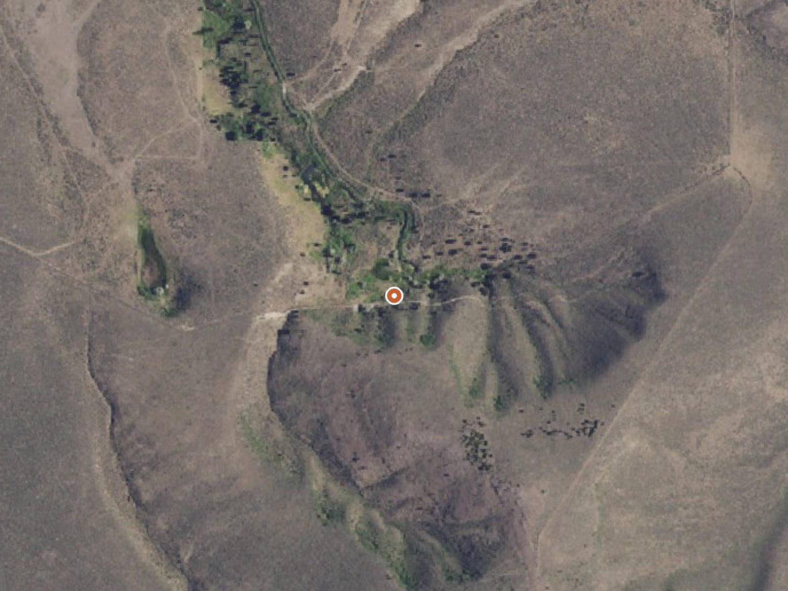
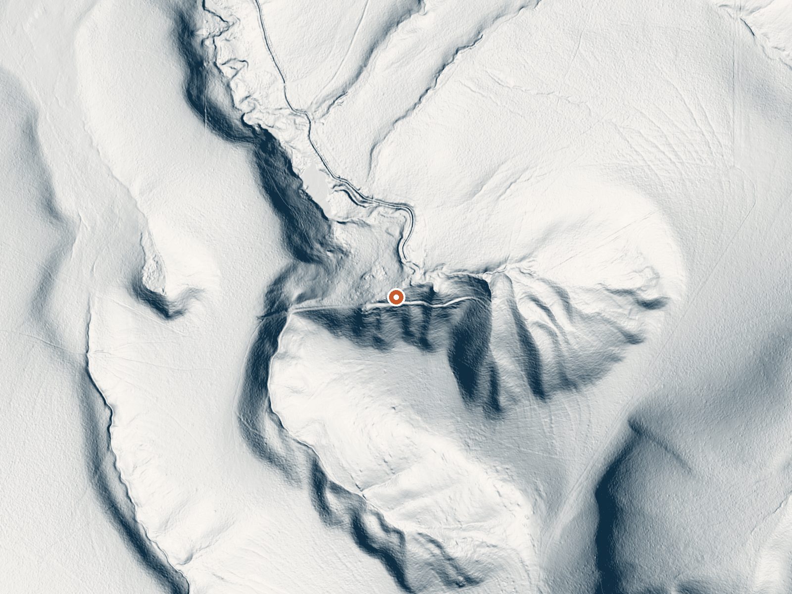
Drag the handle to compare the two views. The orange dot marks the spring, in a frame about three quarters of a mile wide.
Yandell Springs is on the Fort Hall Reservation in Bingham County, Idaho, about eleven miles from Blackfoot. It is tribal land, and public access is listed as unknown, which is the single most important fact here. The water comes out at the low end of soaking warm, body temperature give or take, and flows steadily enough that the USGS measured it.
A roadside point. The nearest road is under three hundred feet away, though its name is not in our data. The land is reservation ground at a high-plains elevation, with around four feet of snow in a normal winter and modest rain. No campground sits close; Morgans Bridge Campground is the closest listed, thirteen miles.
Do not drive onto Fort Hall Reservation land expecting a public soak. Ask the tribal authority first, because access is unknown and the ground is theirs. The record favors winter. Both the water chemistry and the temperature come from a 1977 sample, so either may have drifted.
Aircraft with laser scanners measured this ground to within inches. The scan strips out trees and buildings, leaving the bare shape of the land around Yandell Springs.
- Setting
- Hillside
- The spring sits on a steep slope that climbs to the south.
- Highest ground nearby
- 349 ft above the spring
- Within a quarter mile, to the south
A slice through the ground from south to north, about 0.6 miles end to end.
Elevation data: USGS 3D Elevation Program. Aerial imagery: USGS The National Map. Public domain.
That's about 1½ times the US average of 65. It's higher than at 57% of the springs on this site.
Heat flow measures the warmth working its way up through the ground from deep inside the earth. Where it runs high, rain and snowmelt that seep down through cracks in the rock come back up hot.
See every spring on the geothermal heat map →
Heat flow estimate: Stanford Thermal Earth Model (Aljubran & Horne, 2024), CC BY 4.0.
The water at Yandell Springs is neutral (pH 7.1). It is notably rich in calcium (may support bone density and joint health), magnesium (known for muscle relaxation and stress relief), and sulfate (traditionally used for skin conditions and inflammation).
This BLM managed site located along the Blackfoot River that has opportunities for fishing, camping, and non-motorized boating. Campground rules and regulations are posted at the site. There are no dumpsters on site, visitors must pack in and out their trash. Campsites: 12 developed sites--- 10 which are accessible by vehicle and 2 which are walk-in only. At this time, there is not a reservation system in place for the campsites. Campsites are on a first come first serve basis. This site is e...
Springs Near Yandell Springs
More Springs Around 90°F
Neutral Springs (pH ~7.1)
Hike 1 waterfall near Yandell Springs
Looking for more outdoor adventures? Explore waterfall hikes near Yandell Springs, Idaho.