Ponce De Leon Springs
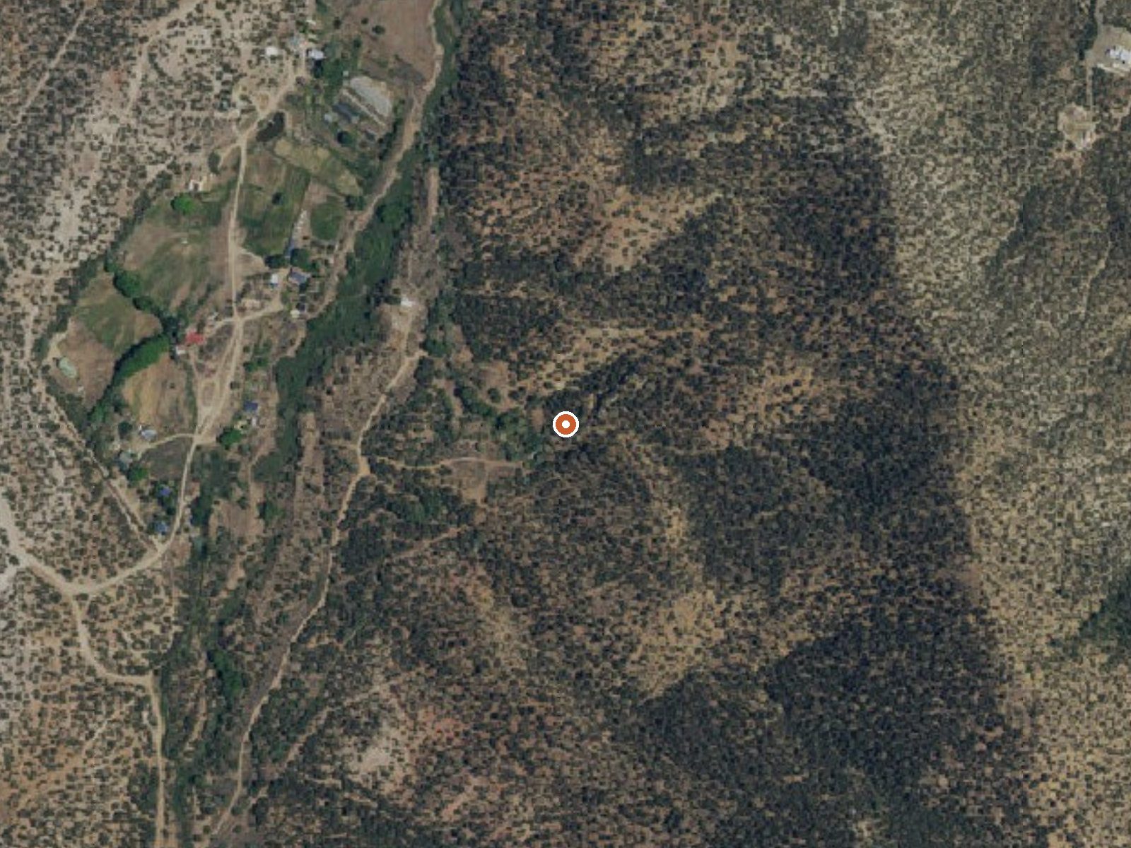
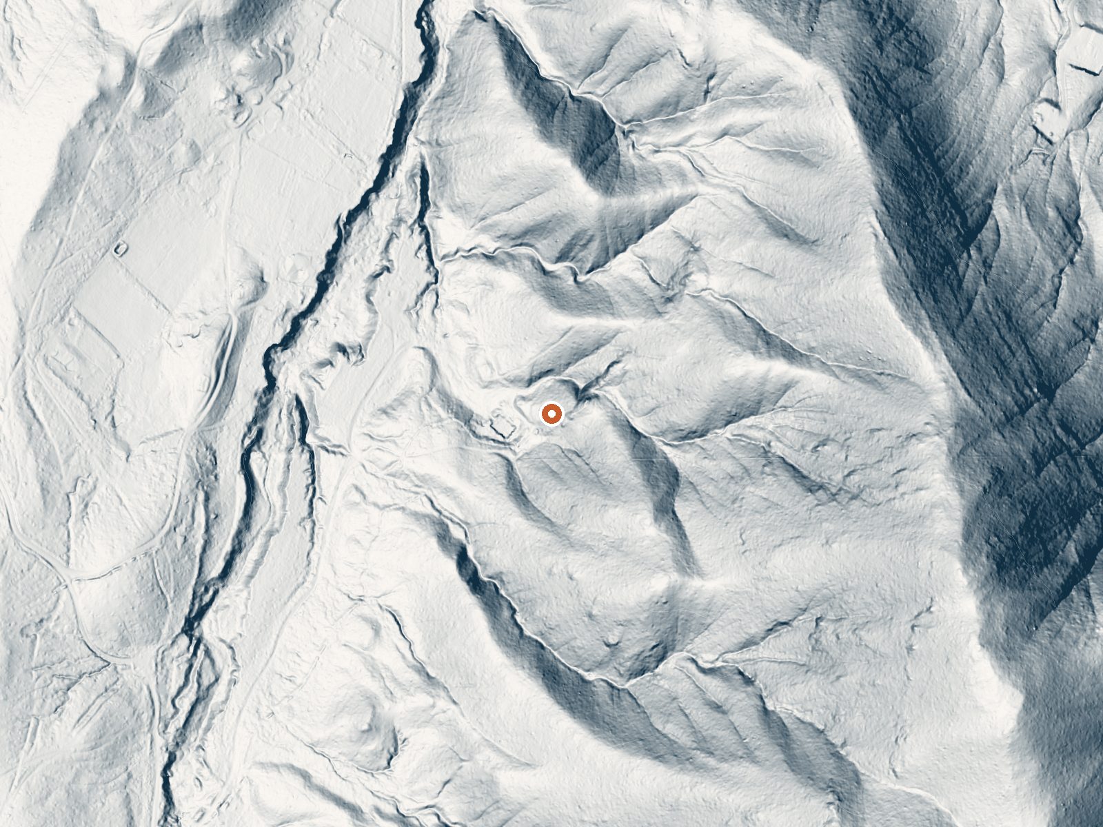
Drag the handle to compare the two views. The orange dot marks the spring, in a frame about three quarters of a mile wide.
Ponce De Leon Springs sits close to Ranchos de Taos in Taos County, under three miles out, at a high elevation. The water sits at the bottom of the soaking range, pleasant on a hot afternoon and not a hot soak. Miranda Canyon Road is a few hundred feet away. Land ownership has not been entered, and the access status is empty.
High country, well above seven thousand feet. Winter snow is heavy and the year is moderately wet, with cool average temperatures. From Miranda Canyon Road the walk is a tenth of a mile or so, short enough that the drive is the whole trip. Las Petacas Campground lies about six miles off. The record assigns no land unit, and nothing says who manages the ground.
The winter flag on this entry sits oddly with the snow totals; the road may be the hard part. The walk in is short. Both readings date from 1974, and the reading puts the water only a little above skin temperature, so it may feel cool in cold weather. Ownership is unrecorded, so ask around Ranchos de Taos.
Aircraft with laser scanners measured this ground to within inches. The scan strips out trees and buildings, leaving the bare shape of the land around Ponce De Leon Springs.
- Setting
- Hillside
- The spring sits on a steep slope that climbs to the southeast.
- Highest ground nearby
- 554 ft above the spring
- Within a quarter mile, to the southeast
A slice through the ground from northwest to southeast, about 0.6 miles end to end.
Elevation data: USGS 3D Elevation Program. Aerial imagery: USGS The National Map. Public domain.
That's about twice the US average of 65. It's higher than at 69% of the springs on this site.
Heat flow measures the warmth working its way up through the ground from deep inside the earth. Where it runs high, rain and snowmelt that seep down through cracks in the rock come back up hot.
See every spring on the geothermal heat map →
Heat flow estimate: Stanford Thermal Earth Model (Aljubran & Horne, 2024), CC BY 4.0.
The water at Ponce De Leon Springs is slightly alkaline (pH 7.8).
Some links are affiliate links. We may earn a commission at no extra cost to you.
Set in a beautiful canyon quite close to Taos, there is good access to Rio Fernando de Taos for fishing.
Ponce De Leon Springs sits at 7,400 feet above sea level, way above the mile-high mark. You may not feel the altitude strongly, but hot water still dehydrates you faster at elevation. UV is about 30% stronger than at sea level, so bring sunscreen and drink more water than you normally would.



As an Amazon Associate, we earn from qualifying purchases.
Ponce De Leon Springs is road-accessible, so you can bring more gear.






As an Amazon Associate, we earn from qualifying purchases.
Springs Near Ponce De Leon Springs
More Springs Around 93°F
Slightly Alkaline Springs (pH ~7.8)
Hike 4 waterfalls near Ponce De Leon Springs
Looking for more outdoor adventures? Explore waterfall hikes near Ponce De Leon Springs, New Mexico.