Richfield Warm Springs

A town park spring. Richfield Warm Springs sits inside Lions Park in Richfield, Sevier County, on city land with public access listed as open. The water is warm the way a summer pond is warm, low seventies, so this is a place to wade or to look at more than a place to soak. Less than a mile separates it from the center of town.
You park on 600 West and the spring is about a hundred and fifty feet away, which is as easy as it gets. Elevation is a bit over five thousand feet. Winters here are snowy, better than four feet in a typical year, and the annual total of rain and snow is about fifteen inches, so it is a cold, mostly dry valley with a real winter. The park is the whole setting as far as the record goes.
Best months on file are the three of midwinter, though a city park is reachable year round. Access is open and roadside. Adelaide Campground is the closest camping on record, about fifteen miles off. No fee is listed, and no water chemistry has been recorded, so what the spring smells or tastes like is not something the record can tell you.
Aircraft with laser scanners measured this ground to within inches. The scan strips out trees and buildings, leaving the bare shape of the land around Richfield Warm Springs.
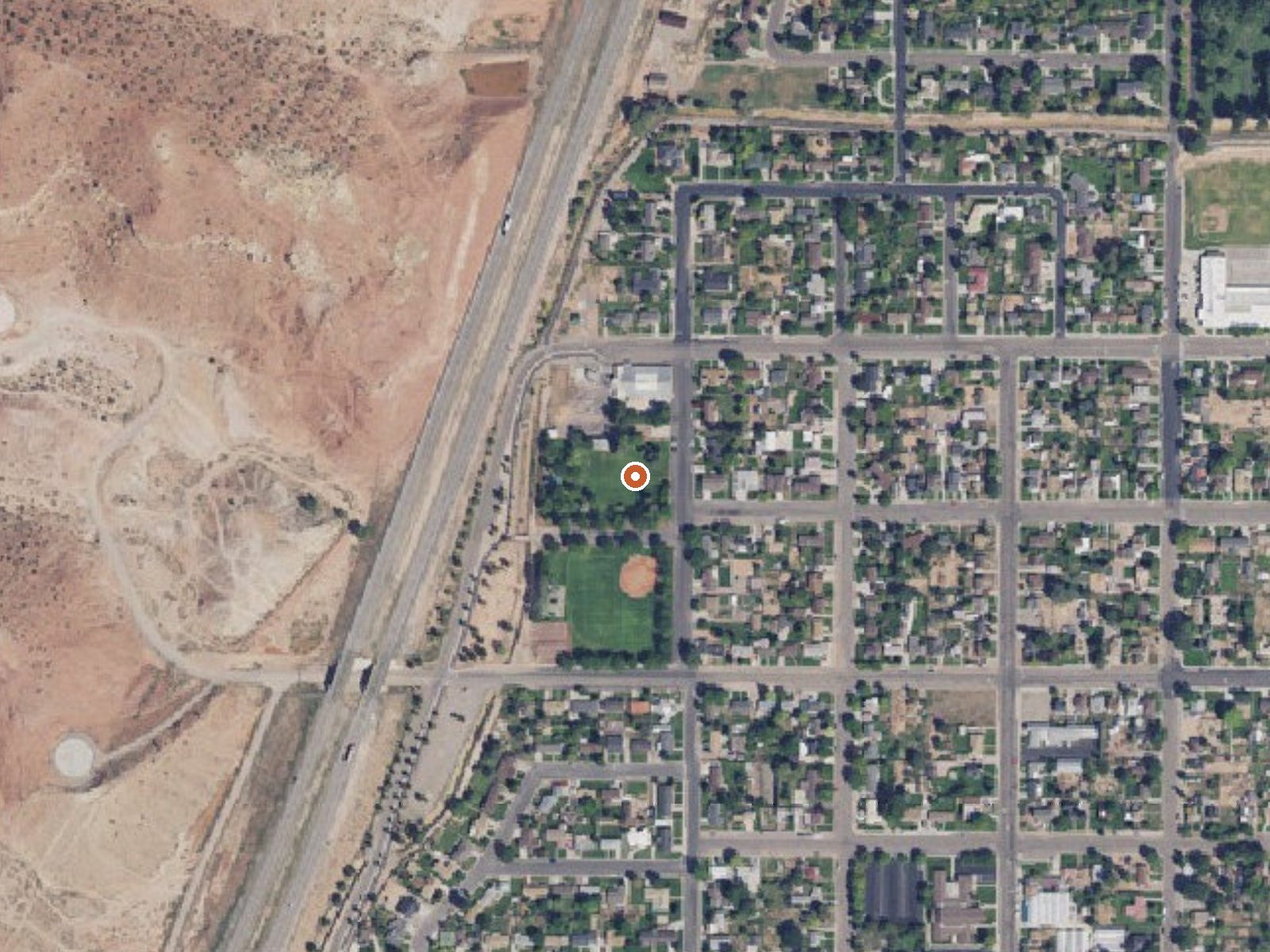
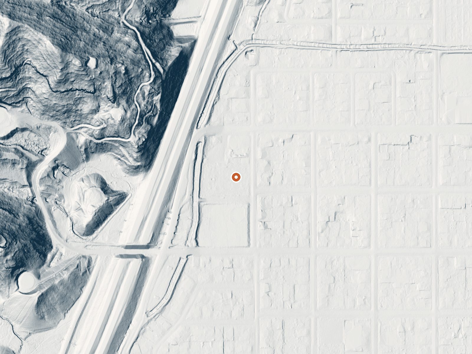
Drag the handle to compare the two views. The orange dot marks the spring, in a frame about three quarters of a mile wide.
- Setting
- Gentle slope
- The ground tilts gently up to the northwest.
- Highest ground nearby
- 276 ft above the spring
- Within a quarter mile, to the northwest
A slice through the ground from northwest to southeast, about 0.6 miles end to end.
Elevation data: USGS 3D Elevation Program. Aerial imagery: USGS The National Map. Public domain.
That's about twice the US average of 65. It's higher than at 72% of the springs on this site.
Heat flow measures the warmth working its way up through the ground from deep inside the earth. Where it runs high, rain and snowmelt that seep down through cracks in the rock come back up hot.
See every spring on the geothermal heat map →
Heat flow estimate: Stanford Thermal Earth Model (Aljubran & Horne, 2024), CC BY 4.0.
Some links are affiliate links. We may earn a commission at no extra cost to you.
Overview Adelaide Campground is located in Corn Creek Canyon on the south end of the Pahvant Mountain Range near Kanosh, Utah.Recreation Corn Creek offers brown and rainbow trout fishing. Hiking and biking trails begin nearby, and the Paiute ATV trail can be easily accessed from the site.Facilities The campground offers 1 group site which can accommodate 48 guests and up to 15 vehicles. 9 individual sites are also available. These sites can accommodate 6 to 8 guests and 2 vehicles. All of th...
Richfield Warm Springs sits at 5,389 feet above sea level, way above the mile-high mark. You may not feel the altitude strongly, but hot water still dehydrates you faster at elevation. UV is about 22% stronger than at sea level, so bring sunscreen and drink more water than you normally would.



As an Amazon Associate, we earn from qualifying purchases.
Richfield Warm Springs is road-accessible, so you can bring more gear.






As an Amazon Associate, we earn from qualifying purchases.
Springs Near Richfield Warm Springs
More Springs Around 73°F
Hike 1 waterfall near Richfield Warm Springs
Looking for more outdoor adventures? Explore waterfall hikes near Richfield Warm Springs, Utah.