Salt Spring
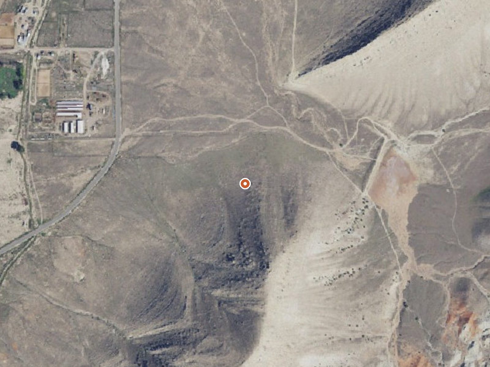
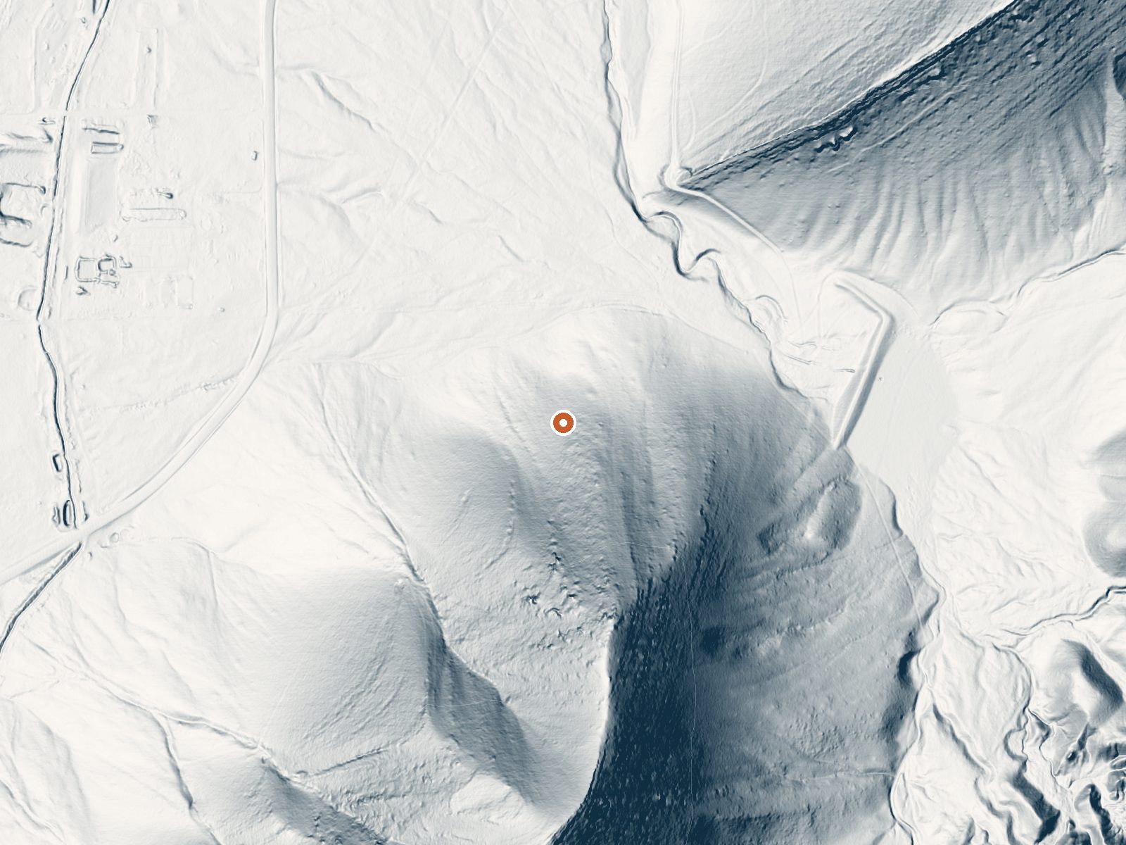
Drag the handle to compare the two views. The orange dot marks the spring, in a frame about three quarters of a mile wide.
Salt Spring lies a few miles outside Salina in Sevier County. The water comes out tepid, low seventies, cooler than a bath. The name fits the chemistry: a sample from 1968 found sodium and chloride along with sulfate, calcium and magnesium, though the dissolved solids are modest for a spring carrying that name. Ownership and public access are blank in the record.
Off the nearest road it is a short walk, somewhere around four hundred and fifty feet, with no road name given. Elevation is a little over five thousand feet. Winters bring near four feet of snow and the year is dry overall. No land unit, owner or designation is recorded, and there is no photo, so you will be finding it by map coordinates alone.
Winter is the season flagged as best. The walk in is short. Maple Grove is the campground on file, about fourteen miles away. The temperature and mineral figures come from a single survey in the late sixties, so do not count on the water matching them today. Ask locally about access before you go, since nobody has recorded if the ground is public.
Aircraft with laser scanners measured this ground to within inches. The scan strips out trees and buildings, leaving the bare shape of the land around Salt Spring.
- Setting
- Hillside
- The spring sits on a steep slope that climbs to the south.
- Highest ground nearby
- 516 ft above the spring
- Within a quarter mile, to the south
A slice through the ground from north to south, about 0.6 miles end to end.
Elevation data: USGS 3D Elevation Program. Aerial imagery: USGS The National Map. Public domain.
That's about twice the US average of 65. It's higher than at 84% of the springs on this site.
Heat flow measures the warmth working its way up through the ground from deep inside the earth. Where it runs high, rain and snowmelt that seep down through cracks in the rock come back up hot.
See every spring on the geothermal heat map →
Heat flow estimate: Stanford Thermal Earth Model (Aljubran & Horne, 2024), CC BY 4.0.
The water at Salt Spring is slightly alkaline (pH 7.8) with 564 mg/L total dissolved solids. It is notably rich in chloride (natural antiseptic with skin health benefits).
Some links are affiliate links. We may earn a commission at no extra cost to you.
Overview Maple Grove Campground sits in Fishlake National Forest in central Utah. Visitors enjoy fishing and hiking the nearby Rock Canyon Trail.Recreation The 3.2-mile Rock Canyon Trail begins in the campground and leads to the top of the Pahvant Range. Younger campers love fishing for rainbow trout in Ivie Creek.Facilities The campground offers three reservable accessible group sites with picnic tables, campfire circles, grills and water spigots. Several single sites are available on a firs...
Salt Spring is road-accessible, so you can bring more gear.






As an Amazon Associate, we earn from qualifying purchases.
Springs Near Salt Spring
More Springs Around 72°F
Slightly Alkaline Springs (pH ~7.8)
Hike 1 waterfall near Salt Spring
Looking for more outdoor adventures? Explore waterfall hikes near Salt Spring, Utah.