Sterling (Peacock) Warm Spring
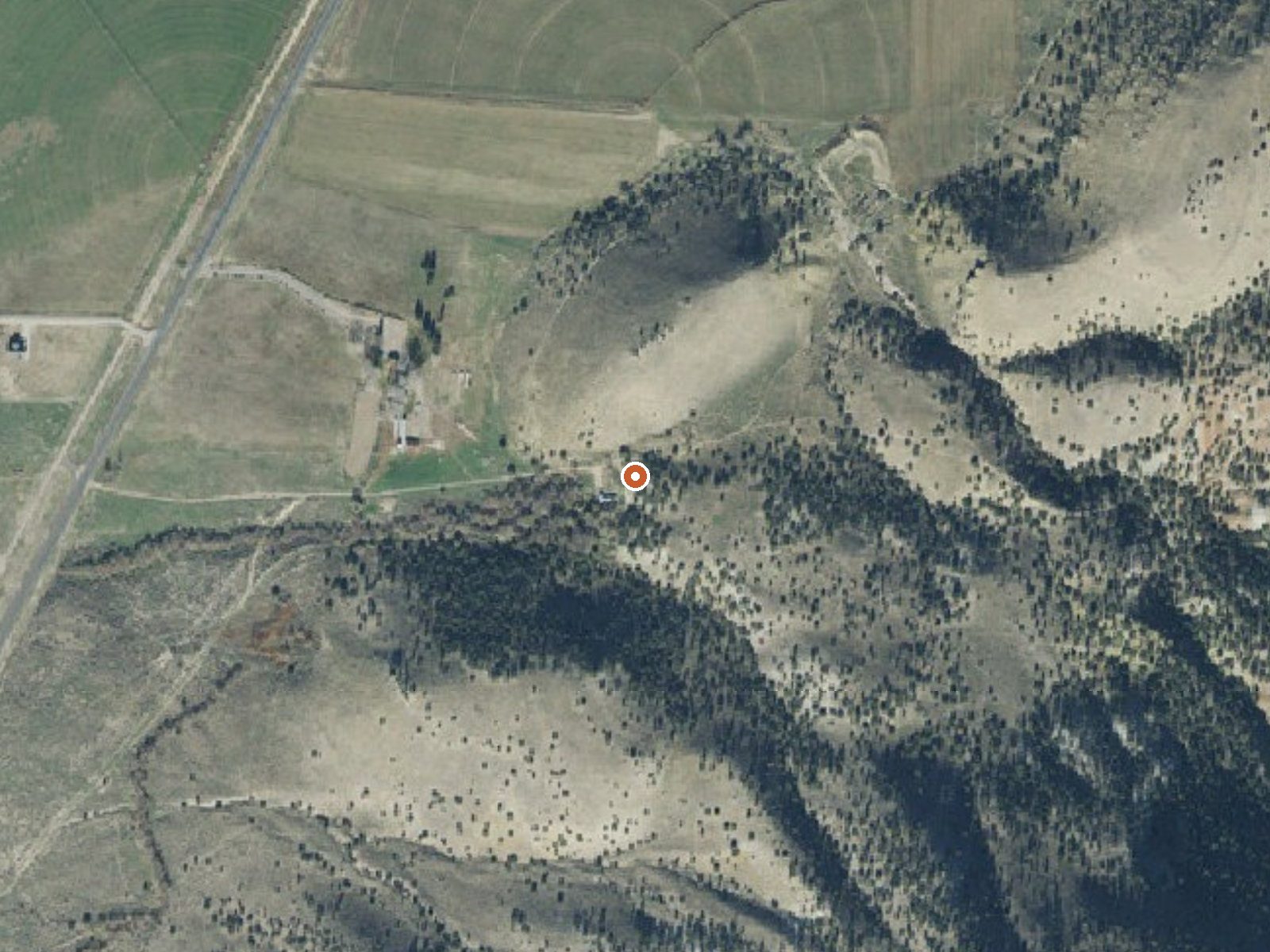
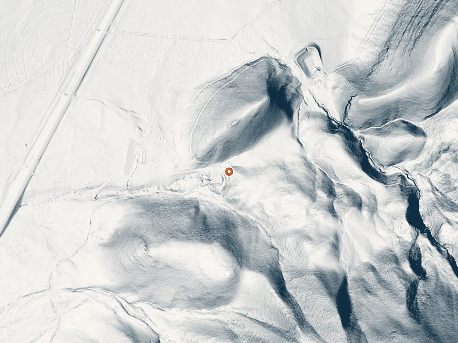
Drag the handle to compare the two views. The orange dot marks the spring, in a frame about three quarters of a mile wide.
Sterling, also written as Peacock Warm Spring, is a tepid spring in Sanpete County a few miles south of Manti, and the USGS counts it among its thermal sites. Water this mild will not heat you through; it is warm the way bathwater left to stand is warm. Ownership and public access have never been recorded, which matters more here than the temperature does.
The spring comes up within spitting distance of a road, under sixty feet from it, and that road goes unnamed, its surface unrecorded. Elevation is mid-range for central Utah, high enough that winter snow piles up to three or four feet over the season. Precipitation the rest of the year is modest. No land manager appears on file.
Winter is the season the record favors, and with snow that deep a roadside spot is the easy kind to reach when the rest of the valley is shut. Twin Lake Campground is about six and a half miles off. No water chemistry has been sampled here, at least none that made it into the record, so the mineral content is anyone's guess. Ask locally before soaking; the access situation is a blank.
Aircraft with laser scanners measured this ground to within inches. The scan strips out trees and buildings, leaving the bare shape of the land around Sterling (Peacock) Warm Spring.
- Setting
- Canyon floor
- Steep ground climbs away on both sides of the spring.
- Highest ground nearby
- 329 ft above the spring
- Within a quarter mile, to the south
A slice through the ground from south to north, about 0.6 miles end to end.
Elevation data: USGS 3D Elevation Program. Aerial imagery: USGS The National Map. Public domain.
That's about twice the US average of 65. It's higher than at 74% of the springs on this site.
Heat flow measures the warmth working its way up through the ground from deep inside the earth. Where it runs high, rain and snowmelt that seep down through cracks in the rock come back up hot.
See every spring on the geothermal heat map →
Heat flow estimate: Stanford Thermal Earth Model (Aljubran & Horne, 2024), CC BY 4.0.
Some links are affiliate links. We may earn a commission at no extra cost to you.
Overview Twin Lake Campground rests in a juniper tree belt between the lower river bottom of Twelve Mile Canyon and the upper sub-alpine top of Skyline Drive. Visitors enjoy exploring a wealth of off-road vehicle trails.Recreation With an off-road vehicle learner loop in the campground and a central location between trails connecting to the Arapeen OHV Trail system and Skyline Drive, Twin Lake is the perfect staging area for exciting riding at any skill level.Facilities The campground contain...
Sterling (Peacock) Warm Spring sits at 5,633 feet above sea level, way above the mile-high mark. You may not feel the altitude strongly, but hot water still dehydrates you faster at elevation. UV is about 23% stronger than at sea level, so bring sunscreen and drink more water than you normally would.



As an Amazon Associate, we earn from qualifying purchases.
Sterling (Peacock) Warm Spring is road-accessible, so you can bring more gear.






As an Amazon Associate, we earn from qualifying purchases.
Springs Near Sterling (Peacock) Warm Spring
More Springs Around 72°F
Hike 1 waterfall near Sterling (Peacock) Warm Spring
Looking for more outdoor adventures? Explore waterfall hikes near Sterling (Peacock) Warm Spring, Utah.